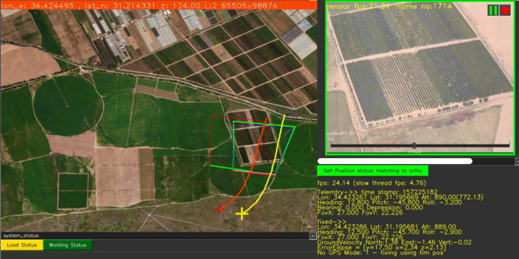
ProTrack has confirmed that it will be showcasing its GNSS-free positioning software solutions for UAVs (unmanned aerial vehicles) at the DroneX conference in London. The company’s software solutions provide enhanced air traffic safety and supply chain continuity in complex flight environments.
In the near future, entire supply chains and services will depend on a variety of autonomous UAV platforms, including deliveries and transportation, security, agriculture, medicine, military, manufacturing, and broadcasting. Large numbers of these autonomous platforms flying simultaneously Beyond Visual Line of Sight (BVLOS) at Very Low Altitude (VLL) in a restricted airspace will pose extreme management challenges and meticulous control.
Drone positions can be tracked by using GNSS, which is highly vulnerable to interference, and drone operators face the constant threat of halting and aborting regular activity to avoid serious accidents. Spoofing, or transmitting fake GNSS signals to confuse navigation systems, is another concern, as it can help an attacker gain control over an airborne system with possibly catastrophic results. Inertial navigation systems (INS) are also popular navigation aids, and usually found in bigger and more expensive airborne platforms. Their disadvantage is that they tend to “drift” over time, and their output becomes less precise.
To keep drones and air-taxis flying securely and to prevent accidents in the skies in GNSS-denied environments, ProTrack has developed a secured element that corrects GNSS and INS data in real time and also maintains a correct position even when they are not working at all, without relying on any outside communications.
Yoav Rosenberg, ProTrack’s CTO, explained: “ProTrack has developed Locator – a real-time software engine that uses very robust and precise video-anchoring capabilities to assist positioning. To put it simply – it calculates the position of the platform by matching its real-time video to a map. The software is installed onboard using a standard processing card, such as NVidia Nano, Qualcomm or similar, which receives video and telemetry and outputs the correct positioning data. It can use the existing onboard PTZ or fixed camera (daytime/thermal/IR) or a dedicated simple camera.”
The integration process is short and straightforward and requires no new navigation or communications equipment. The application is installed on the aircraft or on the ground-control system and is already in use by drone manufacturers.
The company will also present its Flight software, a video anchoring and geo-positioning tool for airborne platforms. The software extracts real-world coordinates of any pixel in day/night real-time video. It also incorporates ProTrack’s proprietary, military-grade VMD (Video Motion Detection) and Object Tracking capabilities. Flight can be seamlessly integrated into existing C4I systems, or operated as a standalone system.
The post GNSS-Free Geopositioning Software for UAVs appeared first on Unmanned Systems Technology.