Quantcast
Channel: UAV News | Drone News | Unmanned Aerial Systems UAS & UAV News
Viewing all 4454 articles
Browse latest View live

DJI Launches Drone Data 3D Mapping Software

$
0
0

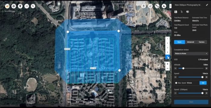
DJI Terra 3D mapping software

DJI has announced the introduction of DJI Terra, a new software tool that transforms drone data into digital 3D models and maps for easy analysis and decision making. DJI Terra enables businesses and organizations using DJI drone technology to capture, visualize and analyze aerial images for a wide variety of applications across the public safety, construction, infrastructure, agriculture and film industries.

“As the leader in the commercial drone industry, DJI continues to develop accessible and easy-to-use hardware and software solutions that help organizations transform their operations with drone technology and gain a competitive advantage in their industries,” said Sunny Liao, Director of Enterprise at DJI. “As an all-in-one mapping and modeling solution, DJI Terra makes it simple and efficient to extract value from drone data, generating conclusions and recommendations across multiple use cases from crash reconstructions to critical infrastructure inspections as well as agriculture field mapping and construction site modeling.”

DJI Terra helps commercial drone pilots quickly plan automated flights with several easy-to-use options based on the area or objects they’d like to capture and the type of map or 3D model they’d like to create. It features three mission planning types:

  • Area – Capture a specific area quickly and easily by drawing a custom polygonal flight zone on a map. DJI Terra automatically generates efficient flight path options based on the area selected.
  • Waypoint – Create dynamic custom flight paths through an area or around objects using waypoints and adjustable parameters like aircraft altitude, speed, heading, gimbal pitch and angle. For more complex missions that require high attention to detail, the 3D Flight Visualization feature enables the design and simulation of missions on existing 3D models.
  • Oblique – Capture a rich data set by automatically flying the same route multiple times. Each flight automatically adjusts the angle of the camera to capture new details, giving an extra crisp 3D model of the object or asset from multiple angles.

With real-time mapping capabilities, DJI Terra allows drone pilots to quickly generate 2D orthomosaic maps as the drone flies, ideal for time-sensitive missions where situational awareness is critical and decisions need to be made in minutes. DJI Terra’s fast processing capability also creates sharp and realistic representations of any environment through detailed 2D orthomosaics and 3D model reconstructions used for industrial applications like reconstructing vehicle crashes, tracking progress on construction projects or conducting large-scale critical infrastructure inspections on bridges and roadways.

In addition to map and model creation, DJI Terra helps users analyze data and generate instant insights with easy-to-use analysis tools that provide a variety of measurements including linear distance, surface area and volumetric estimations. To improve team communication and reporting throughout ongoing projects, annotation labels can be edited and shared. For detailed site inspections and accident reconstruction situations, DJI Terra’s photo inspection tool lets users closely examine every photo used to create the model so they can pinpoint and highlight critical elements.

The post DJI Launches Drone Data 3D Mapping Software appeared first on Unmanned Systems Technology.

New Counter-UAS System Utilizes AI & Machine Learning

$
0
0

Citadel Defense Titan Counter-UAS systemCitadel Defense Company has announced the official launch of their counter-UAS (unmanned aerial system) solution, Titan, after over 6 months of extensive government and military testing. The system is designed for anti-drone scenarios such as drug trafficking, espionage, cyber-attacks and attacks on airports.

Designed and developed alongside U.S. warfighters and security experts, the Titan provides the user real-time information, identifying and classifying an approaching unmanned aerial vehicle or swarm, and selectively applying precise countermeasures to induce the UAV to land or return to its home base. Citadel Defense uses machine learning, artificial intelligence and software defined hardware technology to rapidly address new threats and protect people and assets.

Christopher Williams, CEO of Citadel Defense, explained: “The system’s ease of use coupled with the fact that it can operate in environments where communications are critical, like major cities, airports, or aboard large ships, provide users with a flexible solution for many missions. Citadel’s escalating countermeasure approach is a unique advantage for customers because it can effectively detect, identify, and defeat drones with limited collateral affects to other important signals like WiFi and Bluetooth communications.”

Following more than ten successful government-hosted evaluations where many different counter-drone technologies were compared against each other, Citadel Defense has successfully secured six government contracts. Titan technology is utilized by commercial, government, and military customers to reliably protect critical assets from the growing threat posed by drones.

The post New Counter-UAS System Utilizes AI & Machine Learning appeared first on Unmanned Systems Technology.
World’s Longest Multilayer Flexible PCB Manufactured for UAV Wings

$
0
0

Trackwise 26 metre PCB for UAV wing

Trackwise, a manufacturer of printed circuit boards, has announced that it has has shipped a 26-metre long multilayer flexible printed circuit (FPC), believed to be the longest ever produced, for distributing power and control signals across the wings of a solar-powered, unmanned aerial vehicle (UAV). The circuit is one of over fifty supplied by Trackwise into this vehicle.

The entire interconnect system (power and signal) of the vehicle is made of FPCs representing an estimated total systems weight saving of 60% over traditional wire harness. This will enable the UAV, which is being manufactured in the US, to achieve higher payload and/or improved speed and range. The FPCs are manufactured using Improved Harness Technology (IHT), a patented, reel-to-reel manufacturing technique. Conventional FPCs are rarely more than two metres in length, primarily due to limitations of manufacturing processes. IHT overcomes these limitations, enabling FPCs of unlimited length to be produced.

The UAV’s flexible circuit is based on a polyimide substrate. The planar structure of the circuit dissipates heat better than conventional wiring, enabling higher current carrying capacity for a given weight of copper conductor. Printed manufacturing ensures circuit consistency, fewer connection points are needed so reliability is enhanced, and the FPC is easier to install than wire harnesses, reducing a vehicle’s assembly time and cost.

Trackwise CEO, Philip Johnston, said: “There are many new applications emerging for long, lightweight FPCs but aerospace is a natural fit: weight savings, high reliability and cost-effectiveness are critical. We’re also seeing growing interest from a variety of sectors including medical and automotive. For the latter, manufacturers are challenged to reduce vehicle weight to improve fuel efficiency at a time when there’s an ever-growing array of electrical and electronic circuits in their vehicles. In particular, electric vehicles are accelerating this trend.”

The post World’s Longest Multilayer Flexible PCB Manufactured for UAV Wings appeared first on Unmanned Systems Technology.

UAVOS Announces 3-Axis UAV Camera Gimbal

$
0
0

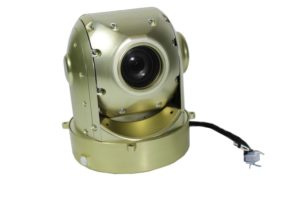
UAVOS 3-axis UAV gimbalUAVOS has announced that it has developed a gyro-stabilized 3-axis gimbal for unmanned aerial vehicles (UAVs) with integrated RGB Full HD video camera and 30x optical zoom and Ethernet output. The gimbal has an extended operational temperature range and is designed to withstand harsh environments, featuring a compact size, low weight of 2.64lb (1,2kg), and a strong mechanical aluminium-cased structure. In addition, the gimbal integrates with UAVOS’ autopilot, allowing for the obtaining of coordinates of ground objects.

Two axes of 360-degree stabilization offer the possibility to obtain images from any point of view. The third axis and precision stabilization provide high image quality at maximum 30x optical zoom. The gimbal is equipped with high-precision 17-bit encoders that provide excellent image stabilization and precision. The high degree of stabilization allows for the gimbal to be successfully operated on UAVOS unmanned helicopters in high-vibration conditions.

Aliaksei Stratsilatau, Chairman of the Board and lead developer, said: “Our gimbal has already shown good results when operating in southern regions with hot and tropical climates, when installed on a fixed-wing UAV aircraft, and when parachuting to hard-rock areas. All landings were undertaken without damage. UAVOS will be an exhibitor at Xponetial 2019 in Chicago, with a major presence covering its entire range of commercial unmanned aircraft, defence, and helicopter UAV products and services, moreover, a number of products will be shown for the first time.”

The post UAVOS Announces 3-Axis UAV Camera Gimbal appeared first on Unmanned Systems Technology.

uAvionix Drone ADS-B Equipment Approved Within Indian Airspace

$
0
0

Quantum-Systems Trinity UAV

uAvionix, a developer of communications, navigation, and surveillance (CNS) equipment for unmanned aerial vehicles (UAVs), has announced that its products have been accepted by the Director General of Civil Aviation (DGCA) of India for use within Indian-controlled airspace.

The Government of India Office of the DGCA previously issued its Requirements for Operation of Civil Remotely Piloted Aircraft Systems (RPAS) in which operational requirements are laid down for civil drones within India. In these regulations, DGCA requires that all drones weighing more than 2kg intending to operate in controlled airspace up to 400 feet (120m) be equipped with a Secondary Surveillance Radar (SSR) Mode C or S transponder, or ADS-B OUT transmitter. In addition, these aircraft must be equipped with Detect and Avoid (DAA) capability.

Recently, Quantum-Systems GmbH was awarded a $3 Million RPAS contract from Survey of India to provide its Trinity+ UAV. Each Trinity+ UAV is equipped with a uAvionix ping20S low power Mode S ES ADS-B transponder and pingRX ADS-B receiver for Air Traffic Control (ATC) interoperability and DAA functionality. The ping20S is the world’s smallest and lightest Mode S ADS-B transponder, weighing only 25 grams. It allows the Trinity+ to respond to interrogations from ATC SSRs and nearby aircraft equipped with Traffic Collision Avoidance Systems (TCAS).

Other uAvionix customers in India have met with similar success by incorporating ping200SR ADS-B Transponders and ping1090i ADS-B Transceivers with integral GPS. Christian Ramsey, uAvionix President, offered the following insight into India’s evolving RPAS market: “With an economy approaching $3 trillion and growing at an 8% rate, India soon will become a “Top 5” country ranked by GDP. In such an environment, leap-frogging technologies such as unmanned systems can fuel further growth. To its credit, the DGCA is playing its part by establishing performance standards and rule-making under which drones can be developed and safely flown. uAvionix aims to contribute to that safety-focused culture by continuing to develop and deploy its low-SWaP avionics so even small drones can fly safely among manned aircraft.”

The post uAvionix Drone ADS-B Equipment Approved Within Indian Airspace appeared first on Unmanned Systems Technology.
Belgium to Acquire MQ-9B SkyGuardian UAS

$
0
0

MQ-9B SkyGuardian RPA

The Defense Security Cooperation Agency (DSCA) has announced that the State Department has made a determination approving a possible Foreign Military Sale to Belgium of MQ-9B SkyGuardian Remotely Piloted Aircraft (RPA) and related equipment for an estimated cost of $600 million.

The Government of Belgium has requested to purchase four MQ-9B RPA; two Fixed Certifiable Ground Control Stations; five AN/DAS-4 Multi-Spectral Targeting Systems; fifteen Embedded Global Positioning System/Inertial Navigation Systems (EGI); five AN/APY-8 Lynx Synthetic Aperture Radars; and five Detect and Avoid Systems.

The contract also includes an Initial Spares Package (ISP) and Readiness Spares Package (RSP) to support a 5-year period of performance; spare and repair parts; support and test equipment; publications and technical documentation; personnel training and training equipment; U.S. Government and contractor engineering; technical and logistics support services; and other related elements of logistical and program support.

This proposed sale will support the foreign policy and national security of the United States by helping to improve the security of a NATO ally. This potential sale enhances the intelligence, surveillance, and reconnaissance (ISR) capability of the Belgian military in support of national, NATO, United Nation-mandated, and other coalition operations. Commonality of ISR capabilities increases interoperability between the U.S. and Belgian military and peacekeeping forces.

Belgium intends to use these defense articles and services to provide for the defense of its deployed troops, regional security, domestic security, and interoperability with the U.S./NATO partners. The current fleet of Belgian Air Component aircraft have proven insufficient to support sustained and persistent ISR operations. The proposed sale will enable the Belgian Air Component to conduct persistent and wide area ISR, including target acquisition, target designation, providing precision coordinates for Global Positioning System (GPS)-aided munitions, battle damage assessment, signal intelligence, communication, and data relays. Belgium will have no difficulty absorbing this equipment and support into its armed forces.

The principal contractor will be General Atomics Aeronautical Systems, Inc., San Diego, California. There are no known offset agreements proposed in connection with this potential sale.

The post Belgium to Acquire MQ-9B SkyGuardian UAS appeared first on Unmanned Systems Technology.

AeroVironment Multi-Sector Antenna Expands Maritime UAS Capabilities

$
0
0

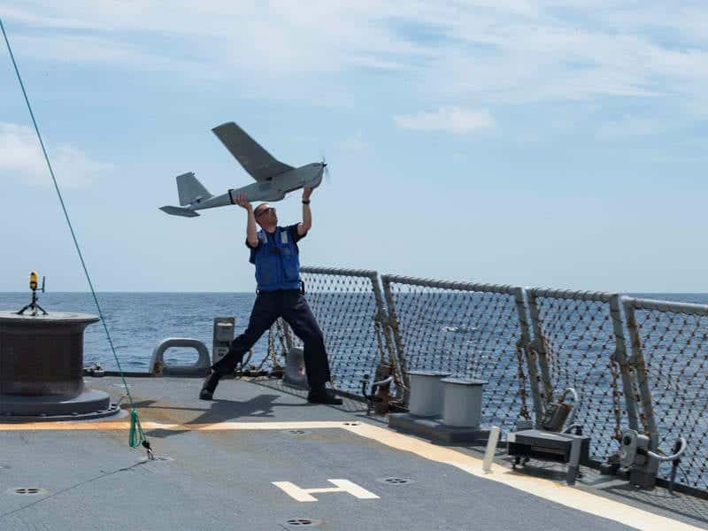
AeroVironment Puma AE maritime UAS

AeroVironment has announced the availability of a new 360 Multi-Sector Antenna (MSA) for its Puma AE small unmanned aircraft systems (UAS). Specifically designed to support Puma AE maritime missions, the 360 MSA provides naval operators with immediate tactical situational awareness, while eliminating the need to redirect the vessel or reconfigure the direction of an antenna to maintain an effective communication link.

Featuring an integrated array of 24 high-gain auto-selective antennas, the new 360 MSA analyzes downlink data quality and automatically switches between antenna patches with greater margin to deliver 360-degree continuous command and control coverage within a 20km nominal range. Commanding Officers (COs) can maintain complete control of the Puma AE aircraft and payload with the 360 MSA and access real time, decision critical ISR information. Additionally, it enables the bridge and combat team with mission planning, real time moving map, high resolution imagery, and contact status capability.

AeroVironment’s new 360 Multi-Sector Antenna (MSA) joins the company’s previously announced Long Range Tracking Antenna (LRTA) to provide operators with immediate tactical Intelligence, Surveillance, and Reconnaissance (ISR) capabilities anytime, anywhere. LRTA’s 360-degree auto-tracking function enables land-based operators to expand the command and control range of Puma AE to approximately 60km, providing critical ISR data while being positioned further away from dangerous areas of interest. The LRTA features an automated two-axis positioner tracking function that ensures a secure and reliable link with Puma while it operates at extended ranges. This antenna gives Puma 3 AE’s Mantis i45 EO/IR gimbal capabilities similar to larger and costlier Group 2 or higher UAS.

“AeroVironment is committed to protecting and enabling allied armed forces and expanding the envelope of missions our Puma AE UAS can support,” said David Sharpin, Vice President, Sales and Business Development for AeroVironment. “The improvements made to the Puma 3 AE, combined with the enhanced capabilities from our 360 Multi-Sector Antenna and Long Range Tracking Antenna, demonstrate AeroVironment’s ability to provide customers with critical ISR data whether on land or at sea.”

The new 360 Multi-Sector Antenna (MSA) is currently available in M3/4/6 DDL operating bands.

The post AeroVironment Multi-Sector Antenna Expands Maritime UAS Capabilities appeared first on Unmanned Systems Technology.

Sentera FieldAgent Delivers Real-Time Drone Data Analytics

$
0
0

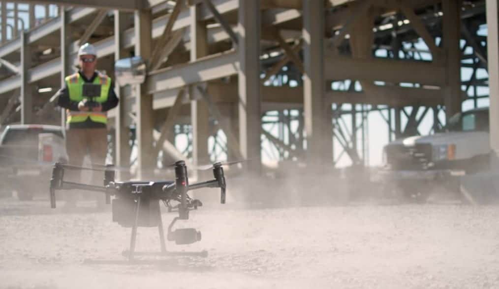
Sentera FieldAgent software

Sentera has announced that its FieldAgent agricultural data analytics platform now delivers instant plant population and weed pressure reports in the mobile app, while the UAV (unmanned aerial vehicle) is still in flight. Agriculture professionals can obtain up to 100 times more in-field measurements versus manual scouting methods and get better coverage all across the field. No memory card or post-flight processing is required. The analytics results are delivered live, as the drone flies.

“Our two most widely-used analytics products can now deliver answers to our customers in real-time,” said Eric Taipale, Sentera CEO. “In-field scouting is about accurately assessing field conditions, and giving scouts, agronomists, and advisors that data to drive the best decisions for their customers. We’re making this process more efficient and more productive for our users.”

Logan Cautrell, mobile developer at Sentera explained: “When the drone begins capturing data, users immediately see the results right in the app. The immediacy, coverage rate, and accuracy will make our customers more efficient and give them a broader picture of the field.”

Real-Time Analytics showcases the combined flexibility and power of the DJI SkyPort architecture, the Sentera AGX710 sensor, and Sentera’s experience in machine learning and computer vision technology. For ag professionals, this means access to the fast, easy, and complete stand count and weed pressure data. Users programs FieldAgent to autonomously scout a field and the system captures 1-2 images per acre, runs the analytics in real-time, and instantly reports the data back to the user’s mobile device, right at the field edge. Calculations happen within seconds and results are delivered instantly.

Using DJI SkyPort, Sentera is able to run analytics on the high resolution, native image product in real-time, as opposed to systems that either run analytics on lower-resolution video, wait for images to download one-by-one, or require post-processing.

Real-Time Analytics is supported on DJI M200 and M210 systems equipped with Sentera AGX710 sensors and are currently offered for corn, soybeans, and potatoes, with additional crop-compatibility being added.

Over time, even more of Sentera’s 20 different analytics products will be available in real-time, helping users achieve greater efficiencies with some of their most tedious and labor-intensive tasks. “With FieldAgent’s Real-Time Analytics, scouts can ground truth areas of interest and instantly see results,” said Greg Thompson, director of sales at Sentera. “It allows a complete, integrated scouting mission to be completed before the drone even lands, expediting delivery of insights – something the industry has been seeking.”

The post Sentera FieldAgent Delivers Real-Time Drone Data Analytics appeared first on Unmanned Systems Technology.


DJI and LAFD to Develop Emergency Response Drone Solutions

$
0
0

DJI firefighting drone

DJI has announced a Solution Development Partnership with the Los Angeles Fire Department (LAFD) to create, test and deploy DJI drone technology as an emergency response and preparedness tool. The agreement marks one of DJI’s largest partnerships with a fire-fighting agency in the United States and will provide the LAFD with access to new technologies, training and support to incorporate drone technology into its operations.

“We are excited to be strengthening our partnership with the LAFD, one of the nation’s preeminent public safety agencies, to help them take advantage of DJI’s drone technology that has been purpose-built for the public safety sector,” said Bill Chen, Enterprise Partnerships Manager at DJI. “Through our two-way collaboration, DJI will receive valuable insight into the complexities of deploying drones for emergency situations in one of the most complex urban environments in the nation. This insight will allow us to continue to refine and develop new technologies that will allow the LAFD and leading public safety agencies around the world to gain more value from life-saving drone technology.”

Through the agreement, the LAFD will continue to deploy and test drone technology developed by DJI for the fire and rescue service industry. To-date, the agency has flown over 175 incident-related missions using DJI’s industrial aerial platforms such as the Matrice 200 Series, Matrice 600 Series, and Phantom 4 Pro drones equipped with visual and thermal imaging cameras that provide real-time video and data transmission to incident commanders. DJI drone technology will continue to be used across a variety of situations including hot-spot identification and aerial mapping to help manage wildfire response, as well as incident response for swift water rescues, hazmat operations, and urban search and rescue missions.

“The LAFD has been working through a pragmatic approach to adopting drone technology for several years, including developing policies and procedures that define clear use case scenarios and building awareness among the general public about the positive life- and property-saving benefits drone technology can provide to our firefighters in their mission to protect the citizens of Los Angeles,” said LAFD Battalion Chief Richard Fields. “We are excited about today’s partnership with DJI because it gives the Department access to cutting edge developments from the world’s leading provider of drone technology, such as drones equipped with thermal cameras that will help give incident commanders a real-time birds-eye perspective. Combining advanced drone technology with new software tools will help bridge the gap between helicopters and firefighters on the ground, allowing us to address life-threatening situations faster and more effectively than ever before.”

“The LAFD’s growing drone program makes them part of over 910 public safety organizations across the United States that are deploying drones for life saving activities,” said Romeo Durscher, Director of Public Safety Integration at DJI. “While the LAFD program shows how drones can succeed when operated within expansive, urban areas by a large department, drone technology is valuable to municipalities of any size.”

The post DJI and LAFD to Develop Emergency Response Drone Solutions appeared first on Unmanned Systems Technology.
Critical Hydraulics Selected for MQ-25 Unmanned Tanker Aircraft

$
0
0

US Navy MQ-25 unmanned refueling aircraft

Triumph Group, a manufacturer of aerospace and defense systems, has announced that it has been awarded a contract by The Boeing Company to supply critical hydraulic system components for the MQ-25 unmanned aerial refueling program.

“Triumph Group is proud to be selected by Boeing to support the U.S. Navy’s unmanned aerial refueling program and provide a variety of hydraulic subsystems used in the flight controls, landing gear, aerial refueling and arresting systems of the MQ-25,” said Frank Dubey, Executive Vice President for Triumph Integrated Systems. “These systems play a critical role in ensuring consistent operational performance of the aircraft to support the mission. We look forward to working with Boeing on the MQ-25 program through to production.”

Triumph Integrated Systems will provide components for the hydraulic systems used in the landing gear and the aircraft’s arresting systems. Integrated Systems provides similar content on other Boeing defense aircraft.

The MQ-25 is the U.S. Navy’s first operational carrier-based unmanned aerial vehicle (UAV) and is designed to provide a much-needed refueling capability. The contract supports Boeing’s engineering and manufacturing development program to provide four MQ-25 aircraft to the U.S. Navy for Initial Operational Capability by 2024.

Triumph Group has been a supplier to Boeing since the company’s founding 25 years ago, and many of its businesses have supported the company even longer. This latest contract will help sustain jobs within the Integrated Systems’ Fluid Power and Actuation operating company. Triumph Group supplies a wide range of systems, components and complex structures for multiple Boeing defense programs.

“The MQ-25 program is vital because it will help the U.S. Navy extend the range of the carrier air wing, and Boeing and our industry team is all-in on delivering this capability,” said Dave Bujold, Boeing’s MQ-25 program director. “The work we’re doing is also foundational for the future of Boeing – where we’re building autonomous systems from seabed to space.”

The post Critical Hydraulics Selected for MQ-25 Unmanned Tanker Aircraft appeared first on Unmanned Systems Technology.

FLIR Provides Thermal Imaging Solutions to DroneBase

$
0
0

FLIR thermal UAS imaging solutions for DroneBase

FLIR Systems has announced that it has made a strategic investment in DroneBase, a global drone operations company that provides businesses access to one of the largest Unmanned Aerial Surveillance (UAS) pilot networks. The investment establishes FLIR as the exclusive provider of thermal product solutions and as the official small UAS thermal imaging training provider for the DroneBase enterprise pilot network through the FLIR Infrared Training Center (ITC).

“Our investment in DroneBase helps expand the adoption of FLIR thermal imaging technology by putting it in the hands of more pilots who fly drones every day,” said Jim Cannon, President and CEO of FLIR. “DroneBase’s enterprise pilot network will receive training by professional thermographers, enabling DroneBase to offer specialized thermal inspection services for customers on a wider scale, and creating an opportunity for FLIR to incorporate additional service offerings through DroneBase in the future.”

DroneBase and its pilots have completed over 100,000 commercial missions in more than 70 countries providing services across multiple industries, such as residential and commercial real estate, insurance, telecommunications, construction, and media. FLIR and DroneBase will collaborate to develop specialized training for DroneBase pilots through the FLIR ITC, creating an exclusive pilot network through a DroneBase certification process.

“Through FLIR’s strategic investment in DroneBase, we are now able to offer scalable thermal solutions to enterprises of any size,” said Dan Burton, CEO and Founder of DroneBase. “This access to valuable data will allow stakeholders to make better decisions about their most critical assets. Like myself, many DroneBase pilots relied on FLIR products when they served in the military. This integration will offer military veterans a chance to work with FLIR again and leverage their training in their civilian lives.”

The post FLIR Provides Thermal Imaging Solutions to DroneBase appeared first on Unmanned Systems Technology.

US Marine Corps Selects SAR Payload for Blackjack Tactical UAS

$
0
0

RQ-21A Blackjack UAS

IMSAR has announced that its NSP-5 Synthetic Aperture Radar (SAR) system has been configured for unmanned aircraft systems (UAS) usage and is currently in production as part of a Mission Kit for the RQ-21A Blackjack Program of Record operated by the United States Marine Corps. The payload project, named “Split Aces,” is a Synthetic Aperture/Ground Moving Target Indicator Radar Payload and has been given the prototype designation AN/DPY-2().

The NSP-5 is powered by operationally proven, Ku-band NanoSAR Synthetic Aperture Radar technology, which is housed in a pod with enclosed electronically scanned array antennas. The NSP-5 provides high-resolution SAR imagery, coherent change detection, and ground moving target indication.

Ryan Smith, President and CEO, said, “IMSAR is excited to provide America’s defense with a genuinely tactical, high-performance radar solution enabling true multi-intelligence for expeditionary platforms at such a critical time.”

The NSP-5 delivers high-performance capabilities despite its small size, weight, and power (SWaP) characteristics. Commercially, the NSP-5 is available in a standard pod configuration that measures 5.4 in. (13.7 cm) in diameter and 45.3 in. (115 cm) in length, weighs 16 pounds (7.3 kg), and consumes 150 watts of power.

The post US Marine Corps Selects SAR Payload for Blackjack Tactical UAS appeared first on Unmanned Systems Technology.
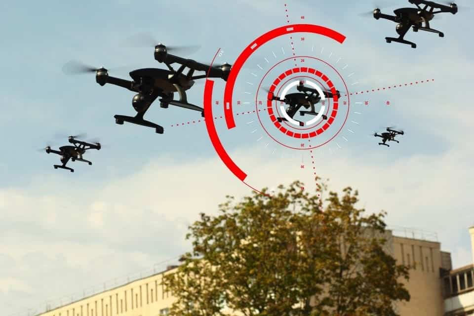
SkyGuardian UAS Ground Control Station Controls First End-To-End Flight

$
0
0

SkyGuardian UAS Ground Control Station

General Atomics Aeronautical Systems, Inc. (GA-ASI) has announced that its Certifiable Ground Control Station (CGCS) has been used to control the complete flight of an MQ-9B SkyGuardian – including takeoff and landing. This is the first time the CGCS has been used to control an entire end-to-end flight of a Remotely Piloted Aircraft (RPA).

“Controlling takeoff and landing was the last step in a progression of flight milestones for the CGCS,” said David R. Alexander, president, GA-ASI. “Our vision is that MQ-9B will be the first RPA certified to fly in national and international airspace. To achieve that goal, our GCS needs to be type-certified, as well. Completing an end-to end flight was an important step in achieving that ultimate goal.”

The flight originated from the Yuma Proving Grounds in Yuma, Arizona. The CGCS features a Pro Line Fusion integrated avionics system from Collins Aerospace, the Abaco FORCE2 flight computer, as well as all the weapons and payload controls for MQ-9B.

The CGCS architecture provides separation between flight and mission critical functions. Flight critical functions are performed using off-the-shelf avionics and flight computers running GA-ASI’s certifiable DAL B software. The mission critical functions are separated and run alongside GA-ASI’s proven Advanced Cockpit payload and weapons equipment.

The post SkyGuardian UAS Ground Control Station Controls First End-To-End Flight appeared first on Unmanned Systems Technology.
UK Ministry of Defence Seeks Counter-Drone Solutions

$
0
0

UK MoD counter-drone technology competition

The United Kingdom Ministry of Defence (MOD) has announced that it has launched a £2million competition for proposals to tackle the future threats of Unmanned Aerial Systems (UAS). The competition, run by the Defence and Security Accelerator (DASA), the MOD’s innovation hub, will seek robust and cost-effective next-generation solutions to the risks posed by hostile UAS.

The MOD is looking to develop new defensive capabilities which draw upon autonomous decision-making mechanisms and networked sensing systems capable of detecting, tracking, identifying and defeating hostile UAS over complex and varied environments.

Defence Secretary Gavin Williamson said: “As the security threats from hostile drones are evolving at pace, it’s critical that our armed forces benefit from the very latest technology to stay ahead. This competition will draw on the brightest and best of our defence industry to find innovative solutions that will ensure we are protected in the years to come.”

The competition is the latest stage in Defence Science and Technology Lab’s (Dstl) ongoing research programme into countering UAS which has been running for ten years. This programme has included the extensive research, testing and evaluation of the counter-UAS technology currently employed by the MOD, including the landmark series of ‘Bristow’ trials with industry in 2013, 2015 and 2018.

Dstl’s Principal Engineer, David Lugton said: “Hostile UAS is a challenging threat in many different ways and requires cutting edge technology and well-thought-out system approaches to counter it effectively. Through this competition we are looking to inspire and develop a range of solutions to mitigate the threat posed by UAS now and in the future. Among the technologies we’re looking for, we’d be interested in those which can detect and track multiple threats simultaneously, with minimal human oversight, and against a broad spectrum of UAS types.”

“We’re also interested in Counter-Unmanned Air Systems which can overcome the challenges posed by line of sight blockages, collateral, and ones which can link systems together to improve understanding of the local “drone air picture”.”

The new call for proposals is focused on tackling the challenges of current and future UAS capabilities, in particular:

  • Next-generation Counter-UAS technology – new technological solutions to provide robust and cost effective sensing and defeat options
  • Flexible Counter-UAS technology – programmes capable of bringing counter-UAS technologies together and linking with other surveillance systems and cooperative drone awareness systems
  • Countering Future UAS Systems – developing capability to detect and mitigate threats from UAS acting autonomously, in swarms and in highly congested airspace

Phase 1, which will deliver proof of concept of the proposals, will be worth approximately £800k and is scheduled to take place from July 2019 to March 2020. The total funding for the competition is expected to be at least £2m, split over multiple phases.

The post UK Ministry of Defence Seeks Counter-Drone Solutions appeared first on Unmanned Systems Technology.

UAVOS Introduces UAV Auto-Tracking Antenna System

$
0
0

UAVOS UAV Auto-Tracking Antenna SystemUAVOS has announced the introduction of the company’s new Auto-Tracking Antenna System, a portable ground-to-air antenna designed for incorporation into unmanned aerial systems (UAS). The tracking antenna enables long-range data transmission, and combined with UAVOS’ ground control unit, it significantly increases the quality and range of stable communication transmission.

The new Auto-Tracking Antenna System has 2 communication channels with different types of antennas. The first antenna is a telemetry radio link that works at 900 MHz frequency and has a range of 100km+, while the second handles high-speed video communication with a data transfer rate of up to 25 Mbit/s.

UAVOS’s Auto-Tracking Antenna System allows for the installation of different modems and antennas, and the turntable system automatically orients the installed antennas towards the UAV.

“Our customers require a system that is simple to put together, turn on, and works,” commented Aliaksei Stratsilatau, UAVOS Chairman of the board and lead developer. “They want to achieve high data-rates and reliable HD video transmission. The new Tracking Antenna System enables video streaming out to distances of up to 100km while maintaining high throughput and strong signal strength. The Auto-Tracking Antenna System delivers a versatile solution for a truly networked unmanned aircraft.”

Designed for ease-of-use, quick assembly, and portability, the Auto-Tracking Antenna System can be assembled and deployed in less than 15 minutes. The portable and lightweight design can be completely disassembled, with the main dual-antenna system breaking down into eight individual parts. The entire system fits into most standard-sized SUVs for easy transportation and compact storage.

The post UAVOS Introduces UAV Auto-Tracking Antenna System appeared first on Unmanned Systems Technology.


BVLOS Flights Conducted in Norway with Electric Long-Endurance UAS

$
0
0

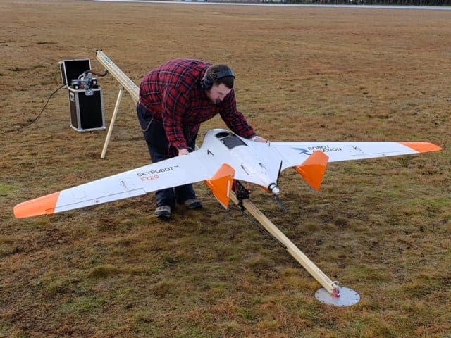
Robot Aviation FX20 UAV

Unmanned aerial system (UAS) manufacturer Robot Aviation and professional UAS flight operator SkySkopes have announced that the two companies have successfully executed Beyond Visual Line of Sight (BVLOS) commercial operations in Norway and look to bring them to the United States. SkySkopes was drawn to Robot Aviation’s electric fixed-wing FX20 UAV platform due to its long-endurance capabilities.

“SkySkopes has flown BVLOS in numerous countries, including the United States. Flying BVLOS in Norway with Robot Aviation was fantastic and everything we would expect from a world-class operator,” said Matt Dunlevy, President and CEO of SkySkopes. “We enjoy working with industry leaders such as Robot Aviation and bringing their cutting-edge air frames to Minot, North Dakota.” SkySkopes has some of the most highly-certified pilots in the United States, and welcomed the opportunity to work with foreign Civil Aviation Authorities in order to prove to domestic clients that SkySkopes’ pilots stand ready to take advantage of BVLOS when permitted.

“With the FX20, our electric long-endurance aircraft, equipped with detect and avoid technology for quiet and safe operations, Robot Aviation supports SkySkopes with its latest technology for operations in the growing energy sector. Our cooperation with SkySkopes will shortly result in activities for our small-tactical FX10 system, and we hope that the day when our 20 hour endurance FX450 flying in North Dakota is not far away,” said Børre Larsen, CEO of Robot Aviation.

The post BVLOS Flights Conducted in Norway with Electric Long-Endurance UAS appeared first on Unmanned Systems Technology.
U.S. Army Completes Gray Eagle Extended Range UAS Equipment Training

$
0
0

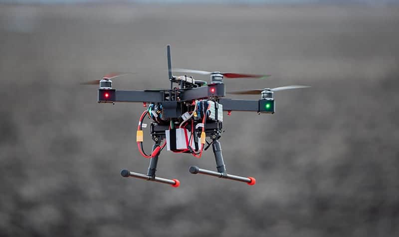
US Army Gray Eagle Extended Range UAS

General Atomics Aeronautical Systems, Inc. (GA-ASI) has announced that the U.S. Army has completed its New Equipment Training (NET) at Fort Campbell, Kentucky for the MQ-1C ER Gray Eagle Extended Range Unmanned Aircraft System (UAS). The training covered new maintenance procedures, manuals and ground support equipment associated with the MQ-1C ER.

The training not only prepared the current Army Company – 160th Foxtrot – to operate MQ-1C ER, it also prepared Echo Company to become the Army’s second Company to be trained to operate the Gray Eagle Extended Range.

“Adding a second Company to operate the MQ-1C ER is a testament to the confidence the Army has in the performance of this UAS,” said David R. Alexander, president, GA-ASI. “The MQ-1C ER provides significant enhancements in capability over the MQ-1C, delivering increased reliability, range and capacity for our Army customer over the previous version.”

The post U.S. Army Completes Gray Eagle Extended Range UAS Equipment Training appeared first on Unmanned Systems Technology.

Intelligent Energy Fuel Cell Module Powers Record-Breaking UAV

$
0
0

MetaVista quadcopter with Intelligent Energy fuel cell module

Intelligent Energy has announced that its fuel cell technology has been used by South Korean liquid hydrogen specialist MetaVista to successfully break the Guinness World Record for longest flight time of a multirotor UAV (unmanned aerial vehicle).

A flight time of 12 hours, 7 minutes and 22 seconds was officially recorded. The MetaVista team used a 6-litre liquid hydrogen cylinder and Intelligent Energy’s 800W Fuel Cell Power Module to power the UAV.

The previous record held stood at 2 hours, 6 minutes and 7 seconds. The substantial difference in flight time achieved demonstrates the impact fuel cells could have on the commercial UAV industry, breaking through the limited flight time constraints of traditional batteries.

Lee Juby, Chief Sales Officer at Intelligent Energy, said: “We would like to congratulate our customer, MetaVista, on their achievement of becoming the new World Record holders for multirotor UAV flight time. The use of liquid hydrogen in this flight showcases the significant flight times that can be achieved and we are sure MetaVista will continue to push the boundaries.”

Dr. Jong Baik, MetaVista Inc. CEO, added: “Our ultra-light weight liquid hydrogen storage tanks complement Intelligent Energy’s lightweight Fuel Cell Power Modules and the World Record attempt has demonstrated what we can achieve.”

Intelligent Energy and MetaVista recently signed a Memorandum of Understanding (MOU) to commit to a long-term partnership and collaboration after a previous test flight achievement of over 10 hours.

The post Intelligent Energy Fuel Cell Module Powers Record-Breaking UAV appeared first on Unmanned Systems Technology.

Multi-User BVLOS UAS Network Completes Initial Field Testing

$
0
0

BVLOS network drone

The University of North Dakota has announced that, along with research partners from Harris Corporation and the Northern Plains Unmanned Aircraft Systems Test Site (NPUASTS), it has successfully completed initial field testing for a first-of-its kind command and control (C2) ground radio network to support beyond visual line of sight (BVLOS) drone flights this week.

The radio network adds C2 functionality to the North Dakota-based Harris UAS (unmanned aerial systems) Network, a 55-mile-long system of integrated communications and surveillance infrastructure between Grand Forks and Fargo that enables commercial drones to fly farther and safer in national airspace. The field tests confirmed the C2 radio network’s ability to provide reliable data communications between remote pilots and unmanned aircraft over long distances, which is critical for safe BVLOS operations that can unlock the benefits of UAS technology for public safety, disaster management, critical infrastructure monitoring, package delivery, precision agriculture, law enforcement and other industries.

Currently, UAS operations are limited to short distances, largely because reliable long-distance communications solutions have not been available. The Harris UAS Network’s C2 service, however, makes safe and routine BVLOS operations possible by allowing pilots to send commands to unmanned aircraft that are necessary for take-off, maneuvering, landing and maintaining control at all times. The unmanned aircraft use the same link to report important information back to the pilots, such as aircraft location, battery life and images collected using on-board cameras. This C2 service is aligned with the Command-and-Non-Payload Communications (CNPC) radio standards that are being developed specifically for integrating drones into the national airspace.

The global UAS industry is forecast to be a $100-billion sector by 2026. Mark Askelson, interim executive director of UND’s Research Institute for Autonomous Systems (RIAS), said the activation of the BVLOS C2 service moves North Dakota closer to unleashing this multi-billion-dollar industry.

“With each testing step, we get closer to realizing the tremendous benefits, both humanitarian and economic, that BVLOS operations provide,” Askelson said.

North Dakota’s willingness to invest in UAS technology has led to several UAS successes for the state, including the deployment of the Harris UAS Network, the nation’s first and only infrastructure for multi-user BVLOS drone applications, at the end of 2018.

The Harris UAS Network, part of a North Dakota Department of Commerce Research ND project, can be expanded into a statewide infrastructure supporting BVLOS UAS operations. George Kirov, vice president and general manager, Commercial UAS Solutions, Harris, said the deployment of the Harris UAS Network and the activation of its C2 service continues to validate and enhance the attractiveness of North Dakota as a leading hub for UAS innovation and commerce.

“North Dakota is unique in the combination of political leadership, sustained investment in UAS, deep research talent at its leading universities and unmatched technical and operational expertise at its UAS test site,” Kirov said. “This made the deployment of the Harris UAS Network possible, which is just one example of how the state is positioning for technology-driven economic development and growth.”

According to Chris Theisen, director of research and development for the NPUASTS, who leads testing of the technologies that make up the current Harris network, having a network infrastructure to enable longer UAS flights is extremely valuable.

“The end solution to enable expanded UAS operations is going to be a layered approach,” he said. “This network has provided the initial steps in understanding that layered environment and will allow for growing the commercial UAS activities in the region.”

UND, NPUASTS and Harris have plans to expand flight operations and testing as well as to continue to add new capabilities to the UAS Network between Grand Forks and Fargo. The partners are confident that new companies will be attracted to the region to take advantage of this unique infrastructure and to participate in cutting edge UAS research, development and operations.

The post Multi-User BVLOS UAS Network Completes Initial Field Testing appeared first on Unmanned Systems Technology.

Parrot Unveils Ultra-Compact Thermal Imaging Drone

$
0
0

Parrot ANAFI Thermal drone

Parrot has announced the launch of ANAFI Thermal, a new unmanned aerial system (UAS) capable of capturing both live and recorded 4K HD video and thermal imaging of surfaces, structures and potentially dangerous areas for professional uses.

The drone utilizes Parrot’s proven ANAFI drone platform and equips it with a built-in 4K HDR camera with a 21-megapixel Sony sensor, as well as a FLIR radiometric thermal-imaging camera, complete with 160×120 resolution and a temperature range of 14°F to 752°F (-10°C to 400°C). ANAFI Thermal’s gimbal can tilt vertically 90° upward or downward, giving professionals an unprecedented field of view. A 3X digital zoom allows pilots to examine hard-to-access areas without taking unnecessary risks. The drone’s visible and thermal light spectrum cameras are stabilized on three axes, allowing for sharp videos and clear pictures in any flight conditions. ANAFI Thermal is 10g lighter than previous ANAFI drones and 2cm smaller with an ultra-compact, folding design for easy storage and portability.

The ANAFI Thermal offers professionals a complete solution that adapts perfectly to their required needs, from rescue service providers and experts in civil security to public works professionals, energy providers and environmental preservation organizations. The ANAFI Thermal offers a robust mix of features, performance and software capabilities to meet the growing needs of a wide variety of professionals who can utilize drones to improve their operations and minimize risk.

The Parrot Skycontroller 3 remote control also provides a reliable Wi-Fi connection for over one mile, meaning operators can use the drone while maintaining a safe distance from at-risk or difficult-to-access areas. Images from the visible and invisible light spectrum can be viewed, analyzed and merged with the FreeFlight 6 app.

Additional performance features include:

  • A 78-minute cumulative flight time (three batteries lasting 26 minutes each per charge) – which is one minute longer than previous ANAFI drones
  • The ability to reach a top speed of 34 mph
  • Capabilities to withstand wind speeds of up to 31 mph, allowing the drone to operate in volatile conditions and environments
  • All-in-one packaging – giving users everything they need to get started right out of the box

The post Parrot Unveils Ultra-Compact Thermal Imaging Drone appeared first on Unmanned Systems Technology.

Viewing all 4454 articles
Browse latest View live


<script src="https://jsc.adskeeper.com/r/s/rssing.com.1596347.js" async> </script>