Quantcast
Channel: UAV News | Drone News | Unmanned Aerial Systems UAS & UAV News
Viewing all 4454 articles
Browse latest View live

High-Accuracy Terrain Following Solution Developed for UAV Surveying

$
0
0

SPH Engineering drone terrain following

SPH Engineering has announced that it has developed a new accurate terrain following solution for unmanned aerial systems (UAS) that removes the need to rely on map data. With the help of a proprietary data logger and a laser altimeter, the new solution solves the problem of how to follow terrain without compromising effectiveness and precision.

The new integrated solution is especially significant for inspections, mining, engineering, agriculture and environmental industries where ground penetrating radars or analysers are used or where being able to fly over objects at a particular height is crucially important for other reasons. As this usually requires flying above the ground at a very precise height, rough estimates are not good enough. Previously, digital elevation model (DEM) data was essential for this process; however, this is often not available for a given region or is not sufficiently accurate. For example, if a drone with a ground-penetrating radar needs to be flown at a height of one metre, but the precision of the available data is three metres, the data is of no use for this purpose.

However, having too much information can be as problematic as having too little. Modern LiDARs can create extremely accurate terrain maps by providing a precision level of up to one centimetre. However, for drone mission planning, this would mean including too many waypoints. If the waypoints need to be loaded onto the drone in batches of no more than 99 at a time, following a LiDAR-mapped area of terrain with the necessary precision would involve flying over the area time and time again.

SPH Engineering has solved both of these issues by gathering and using terrain data on the go. The laser altimeter gathers an uninterrupted data flow by measuring the flight time of a short flash of infrared laser light as it bounces back off the surface of the terrain, while the UgCS data logger adjusts the drone flight height accordingly. As it uses actual and not pre-existing data, the mode is called True Terrain Following.

The new solution, together with SPH’s UgCS ground control software, allows for hassle-free drone mission planning with uncompromised flight height precision. The operator only needs to set the desired flight height and speed, and activate the True Terrain Following mode. The function is currently available for DJI M600/M600 Pro drones and can also be used with custom drones based on the DJI A3 autopilot.

Watch a video about the new UAV terrain following solution below:

The post High-Accuracy Terrain Following Solution Developed for UAV Surveying appeared first on Unmanned Systems Technology.

New Industrial-Grade Drone Features Dual-Rotor Coaxial Design

$
0
0

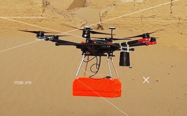
Ascent AeroSystems Spirit drone

Ascent AeroSystems has announced the launch of Spirit, the company’s new dual-rotor coaxial unmanned aerial vehicle (UAV), and has named defense technology firm Dynetics as the launch customer.

“Bulky, fragile and unable to fly in bad weather, today’s ‘industrial’ drones are not well-suited for mission-critical operations. Damage from normal handling and weather conditions like light rain and moderate wind often delay, interrupt or cancel flights. That means wasted time, higher costs, and increased risks for operators and the customers who depend on them,” said Peter Fuchs, Ascent AeroSystems CEO.

“Our vertical cylinder configuration reduces the size of the airframe to an absolute minimum, making the drone really portable. Cylinders are also inherently strong. With a simpler structure it’s also easier to make resistant to water and dirt, so we’ve got the smallest, strongest, most environmentally resistant aerial vehicle possible,” said Nate Meringer, Chief Engineer.

The Spirit is an ideal platform for public safety, military and intelligence operators. “The core is not much bigger than a coffee can and weighs just 3 pounds, but it can carry more than 10 pounds. With two batteries and a 2-pound payload it can fit in a backpack and fly for more than 50 minutes. That’s unprecedented,” said CEO Peter Fuchs. “We’ve included quick-connect attachments on the top and the bottom of the drone, so you can configure batteries and payloads as needed to suit any mission.”

Dynetics is the launch customer for Spirit. Mark Miller, Dynetics’ Vice President and Division Manager of Missile and Aviation Systems, said, “Dynetics has been using Ascent’s coaxial technology for more than a year, and we’ve been impressed by the performance and reliability of these vehicles. Not only is the cylindrical shape great for austere environments, it also makes it possible to launch the vehicle in ways that other configurations simply can’t do. This opens up an entirely new set of potential missions that can’t be met by conventional UAVs.”

Steve Norris, Dynetics’ Department Manager for Unmanned Systems, explained the company’s selection. “We have found that stability, maneuverability and speed of Ascent’s UAVs are excellent, and its lifting capability is outstanding for such a compact vehicle. We see a wide range of uses for this unique VTOL platform. The Spirit’s modular configuration also improves our ability to incorporate new technologies, so we can rapidly develop new payloads and demonstrate new capabilities to our customers in the defense and intelligence communities.”

“Spirit will be available in a number of configurations, including ready-to-fly versions with a gimbal, thermal camera, and a choice of ground control station. An ‘airframe only’ version is also available,” said cofounder and COO Jon Meringer.

Ascent AeroSystems is exhibiting at the AUVSI Xponential trade show in Chicago.

The post New Industrial-Grade Drone Features Dual-Rotor Coaxial Design appeared first on Unmanned Systems Technology.

Indago UAS Adds Tethering Option for Persistent ISR

$
0
0

Lockheed Martin Indago tethered UAS

Lockheed Martin has announced that it has expanded its portfolio of Indago unmanned aerial systems (UAS) to include a tethering option. The tethered drone is designed for military and special forces ISR (intelligence, surveillance and reconnaissance) missions such as counterinsurgency and national security.

Without the tether, the group 1 small UAS Indago 3 flies for 50-70 minutes and can be carried in a rucksack. For uninterrupted ISR, special forces can quickly configure the tether, taking away the need for battery reliance.

“When it comes to unmanned systems and capability, size does matter,” said Michael Carlson, Business Development manager for Indago. “We want to make something as important as force and facility protection as simple and effective as possible – the tethered Indago can do that.”

Its payloads provide high resolution, daytime, electro-optical imagery capable of reading a license plate from a 1000-foot standoff distance. For nighttime, it provides detailed thermal infrared that can identify a person, weapon, and other intelligence, such as warmth of vehicle tracks on the surface. This includes imagery in black hot, white hot, and ironbow, an orange and purple heatmap color scheme.

The post Indago UAS Adds Tethering Option for Persistent ISR appeared first on Unmanned Systems Technology.

US Army Short Range Reconnaissance UAS Prototype Under Development

$
0
0

US Army Short Range Reconnaissance UAS Prototype

Altavian, an Unmanned Aircraft System (UAS) engineering and manufacturing firm, has announced that it has been awarded the Short Range Reconnaissance Prototype (SRR) contract as a part of the Army’s effort to field a next generation drone weighing less than 5 pounds flown by a single operator.

This program is the first of several Army multi-year efforts to refresh the UAS technology portfolio to better protect soldiers through superior situational awareness capabilities. The SRR program is intended to augment the existing fleet of small UAS currently deployed by the Army in short range and urban environments. This endeavor is being spearheaded by the Defense Innovation Unit (DIU), working with PEO Aviation, to speed prototype deployment and guide program development.

“This is an exciting new opportunity for Altavian,” said Thomas Rambo, Chief Operating Officer and Cofounder of Altavian. “This contract is a strategic win for Altavian and the entire U.S. drone manufacturing base. The defense sector is actively seeking leading edge technology solutions developed by small, agile, and innovative companies that are competitive in a global market. We are pleased that we were selected to participate.”

This is the second major award for Altavian in small UAS in the past 13 months. The company previously won a competitive contract to provide products for the existing UAS fleet, including avionics, radios, ground controllers, and spare parts. Altavian is now simultaneously supporting legacy systems with a full capability set while developing for future programs of record.

This contract is scheduled to continue into 2020. Under DIU’s guidance, in close coordination with PM UAS, the selected system has the potential to become the Army’s newest UAS program of record; the first major competition for a new small UAS out of the UAS program since 2005.

The post US Army Short Range Reconnaissance UAS Prototype Under Development appeared first on Unmanned Systems Technology.

Echodyne to Demonstrate Augmented Reality UAS Airspace Management

$
0
0

Echoguard airspace management radarEchodyne, a manufacturer of small electronically scanned array (ESA) radars for government and commercial markets, has announced today that it will demonstrate enhanced airspace situational awareness by visualizing EchoGuard sensor data through augmented reality at AUVSI XPONENTIAL 2019 in Chicago.

During the conference, Echodyne will display how its EchoGuard radar offers superior performance for both primary UAS (unmanned aerial system) use cases: commercial mission safety, and counter-UAS. The demonstration will feature an AR interactive experience using Microsoft’s Hololens and allows participants to experience unprecedented airspace situational awareness.

Echodyne’s ESA radar is the first of its kind in the industry. Recently, the Company affirmed its participation in a number of initiatives at UAS Centers of Excellence across the country, including NASA’s Unmanned Traffic Management (UTM) Technical Capability Level (TCL), FAA’s UTM Pilot Program (UPP) and FAA’s UAS Integration Pilot Program (IPP).

“Having the ability to demonstrate how our EchoGuard radar contributes to airspace safety at the premier conference for the unmanned systems industry is just another exciting step for Echodyne,” said Eben Frankenberg, CEO of Echodyne. “This is another example of Echodyne delivering innovation that enhances both mission and public safety.”

The post Echodyne to Demonstrate Augmented Reality UAS Airspace Management appeared first on Unmanned Systems Technology.

TriSonica Ultrasonic Anemometer Upgraded for Remote Monitoring

$
0
0

Anemoment TriSonica MiniAnemoment LLC, a specialized meteorological instrument design firm, has announced integration of the company’s TriSonica Mini Wind and Weather Sensor with the Flex Q-Series off-grid SCADA equipment developed by FlexSCADA, a remote monitoring technology firm. The TriSonica Mini Wind and Weather Sensor (FlexSCADA edition) is a drop-in solution incorporating flexible and efficient ways to log data from the device, to interact with it, and to troubleshoot it — over a modern and efficient internet connection from either Ethernet or Narrowband LTE. Users will now have the ability to remotely monitor and evaluate winds without the cost of a large microwave backbone — doing all this with extremely low power consumption (typically as low as 0.4 watts).

“For our clients in the remote repeater market, including those monitoring telecom towers and wind turbines, reliability and power consumption are key,” states Jon Mundall, Managing Director–Engineering Services, FlexSCADA. “We have brought to the TriSonica Mini Wind and Weather Sensor a new level of accessibility and transparency our customers and clients can leverage in monitoring and evaluating wind and weather.”

The TriSonica Mini Wind and Weather Sensor (FlexSCADA edition) supports a variety of industry-standard protocols including SNMP, HTTP and Modbus with ful IPV4 and IPV6 support. Users can now log into their TriSonica Mini from their smartphone, their tablet, or their computer and see real-time data from their device resulting in easier deployments, integration and connectivity for operators and integrators around the globe.

In addition to providing complete wind statistics (wind speed, direction, temperature, moisture borne in the wind, dew point, and air density), the TriSonica Mini Wind and Weather Sensor (FlexSCADA edition) combined with the FlexSCADA Q5 allows users autonomous monitoring and control of their micro wind turbines, enabling remote and automatic shut down of turbines in high wind situations — disconnecting it from the battery pack to protect the battery bank from harm.

Anemoment will be showcasing its wind sensing solutions for UAVs (unmanned aerial vehicles) at the AUVSI Xponential 2019 trade show in Chicago.

The post TriSonica Ultrasonic Anemometer Upgraded for Remote Monitoring appeared first on Unmanned Systems Technology.

Sky Power Opens US Subsidiary

$
0
0

Sky Power SP-275 FI TS UAS engineSky Power, a German manufacturer of engines for unmanned aerial systems (UAS), has announced that the company has opened a subsidiary in the United States in order to further expand their business. Sky Power America LCC, located in Colorado, will focus on all business and marketing matters in the Americas.

“We are thrilled to be able to announce the incorporation of Sky Power America just before Xponential 2019,” commented Constantin Diehl, responsible for the distribution of Sky Power products in the Americas sales region. Diehl will be heading the new organization as its MD. “Due to the different time zones to Germany it is difficult to handle inquiries from this continent appropriately. Therefore, it was easy to decide on a subsidiary in the US,” he added.

Sky Power America will place a foremost focus on distribution. “To open a subsidiary in the US shows we take the American markets very seriously and strive to establish good relationships with our costumers and stakeholders. Therefore, we need the best structure, especially focusing on project management,” commented Karl Schudt, MD of Sky Power GmbH, Germany.

Sky Power will be exhibiting its engines and propulsion solutions for UAS at the AUVSI Xponential 2019 trade show in Chicago.

The post Sky Power Opens US Subsidiary appeared first on Unmanned Systems Technology.

Flyability Launches New Inspection Drone for Confined Spaces

$
0
0

Flyability Elios 2 indoor inspection drone

Flyability, a developer of indoor inspection and exploration drones, has announced the launch of Elios 2, a new generation of confined space inspection UAVs (unmanned aerial vehicles).

“At the heart of Flyability products lies collision-tolerance. It is the true enabler to gathering data in the intricate and hostile places where our customers are searching for insights,” said Patrick Thévoz, CEO of Flyability. Elios 2 features intuitive flight operation and data collection capabilities to safely and easily inspect dangerous and confined spaces while delivering the actionable data needed to make critical maintenance and certification decisions.

“To date, more than 550 Elios drones have been deployed at over 350 sites to inspect critical infrastructure for industries as diverse as power generation, mining, oil and gas, and chemical, even operating in radioactive areas of nuclear plants,” Thévoz said. “While Flyability’s expertise is in drone technologies, we are really in the business of keeping people safe and reducing asset downtime.”

Building upon years of customer feedback, Flyability has learned the importance of building tools that can be used by anyone, that provide high data quality, and that can replicate techniques used by seasoned inspectors in the field. “In developing Elios 2 we asked our users to challenge us. With their critical feedback, we went back to the drawing board to design, from the ground up, the ultimate indoor inspection drone they had dreamt about,” said Dr. Adrien Briod, Co-founder & CTO of Flyability. “The result is an intuitive-to-fly drone fitted with an unobstructed 4K camera that can hover in place to spot sub-millimeter cracks. It performs reliably in GPS denied environment, in dark, dusty and troubled airflows, beyond line of sight, and particularly in places that no other drone can access.”

Flyability has reinvented collision-tolerance, transforming a formerly passive mechanical protection design into active intelligence built into the flight controller and motors of the Elios 2. Complemented by 7 vision stability sensors pointing in all directions to provide GPS-free stabilization, Elios 2 makes airborne indoor inspection accessible to everyone.

“Here is a drone you can hand to somebody who’s never used it and they’ll be successful with it”, said Ryan Turner, Geotechnical Engineer at the Barrick Golden Sunlight Mine.

With its 4K camera optimized for rendering images with a resolution of 0.18 mm/px at 30 cm, Elios 2 provides the level of details professional inspectors would get by standing at an arm’s length of objects of scrutiny. The Elios 2 also features the most powerful and intelligent lighting system ever built on a commercial drone. It produces 10K Lumen of light for increased situational awareness in large spaces. The Indirect, dustproof lighting configuration allows traversing dirty places without losing sight of the objective.

Elios 2 also features an oblique lighting mode to reveal the texture of surfaces, detecting pitting and cracks, by creating shadows in all asperities. Coming together, these features turn the Elios 2 into an inspection tool fit to carry on regulated inspections.

“If you wonder whether the Elios 2 can be used for an official API510 pressure vessel inspection witnessed by a third-party inspection entity, the answer is yes,” said Steven Verver, Founder of Ronik Inspectioneering.

The Elios 2 brings to market many other features including a thermal camera, shockproof payload, full HD live video feedback, distance lock, 2D measurements, 3D modeling, a modular design for easy maintenance, and a completely redesigned software suite that streamlines data management for planning to reporting.

Flyability will be exhibiting the Elios 2 at the AUVSI Xponential 2019 trade show in Chicago.

The post Flyability Launches New Inspection Drone for Confined Spaces appeared first on Unmanned Systems Technology.

Unmanned Helicopter Conversion Successfully Flight Tested

$
0
0

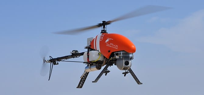
Uavos converted unmanned helicopter

UAVOS has announced that it has successfully converted a Robinson R22 helicopter to unmanned flight and completed programmed missions with the new drone. The first flight, with a duration of more than 1 hour, was fully self-piloted, reaching a height of up to 2200ft (670m). During the flight all scheduled tests were performed including fully automatic take-off, en-route flight and landing. Tuning of the UAV (unmanned aerial vehicle) control settings was also completed.

UAVOS manufactured several of the components fitted into the converted unmanned helicopter, including the autopilot, servo drives, sensor system and additional backup power supply. During the conversion the aircraft electrical system was upgraded, manual control was removed, and the fuselage was altered to fit the servo drives and components of the automatic control system. In addition, the pilot seats were removed and replaced by additional fuel tanks.

Aliaksei Stratsilatau, UAVOS Chairman of the Board and lead developer, stated: “UAVOS’ SD-1 high-speed and highly reliable actuators without free play allowed us to achieve precision accuracy control of the helicopter and get full control in all flight modes. We’ve also developed an autorotation algorithm that increases reliability of the unmanned system. Enhancing an UAV with our autopilot system gives additional features and advantages to the existing options: automatic take-off and landing, remote Ground Controls network capability, dead-reckoning and operations with jammed GPS, auto-rotation landing capability, and high efficiency flight control, based on TECS (Total Energy Control System).”

The converted R22-UV is an excellent platform for future research and testing of various commercial options for unmaned aircraft. Future test flights will include cargo delivery of up to 330lb (150kg) in automatic mode, and flights with duration of 6+ hours using additional fuel tanks and a payload for monitoring the landing surface. UAVOS also plans to check operational limitations of the UAV during night flights and flights under severe weather conditions. One of the top priorities is to test the possibility of outfitting the R22-UV with spraying equipment for agricultural purposes.

Powered by a gasoline engine, the unmanned R22-UV helicopter is able to deliver cargo or carry payloads with a total weight of up to 330lb (150kg) with a maximum take-off weight of 1400lb (635kg). The converted aircraft a has practical ceiling of 13,780ft (4,200m) and has a top speed of 189 kph. The UAV is designed to carry high-precision, heavy professional equipment of up to 88lb (40kg) for a wide variety of missions, including lidar, SAR, heavy optical equipment, and gas analyzers.

The R22-UV can be operated in regions without airfields, under severe weather conditions and during night-time, in conditions which would carry a high degree of risk for a human pilot. The converted helicopter would be indispensable for oil and gas companies which need to deliver cargo to hard-to-reach areas, where chemicals hazardous to humans are spread on fields and forests. Operational limits for high-altitude flights and missions in heavy turbulence and high mountain regions will be defined after appropriate testing.

Aliaksei Stratsilatau explains why the Robinson R22 helicopter was chosen for conversion: “In this project we applied all our knowledge and experience gained during the conversion of the Pipistrel aircraft. The converted Robinson helicopter is very interesting for our potential customers in the growing market of heavy, reliable UAVs. The R22-UV has a low price because the base helicopter is rather cheap. In addition, the operating cost for this aircraft is very low, which makes it attractive for commercial use. The aircraft was certified, and a large number of such helicopters are now in operation all over the world. The customer has access to 95% of spare parts and is able to purchase them at service centers. In addition, Robinson offers basic training for technicians in the training centers.”

UAVOS will be exhibiting at the AUVSI Xponential 2019 trade show in Chicago.

The post Unmanned Helicopter Conversion Successfully Flight Tested appeared first on Unmanned Systems Technology.

Fully Automatic Autorotation Introduced for Alpha 800 UAV

$
0
0

Alpha 800 UAV

Alpha Unmanned Systems has announced that, in conjunction with autopilot developer UAV Navigation, it has developed a fully automatic autorotation feature for its Alpha 800 UAV (unmanned aerial vehicle) platform.

Autorotation, a critical capability for helicopters in case of engine or tail rotor failure, is a state of flight in which the main rotor system turns by the action of air moving up through the rotor, as with an autogyro, rather than by engine power driving the rotor.

Autorotation is difficult for manned helicopter pilots to achieve, and in the case of a UAV helicopter, automatic autorotation has been previously unachievable.

The new capability represents an important step forward in that it enables a UAV in distress to be safely landed, minimizing risk to people and property on the ground. It also greatly increases the likelihood that the payload and other expensive components on the platform will be recovered.

Alpha Unmanned Systems and UAV Navigation have been collaborating on this technology for several years. The robust Alpha 800 was fitted with sensors and hardware to feed the necessary information to UAV Navigation’s VECTOR autopilot. The Alpha 800 platform has proven to be very effective for developing software as well as for extensive simulation with an advanced Hardware In the Loop simulator. Actual flight-testing confirmed the results with repeated successful landings following autorotations from a variety of altitudes, wind directions and headings. In all cases, no engine power whatsoever was supplied to the rotors.

Autorotation is just one of the safety features provided by the VECTOR autopilot to the ALPA 800 UAV. The system is also capable of flying in GPS-denied environments and in situations where the onboard magnetometer is unavailable.

Watch a video showcasing the new autorotation feature below:

The post Fully Automatic Autorotation Introduced for Alpha 800 UAV appeared first on Unmanned Systems Technology.

Autonomous UAV Power & Communication Solutions Unveiled

$
0
0

Atlas Dynamics AtlasPro UAV

Atlas Dynamics, a provider of autonomous unmanned aerial vehicle (UAV) solutions, has announced that it has developed new autonomous and multi-UAV capabilities which will be showcased at AUVSI Xponential 2019 in Chicago. The company aims to start deploying its autonomous capabilities to U.S. military, security and first responder operations.

“Our technology allows the user to operate several UAVs in tandem on the same mission as well as in multiple locations. This technology not only allows for near-limitless surveillance, but the cost-effective system also enables the user at the command and control station to seamlessly collect data whenever and wherever he needs it,” said Atlas’ Co-founder and CEO Ivan Tolchinsky.

The main display is the AtlasNEST, an advanced docking station for autonomous takeoff, landing and battery swapping. The primary use of the technology is perimeter security and first response for sensitive facilities, providing their command and control with accurate real-time data without risking human operators, enabling them to make decisions in real time. The AtlasNEST provides a wide array of deployment capabilities for constant readiness and preplanned missions. It is designed for the company’s proprietary AtlasPRO UAV — a versatile, high-end platform with endurance of 50 minutes, a communication range of 10km with HD streaming and the ability to survive extreme conditions.

The company will also be launching the AtlasMESH Multi-UAV Communication System. The new system has three unique features — control of multiple UAVs from one ground control station for continual mission operation beyond battery life limitations through the “UAV Hot Swap,” video stream from one UAV to numerous ground control stations or smartphones, and using an AtlasPro UAV as a physical relay.

The post Autonomous UAV Power & Communication Solutions Unveiled appeared first on Unmanned Systems Technology.
Aerosonde sUAS Joins Wave Relay MANET Ecosystem

$
0
0

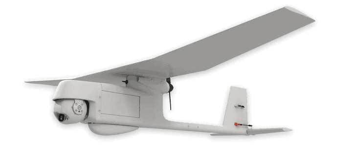
Textron Systems Aerosonde sUAS

Persistent Systems has announced that Textron Systems will join the Wave Relay Ecosystem, an industry alliance of unmanned platform and sensor manufacturers sharing Persistent’s Wave Relay mobile ad hoc network (MANET).

As part of the five-year agreement with Persistent, Textron Systems will incorporate the compact, lightweight, MANET-enabling Embedded Module into its Aerosonde Small Unmanned Aircraft System (SUAS) for select applications.

“We are extremely excited to have Textron Systems join the Wave Relay Ecosystem. Their products will be a part of building the future of battlefield networking,” said Louis Sutherland, Vice President of Business Development for Persistent. “This integration provides the Aerosonde SUAS with a reliable communication link, necessary for a wholly networked battlefield.”

Each radio, each communications node, in a MANET acts as both a receiver and a relay station. This allows for a robust, self-forming, self-healing network of voice, video, text and sensor data — all without a vulnerable central node or fixed communications infrastructure.

“It is critically important for an unmanned aircraft system to have a reliable communication link, as our customers depend on our system during thousands of operational flight hours each month,” says Textron Systems Vice President of Tactical Mission Systems Chris Mallon. “The integration of the Wave Relay MANET technology helps us provide this reliability to our customers.”

Textron Systems’ Aerosonde SUAS, which offers proven multi-mission performance in land- and sea-based applications, has accumulated more than 315,000 flight hours of operational maturity. The platform is equipped for real-time, full-motion video and communications relay within a single flight, day or night. The Aerosonde system features a range of 75 nautical miles, 200 watts of available payload power, more than 14 hours of endurance, distributed manned/unmanned teaming capability and is deployable in 20 minutes or less. With its Lycoming EL-005 heavy fuel engine, the Aerosonde is the only platform in its class with a propulsion system completely supported by a manufacturer with such manned aviation expertise, including a Federal Aviation Administration (FAA) Production Certificate.

The post Aerosonde sUAS Joins Wave Relay MANET Ecosystem appeared first on Unmanned Systems Technology.
AeroVironment Opens UAS Innovation Center

$
0
0

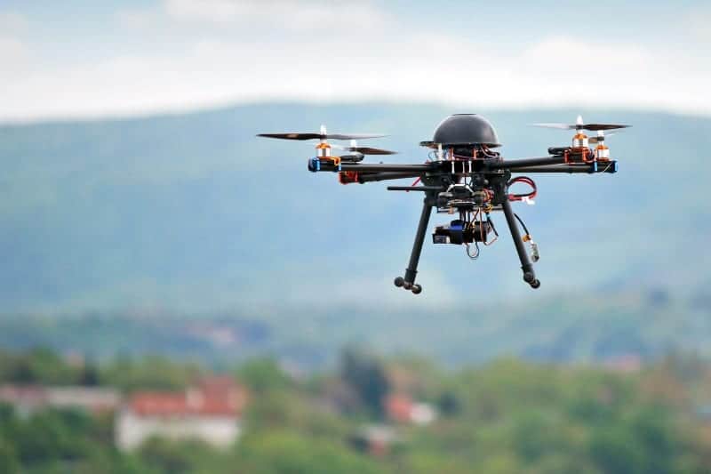
AeroVironment small UAS

AeroVironment, a provider of Unmanned Aircraft Systems (UAS) for both defense and commercial applications, has announced the creation of its New England Innovation Center (NEIC). The new office will lead development of advanced solutions complementing AeroVironment’s small UAS and furthering the company’s growth strategy.

“We are expanding our capabilities, our team and our footprint to achieve our growth objectives,” said Wahid Nawabi, AeroVironment president and chief executive officer. “The greater Boston region is a dynamic center of advanced development and talent in technologies key to the future of our customers’ operations, including robotics and artificial intelligence. Our latest Innovation Center will expand AeroVironment’s capabilities so that we may translate advances in key technologies into ever more valuable solutions that support our customers across the globe.”

“We welcome Tom Vaneck to our team with his extensive experience and knowledge of the unmanned systems industry and a track record of competitive success. We look forward to Tom’s leadership of our NEIC and his contributions to supporting our customers,” Mr. Nawabi added.

“I’m excited to be part of the team at AeroVironment, the leader in unmanned systems technologies for those on the front-line, and a company I have watched and admired for many years,” said Vaneck, vice president and managing director of AeroVironment’s NEIC. “Our New England Innovation Center will develop new robotic platforms to expand our family of systems, advance our autonomous capabilities and build on AeroVironment’s history of delivering innovative solutions that help customers proceed with certainty.”

AeroVironment is actively seeking top talent for its New England and Simi Valley operations, with more than 70 open positions, and will hold a special interactive recruiting event at the AUVSI XPONENTIAL 2019 trade show.

The post AeroVironment Opens UAS Innovation Center appeared first on Unmanned Systems Technology.

Integrated Hardware & Software Platform for Commercial Drones Developed

$
0
0

Drone flying

GE Aviation and Auterion have announced the integration of the Auterion Enterprise PX4 operating system on GE Aviation’s Unmanned Aircraft System (UAS) avionics platform. The two companies signed a teaming agreement to provide a comprehensive hardware and software solution for drone manufacturers and operators seeking to enable commercial drone operations at scale.

The teaming enables a full stack solution with airborne autopilot and application computing hardware, flight management, safety management and integration. GE Aviation is providing the avionics hardware, application computing, flight management and integration into airframes. Auterion is providing Enterprise PX4, the operating system that runs on the vehicle, in the cloud and the ground station.

The core architecture of the hardware and software platform has been implemented with the objective of supporting developers through global open software standards while maintaining an independent and authoritative safety controller. The combination of the two supports long-term flexibility and a high level of design assurance to enable commercial drone operations beyond visual line of sight and within complex airspace and obstacle environments.

Flight testing of the hardware and software platform took place at Reno-Stead airport in Reno, Nevada. “In demonstrating a seamless integration of ground, cloud and airborne components, we’ve reached another milestone in helping to unlock the value in autonomous and UAS advanced operations,” said Alan Caslavka, president of Avionics Systems for GE Aviation. “Auterion’s open standards leadership and cooperative legacy with the developer community is foundational to a scalable and sustainable solution critical for commercial drones.”

“We are excited about the collaboration with GE Aviation that allows us to offer our operating system on high reliability hardware to meet future regulations,” said Kevin Sartori, Co-Founder of Auterion. “With this collaboration, the combined solution will significantly reduce barriers commercial cargo drones face flying in manned airspace or inspection drones to flying in urban areas.”

This collaboration combines proven prerequisites where GE Aviation leverages their experience in avionics and unmanned airborne systems whereas the Auterion team, around co-founder Lorenz Meier, brings to the table more than a decade of experience of software development for autonomous systems in the open source community.

Auterion’s software platform provides core airborne software infrastructure including flight peripherals and camera integrations, data networking, precision navigation and compliance with traffic management. Working closely with the open source community, Auterion software on the vehicle is largely developed on top of the leading open source robotics software projects, PX4 and ROS 2.

The hardware and software platform is designed with commercial vehicle original equipment manufacturers (OEMs) and/or service providers in mind, and will be demonstrated at the AUVSI Xponential trade show in Chicago.

The post Integrated Hardware & Software Platform for Commercial Drones Developed appeared first on Unmanned Systems Technology.

Raytheon Demonstrates Directed-Energy Counter-UAS System

$
0
0

Raytheon counter-UAS laser system

Raytheon Company has announced that its advanced high power microwave and mobile high energy laser systems engaged and defeated multiple unmanned aerial system (UAS) targets during a U.S. Air Force demonstration. The mature HPM and HEL technologies aim to offer a solution to the growing UAS threat.

The HEL system, paired with Raytheon’s Multi-spectral Targeting System, uses invisible beams of light to defeat hostile UAS. Mounted on a Polaris MRZR all-terrain vehicle, the system detects, identifies, tracks and engages drones.

“Countering the drone threat requires diverse solutions,” said Stefan Baur, Raytheon Electronic Warfare Systems vice president. “HEL and HPM give frontline operators options for protecting critical infrastructure, convoys and personnel.”

Raytheon’s HPM uses microwave energy to disrupt drone guidance systems. High power microwave operators can focus the beam to target and instantly defeat drone swarms. With a consistent power supply, an HPM system can provide virtually unlimited protection.

“After decades of research and investment, we believe these advanced directed energy applications will soon be ready for the battlefield to help protect people, assets and infrastructure,” said Dr. Thomas Bussing, Raytheon Advanced Missile Systems vice president.

Raytheon’s HEL and HPM were the only directed energy systems that participated in this Air Force experimentation demonstration. The event expanded on previous directed energy demonstrations such as a U.S. Army directed energy exercise held in 2017.

The post Raytheon Demonstrates Directed-Energy Counter-UAS System appeared first on Unmanned Systems Technology.

Computer Vision Detect-and-Avoid Solution Enables BVLOS for Autonomous Vehicles

$
0
0

Casia BVLOS detect and avoid solution

Iris Automation, an artificial intelligence and safety avionics company, has announced the launch of Casia – the first commercially available computer vision detect-and-avoid solution to enable Beyond Visual Line of Sight (BVLOS) operations for autonomous vehicles.

The system allows Unmanned Aircraft Systems (UAS) and other unmanned platforms to understand the aviation environment around it as if a pilot were on board. Casia detects other aircraft, uses machine learning to classify them, makes intelligent decisions about the threat they may pose to the vehicle, and triggers automated maneuvers to avoid collisions.

Casia is a combination of both hardware and software that is ultra lightweight, low power and small in size. It comprises sophisticated artificial intelligence algorithms and software packaged in a self-contained supercomputer that works with a machine vision camera.

“Casia is the critical piece our industry has been dreaming about for years – finally allowing us to use drones to their full commercial potential,” said Iris Automation CEO Alexander Harmsen. “By unlocking BVLOS flight with Casia, operators all over the world will be able to use their aircraft in every conceivable scenario.”

The Casia technology has been extensively tested, with 7,000+ real-world test flights and mid-air collision scenarios – flying various manned aircraft against UAS – and over 40,000 encounters in simulation. Casia also ran a successful early adopter program with more than 30 participating beta customers from five countries.

Iris Automation is working directly with regulators around the world to make drones safer and more accessible, ensuring Casia achieves the highest levels of safety for national airspace use. With the Casia launch, Iris Automation will also offer customers regulatory support for Part 107 waiver writing and regulatory approval processes to secure the necessary permissions for their unique UAS operations.

The post Computer Vision Detect-and-Avoid Solution Enables BVLOS for Autonomous Vehicles appeared first on Unmanned Systems Technology.

Cloud-Based Remote Drone Operations Solution Launched

$
0
0

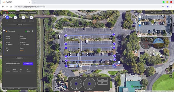
FlytGCS Cloud-Based Remote Drone Operations Solution

FlytBase, an enterprise drone automation company, has announced the launch of FlytGCS, a cloud-based remote drone operations solution, at AUVSI Xponential 2019. With BVLOS capability at its core, FlytGCS is built for subject matter experts, drone operations managers and UAV operators who wish to automate, simplify and scale their missions.

UAVs will create significant business value as soon as drone fleets can fly BVLOS. Technologists, regulators, business executives and drone operators all expect the industry to soon progress towards remote, autonomous, cloud-based drone operations across geographies, sectors, and use-cases. To support the execution of such automated missions, and bring new insights to drone stakeholders, FlytBase has developed FlytGCS.

FlytGCS offers a wide range of features including connectivity and control over 4G/LTE/5G, live HD video feed, fleet management, unlimited missions and unlimited drone addition, remote gimbal control, pre-flight checklist and geofence, mission planner, and cockpit view from web-dashboard.

FlytGCS is a hardware-agnostic solution that helps securely deploy industry-standard drones over the cloud, for BVLOS operations, using a mobile app (for DJI drones) or onboard SBCs (for Ardupilot and PX4 drones). Add-ons like precision landing, fleet management, pilot team management and drone-in-a-box make FlytGCS a powerful and scalable alternative to traditional desktop-based GCS products.

“With FlytGCS, the power of autonomy is made available to drone operators, subject matter experts and service providers who can now seamlessly manage drones over 4G/5G networks, with best-in-class latency and live video quality,” said Nitin Gupta, FlytBase CEO. “As a SaaS product, this FlytBase offering helps our customers get started immediately, for free, and upgrade to the feature set that is best suited for their business needs. Operators have used FlytGCS in applications ranging from construction management and security/surveillance operations to emergency response and utility/asset inspections.”

The post Cloud-Based Remote Drone Operations Solution Launched appeared first on Unmanned Systems Technology.
Customizable Geospatial Simulation Technology Showcased at Xponential

$
0
0

UAS Simulation Software provider Presagis is demonstrating its range of innovative geospatial simulation products aimed at the unmanned vehicle market at the AUVSI Xponential trade show.

Presagis Simulation Software

“Presagis’ research and innovation is perfectly in alignment with the UAS market’s trends and opportunities,” says Rémi Lecerf, Presagis Vice President Strategy and Business Development. “Our integrated and embedded solutions are at the forefront of geospatial simulation technology and can be leveraged to simulate everything from UAS sensors and subsystems to urban air traffic management environments and the ergonomic displays of tomorrow,” adds Lecerf.

Presagis products are pushing the boundaries of UAS and UTM simulation for research, design, and training.

Perfect for creating 3D urban air mobility simulations, VELOCITY is an automated solution for creating massive – yet precise – urban synthetic environments. VELOCITY is designed to process and fuse large amounts of geospatial and sensor data and produce simulation-ready terrain databases in hours instead of weeks or months.

CRAFT customizable platforms are ideally suited for the designing, testing, and researching UAS systems and subsystems. Modular and customizable, UAV CRAFT will be at AUVSI Xponential showcasing a range of uses including; enhanced sensor (IR, LiDAR, Leddar) capabilities, newly developed UAS components (collision avoidance), and advanced UAM projects (air taxi).

A valuable asset for airworthiness certification, Presagis Embedded Graphics solutions allow the creation of complex HMI systems. Running on embedded avionics hardware, a VAPS XT ergonomic display can help achieve certification for both current and future displays.

Building on a strong core of geospatial, sensor and simulation applications, Presagis is leveraging its experience and deep technological knowledge to help manufacturers, researchers, and trainers in the UAS market tackle even the most complex projects – confidently.

The post Customizable Geospatial Simulation Technology Showcased at Xponential appeared first on Unmanned Systems Technology.

StreamCaster Wireless Datalink Aids UAS Organ Delivery

$
0
0

UMD drone organ delivery

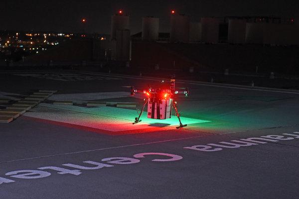
Silvus Technologies has announced that its StreamCaster 4200 MIMO (multiple-input multiple-output) radio has supported the world’s first unmanned aircraft system (UAS) flight that delivered a donor kidney to surgeons in Baltimore, Maryland for successful transplantation into a patient with kidney failure. The StreamCaster 4200 was used as the primary wireless datalink between the drone and the ground control station (GCS). The system operated flawlessly in a highly populated and dense urban environment at a distance of 3 miles.

The flight was a collaboration between transplant physicians and researchers at the University of Maryland School of Medicine (UMSOM) in Baltimore; aviation and engineering experts at the University of Maryland (UMD); and collaborators at the Living Legacy Foundation of Maryland (The LLF). While organ transport by drone has been previously tested successfully between medical facilities by the University of Maryland UAS Test Site in St. Mary’s County, this is the first time the flight operation was used to deliver an organ for transplant.

The unmanned aircraft system (UAS) flight operation was monitored by AiRXOS’ Air Mobility Platform, a cutting-edge grade framework enabling unmanned traffic management applications, operations and services. The Air Mobility Platform manages the volume, density, and variety of unmanned traffic data, while coordinating and integrating that data within a secure, FAA-compliant, gated cloud environment to ensure safe unmanned operations.

Among the many technological firsts of this effort include: a specially designed, high-tech apparatus for maintaining and monitoring a viable human organ; a custom-built UAS with eight rotors and multiple powertrains to ensure consistently reliable performance, even in the case of a possible component failure; the use of a mesh network radios to control the UAS, monitor aircraft status, and provide communications for the ground crew at multiple locations; and aircraft operating systems that combined best practices from both UAS and organ transport standards.

On Friday, April 19th, at approximately 12:30am, a human donor kidney was loaded onto the UMMC drone. The flight, led by the University of Maryland UAS Test Site at St. Mary’s County, commenced at 1:00am. The vehicle traveled 2.6 miles (4.3 km) and flew for approximately 10 minutes. The human kidney was successfully delivered to University of Maryland Medical Center (UMMC) and was scheduled to be used for a transplant surgery at 5:00am.

Maryland faculty and researchers believe this prototype organ transport blazes a trail for the use of UAS to expand access to donated organs, improving outcomes for more people in need of organ transplants. Currently organs are transported by commercial aircraft or charter flights. Organ transplants have a limited window of cold ischemia time (CIT) in which an organ can be chilled and then have blood supply restored. As of January 2019, almost 114,000 individuals were on the national transplant waiting list and every day approximately 80 people receive organ transplants, according to the United Network for Organ Sharing – the nonprofit that manages the transplant system. For sensitive medical deliveries, reducing the amount of travel time in urban settings, as well as vibration during travel can help lead to better outcomes.

The post StreamCaster Wireless Datalink Aids UAS Organ Delivery appeared first on Unmanned Systems Technology.

New 2-Cylinder UAS Engine Developed for High-Speed Applications

$
0
0

Sky Power SP-275 TS CR UAS engine

Sky Power, a manufacturer of engines for unmanned aerial systems (UAS), has announced the introduction of a new high-performance two-cylinder engine at the AUVSI Xponential 2019 trade show in Chicago.

The SP-275 TS CR has been developed for affordable and high-performance applications such as drone training. The carburetor of the SP-275 TS CR is located at the rear of the engine, making the system highly suitable for high speed applications due to its flat design.

“Some of our customers were asking about a simple, high-performing engine. Based on the application, the budget and the operating environment they like to forego technical complex additions, like fuel injection. Based on our customers’ demand we decided to develop such an engine,” stated Karl Schudt, CEO of Sky Power.

Based on the engine’s design and performance Sky Power predicts a great variety of possible applications for UAS. “The engine is an option for all applications that need a high-performing, simple to operate and easy to maintain engine,” added Schudt.

Almost all of Sky Power’s engines are equipped with two spark plugs per cylinder. This holds many benefits for the customer: the engine runs at a lower idling rate and the engine’s performance across the entire operational range is more balanced. Furthermore, in case one of the two spark plugs fails, the second ignition working independently ensures that the engine continues to run.

The post New 2-Cylinder UAS Engine Developed for High-Speed Applications appeared first on Unmanned Systems Technology.

Viewing all 4454 articles
Browse latest View live


<script src="https://jsc.adskeeper.com/r/s/rssing.com.1596347.js" async> </script>