Quantcast
Channel: UAV News | Drone News | Unmanned Aerial Systems UAS & UAV News
Viewing all 4454 articles
Browse latest View live

CIRCOR Develops DC Motors and Pneumatic Launchers for UAVs and Drones

$
0
0

CIRCOR Aerospace & Defense, a leading developer of specialty fluid and motion control solutions for demanding aerospace and defense applications, has partnered with Unmanned Systems Technology (“UST”) to demonstrate their expertise in this field. The ‘Silver’ profile highlights how their products are suited to fixed-wing and rotary unmanned aerial vehicles (UAVs) and other robotic platforms in a wide range of commercial and military markets.

CIRCOR’s industrial-grade fractional HP motors are designed to provide reliable and efficient performance for a wide variety of commercial and industrial drone and robotics applications.

Special modifications can be made to the standard design, altering aspects such as RFI/EMI filters, pinions, mounting flanges and brakes to suit precise requirements. Custom speeds and voltage ranges are available upon request.

Military-Grade Fractional HP DC MotorsCIRCOR military-grade fractional HP motors are designed to meet the needs of demanding military UAV and robotics applications, and feature excellent power-to-weight ratios as well as high reliability and efficiency. Many models have been engineered to meet relevant portions of the MIL-M-8608 and MIL-E-5272 standards, including environmental ruggedness and explosion-proofing.

These permanent magnet motors can be customised with flexible design options for flanges, pinions, filters, brakes and more. Custom speeds and voltage ranges are available upon request.

CIRCOR brushless fractional HP motors feature low noise, longer lifespan and improved efficiency. They are ideal for a wide range of commercial, industrial and military applications in both aerial drones and ground robotics platforms. Windings can be tailored to specific voltage, speed and torque requirements.

The TruLaunch series of high-pressure pneumatic launchers for UAVs feature unlimited launch capacity with multiple launches per charge. The lightweight, durable carbon fibre construction makes the launchers easy to transport and assemble.

With no electronics and no external power requirements, the TruLaunch systems can be deployed under a wide range of conditions, getting UAVs airborne quickly and efficiently. Launch velocities and other parameters can be easily fine-tuned to support particular UAS specifications.

TruLaunch UAV LauncherTruLaunch 1 and 2 are pneumatic rail launchers compatible with multiple UAS configurations, while TruLaunch T is a tube launcher that can accommodate multiple canisters or projectiles, and can be deployed on both fixed and mobile platforms.

To find out more about CIRCOR and their motion control and pneumatic launching solutions for unmanned systems, please visit their profile page:
https://www.unmannedsystemstechnology.com/company/circor-aerospace-defense/

The post CIRCOR Develops DC Motors and Pneumatic Launchers for UAVs and Drones appeared first on Unmanned Systems Technology.


Leonardo Unveils New Long-Endurance Tactical UAS

$
0
0

Leonardo Falco Xplorer UAS

Leonardo has announced the introduction of its largest-ever Remotely-Piloted Air System (RPAS), the Falco Xplorer. Building on the success of the company’s Falco family of tactical-class RPAS, the new drone features a payload capacity of 350kg, more than 24 hours flight time and a satellite communications capability for beyond-radio-line-of-sight operations, all within a 1.3 ton maximum take-off weight (MTOW). Everything is designed in-house by Leonardo, from the aircraft itself to the sensor suite, mission system and ground control station and the Falco Xplorer will be offered as both an integrated platform and as a fully-managed information-superiority service. In the latter model, Leonardo will operate the aircraft and its sensors and manage logistics to provide actionable information directly to the customer.

“Leonardo invests continuously in new capabilities to ensure we position the right products in the right markets”, said Leonardo CEO Alessandro Profumo, who presented the Falco Xplorer at its unveiling at the Paris Air Show. “The Falco Xplorer is designed to be extremely competitive in its category, building on the experience we’ve gained working with Falco family customers over a number of years and our Company’s strengths in the unmanned domain. By understanding and being able to meet our customers’ needs, we expect to increase our share of the unmanned systems market.”

The Falco Xplorer has been designed from the ground-up to access the widest possible market. It is undergoing certification for flight in non-segregated airspace, meaning Leonardo will be able to pitch it to civil customers such as coast guards and emergency responders as well as the military market. Because the Falco Xplorer system is entirely designed and manufactured in Europe, it is not subject to International Traffic in Arms Regulations (ITAR) restrictions and its technical characteristics place it within the Missile Technology Control Regime (MTCR) class II category. Together, these make the Falco Xplorer readily exportable around the world.

Following the unveiling, the new RPAS is expected to embark on its maiden flight from Trapani Airport in Italy. A series of trials will then take place throughout the year, capped off by a flight campaign with the platform’s fully-integrated sensor suite on-board. The RPAS could then be delivered to its launch customer as early as 2020. The drone will be certified according to NATO STANAG4671, meaning that it will be readily approved to fly for NATO countries.

Leonardo believes that an unmanned capability goes beyond the aircraft, so the baseline ‘Block 10’ equipment fit for the new RPAS takes advantage of Leonardo’s in-house electronics portfolio to offer a comprehensive Intelligence, Surveillance and Reconnaissance (ISR) capability over land and sea.

The platform will come equipped with a Gabbiano T-80 surveillance radar, LEOSS electro-optical turret, SAGE electronic intelligence (ELINT) system and an automatic identification system (AIS) for maritime use. The sensors will be integrated through Leonardo’s powerful mission management system, which draws on the company’s experience in both the manned and unmanned domains and includes protection from cyber-attacks as standard under the Company’s ‘secure by design’ philosophy. Leonardo can also flexibly modify the sensor suite in-line with customer requirements, including integrating third-party sensors.

The platform’s Ground Control Station (GCS) allows operators to control the aircraft and its sensors and incorporates data exploitation tools, enabling the dissemination of useful information to wider C5I systems. It also provides mission data analysis, mission planning, training and simulation capabilities.

The new platform joins Leonardo’s Falco family of tactical RPAS. The original Falco was chosen by five nations, while its successor, the Falco EVO, has been chosen for the United Nations MONUSCO humanitarian mission and has been deployed for the European Union’s Frontex surveillance research programme. Today more than 50 Falco family RPAS are currently engaged on operations around the world, some being operated by customers directly and some being owned and operated by Leonardo on behalf of customers as a managed service.

The post Leonardo Unveils New Long-Endurance Tactical UAS appeared first on Unmanned Systems Technology.

Tethered Drone Provides Surveillance for Champions League Final

$
0
0

Elistair Safe-T drone tether system at Champions League Final

Elistair has announced that its Safe-T tethered drone station was used by Madrid police forces during the UEFA Champions League Final for traffic monitoring, crowd control, and global surveillance. The station was used in conjunction with UMILES Group’s multirotor U06 Plus UAV (unmanned aerial vehicle).

During the 64th season of Europe’s premier club football tournament, Madrid welcomed 200,000 fans on its streets and more than 67,000 in the Wanda Metropolitano Stadium. In response to the heightened terrorist threat level in Spain, authorities conducted the largest security operation ever for any sporting event in the Spanish capital. The response included 4700 police officers, civil protection teams, firefighters and paramedics on standby and for the first time, a drone piloted by UMILES Global Solutions teams, and tethered to Elistair’s Safe-T station. Police Director Francisco Pardo said this was probably the largest deployment ever made to ensure public safety, and that aerial control of the surroundings and coordination in real time via a drone was a unique capability.

Deployed close to the stadium, the UMILES drone was tethered to Elistair’s Safe-T station to provide extended flight time. Continuously supplied with power, the drone maintained its position at a 50 meter elevation for 8 consecutive hours. Watching over the stadium surroundings and 3000-space car park, it provided authorities with real-time images of the crowd and vehicle movements, considerably aiding the decision-making process and coordination of security teams.

The National Police had instant access to the drone images through a fibre connection and directly communicated with UMILES pilots to monitor the camera and control the main highways and streets leading to the stadium, as well as the crowd movements and the entrances of the Wanda Metropolitano.

José Calcedo, UMILES Group Commercial Director, said: “National Police needed eyes in the sky to control the Stadium surroundings during the 8 hours deployment. The tethering system was the key to achieving this mission and maintaining our drone in the air for so long in the safest conditions, all the more since we had to fly day and night, with buildings very close, a lot of people walking around and helicopters flying in the same area. It is the first time a drone company has been allowed to fly in such conditions. This would not have been made possible without the Safe-T tether.”

The post Tethered Drone Provides Surveillance for Champions League Final appeared first on Unmanned Systems Technology.

US Army Deploys New Battlefield Counter-UAS Capability

$
0
0

US Army battlefield counter-drone system

The U.S. Army has announced that its Howler counter unmanned aerial system (UAS) capability has achieved Initial Operational Capability, putting critical protection against drones in the hands of soldiers.

Howler, a name coined by the U.S. Army, combines the capabilities of Raytheon’s Ku band radio frequency system multi-mission simultaneous radar and Coyote unmanned aircraft system. The KuRFS advanced electronically scanned array acquires and tracks all size UAS threats. Coyote works with KuRFS using its advanced seeker and warhead to identify and eliminate UAS threats.

“We developed and fielded this system in just 17 months,” said Bryan Rosselli, vice president of Mission Systems and Sensors. “Detecting the drone threat is the first critical step in the counter-UAS kill chain. The combination of precise tracking and engagement of these two proven systems gives the U.S. Army a vital capability to defeat this constantly evolving threat.”

In addition to providing advanced situational awareness, precise discrimination and mobility to successfully counter UAS threats, Howler gives the Army singular flexibility to adapt to the quickly changing, multidimensional threat environment.

“Test after test proves that our Coyote is an integral solution for defeating the growing number of enemy drones in the skies above the battlefield,” said Sam Deneke, Raytheon Land Warfare Systems vice president. “Protecting soldiers on the ground is a top priority, and this new system truly delivers.”

Raytheon’s portfolio of sensors, and kinetic and non-kinetic effectors networked into a command and control system covers the full counter-UAS kill chain.

The post US Army Deploys New Battlefield Counter-UAS Capability appeared first on Unmanned Systems Technology.

Counter-UAS Technology Under Development for Urban Environments

$
0
0

Raytheon and Black Sage counter-UAS technology

Raytheon Company and Black Sage have announced that the two companies are partnering through a formal teaming arrangement to provide an integrated drone detection and mitigation system for civil authorities, critical infrastructure and military organizations around the world.

“As we saw at Gatwick and Heathrow airports, drones operating inside commercial air corridors are posing a real challenge,” said Todd Probert, vice president of Raytheon Intelligence, Information and Services. “And though Raytheon has developed a range of counter-drone systems, from missiles to lasers to high-powered microwaves, authorities also need a system that can safely stop and land a drone where it may not be safe to shoot them down. That’s why we’ve teamed with Black Sage on a solution safe enough to operate in a populated area.”

To defend urban environments, like airports and cities, against drones, Black Sage’s sensors, AI, and radio-frequency jammers have been integrated into Raytheon’s Windshear command and control system. This combined system allows a single operator to control a network of sensors and effectors that safely and quickly track, take over or land drones flying where they shouldn’t.

Though the integrated system is designed primarily for urban environments, the systems are rugged enough to operate at even the most remote military bases.

“Together we address a diverse range of customer missions combining some of the deepest and strongest capabilities in the industry,” said Dave Romero, managing partner at Black Sage. “Customers now have access to an unprecedented and complete kill-chain; one that can be deployed as narrowly or broadly as the mission requires.”

The post Counter-UAS Technology Under Development for Urban Environments appeared first on Unmanned Systems Technology.

Drone-Based Forest Fire Detection System Tested in Spain

$
0
0

Drone-based forest fire detection

Telefónica, in collaboration with the Carlos III University of Madrid, Divisek and Dronitec, has announced that it has carried out a sustainable drone-based pilot scheme for the early detection of forest fires, based on Internet of Things (IoT) solutions. Contributing to the prevention of fires is highly important for Spain, as they are one of the greatest ecological threats in the country.

Vicente Muñoz, Chief IoT Officer of Telefónica, pointed out: “The evolution of unmanned vehicles such as drones, improvements in sensors and IoT communication networks are revolutionising the monitoring of all kinds of infrastructures and the management of emergencies such as fighting forest fires. Thanks to IoT technology, fires can be detected early and vital information can be known to make better decisions at an early stage, which can help to quell an emerging fire so that it does not lead to a large devastating one.”

Specifically, the project takes advantage of the telecommunications towers that Telefónica has throughout the territory. The towers are equipped with thermal sensors, which are capable of detecting any possible outbreak of fire in a perimeter of up to 15 km. Within these towers there is a hangar with a drone, also equipped with sensors including thermal and optical cameras. Once the thermal sensors detect a fire they send an alert to the drone with the exact location where a fire may have started. The drone then flies autonomously to that point, even in conditions of low visibility, collects optical and thermal images and sends in real time all the information it collects to the emergency services thanks to the mobile connectivity provided by Telefónica towers.

The system also allows the emergency control centre to take control of the drone at any time to gather more information and track the fire environment. Once the mission is over, the drone returns to the hangar and gets ready for future flights, automatically recharging its batteries. Knowing what is going on allows the emergency services to make better decisions such as what resources to send or how best to extinguish the fire.

This pilot was conducted in collaboration with the Carlos III University, Divisek and Dronitec. This University has developed the entire autonomous flight system and the interface with which the emergency service sees all the information in real time, while Divisek has been in charge of the autonomous drone recharging system and Dronitec has collaborated in all the services associated with the drone.

This is the first step towards the development of services that contribute towards preventing forest fires with technology and thus reversing the figures that make Spain the European country most affected by forest fires, with 7,143 fires and 25,162.44 hectares devastated by flames in 2018.

The post Drone-Based Forest Fire Detection System Tested in Spain appeared first on Unmanned Systems Technology.

DJI Unveils High-Security Government Drone Solution

$
0
0

DJI Government Edition drone solution

DJI has announced the introduction of DJI Government Edition, a new comprehensive drone solution created specifically for use in high-security situations by government agencies around the world. While DJI customers have always had full control over how the data they generate with drones is collected, stored and transmitted, Government Edition’s unique architecture ensures that drone data – including photos and videos captured during flight – never leave the drone and therefore can never be shared with unauthorized parties including DJI. This architecture ensures Government Edition meets the stringent requirements of the government sector for data management, risk mitigation, and enterprise-level data sharing control.

“DJI Government Edition allows government agencies to serve the public more efficiently and effectively using the industry’s most widely-adopted drone technology, while maintaining total control over their data,” said Mario Rebello, Vice President and Regional Manager of North America at DJI. “This is DJI’s most secure drone solution to-date because it prevents users from accidentally or even intentionally transferring data off of the drone to other parties. By incorporating these assurances into its architecture, the Government Edition solution meets the rigorous data security expectations of government agencies, and provides them the safety, reliability, and ease of operation that DJI’s products are respected for by commercial drone pilots around the world.”

Government Edition empowers government agencies around the world to benefit from DJI’s civilian drone technology for use cases like agricultural analysis and infrastructure inspections to public land management and disaster response. DJI developed the solution to meet the needs of the U.S. Department of the Interior Office of Aviation Services, which operated more than 10,000 drone flights in 2018 alone. Government Edition drones were used in over 1,500 of those missions and their security has been validated through multiple audits performed by DOI’s external and internal partners.

The Government Edition solution is based on DJI’s drone hardware and is controlled by custom device firmware and operational software in a unique architecture that supports the highest data security requirements:

  • No Data Transmission – A permanently enabled Local Data Mode within the custom DJI Pilot application prevents data transfer from the mobile application over the internet to third parties or to DJI.
  • Firmware Update Reviews – Government agency aviation and IT departments can review firmware updates in electronic isolation before applying them to their fleets, and have full control over how to validate them and when to install them on DJI drones.
  • Restricted Hardware Pairing – Drones and remote controllers running Government Edition solution firmware can only be linked with each other and are not compatible with other DJI products, preventing the use of unsecure hardware and unauthorized third-party applications.

“Government Edition allows us to tell our clients that all of their telemetry data, meaning where their drone is flying, is stored securely and not shared with anyone but them,” said Brandon Torres Declet, CEO and Co-Founder at Measure. “Having Government Edition will allow us more control over that process, and avoiding automatic firmware updates that can potentially impact our operation schedule is important – it’s also important to government customers.”

The post DJI Unveils High-Security Government Drone Solution appeared first on Unmanned Systems Technology.

Kratos Target Drones Used in German Navy Missile Exercise

$
0
0

Kratos Target Drone

Kratos Defense & Security Solutions has announced that its Unmanned Systems Division has successfully completed a Swedish Defence Materiel Administration (FMV) missile firing exercise with the German Navy. The exercises, hosted by FMV, utilized the Kratos MQM-178 Firejet and BQM-167i aerial target UAVs (unmanned aerial vehicles) and support services.

During this live-fire exercise in the open water outside of Härnösand, Sweden, 19 Kratos target flights were completed in both high and low altitude patterns, allowing the German Navy to run attack scenarios to test multiple weapon systems. Several missions were operated in dual flight configuration, having two target drones flying in patterns and formations to simulate certain ship-defeating threats.

Steve Fendley, Unmanned Systems Division President of Kratos, said, “We’re honored and excited to be a key part of this important exercise with our allied warfighters around the world. The outstanding multi-year relationship we continue to share with our valued customer and partner, the Swedish FMV, is key to our opportunity and success in both preparation and conduct of critical large-scale missions.”

The post Kratos Target Drones Used in German Navy Missile Exercise appeared first on Unmanned Systems Technology.


Schiebel Pacific Opens New Facility in Australia

$
0
0

CAMCOPTER VTOL UAV Maritime Applications

Schiebel Pacific Pty Ltd (SPL), a developer of rotary unmanned aerial systems (UAS), has announced that, one year after its foundation, the company is celebrating the opening of its new office and workshop at the Albatross Aviation Technical Park (AATP) in Yerriyong, New South Wales. The company has also announced its cooperation with Air Affairs Australia Pty Ltd (AAA).

This new SPL facility at the AATP firmly establishes Schiebel in Australia and allows for further expansion as the company grows over the next years. It puts SPL in close proximity to its customer, the Royal Australian Navy (RAN) at HMAS Albatross and provides direct access to the airfield. It also facilitates close cooperation with its next-door neighbour and new partner, AAA, who is an established provider of equipment and services to the Australian Defence Force, major government departments and multinational companies.

As part of the Memorandum of Understanding (MoU), SPL and AAA agree to collaborate on the compilation and submission of Request For Tender (RFT) responses for Remotely Piloted Aerial System (RPAS) opportunities in Australia and the Pacific region, as well as the subsequent close cooperation in contract delivery, support and services.

“Building on our current contracts, we see enormous potential in Australia for Schiebel and our unrivalled CAMCOPTER S-100 RPAS due to several significant upcoming programmes and working with established Australian companies will be key to success,” notes Hans Georg Schiebel, Chairman of the Schiebel Group. “A strong physical presence through SPL and a MoU with a strong partner are logical steps in preparing for the tremendous opportunities in Australia, a nation at the forefront of embracing robotic technology and modernizing its Defence Force.”

As a mature and proven capability for shipborne intelligence, surveillance and reconnaissance (ISR), Schiebel’s CAMCOPTER S-100 is currently under contract for the Navy Minor Project (NMP) 1942. This evaluation programme aims to develop the RAN’s understanding of the capabilities of an advanced Vertical Takeoff and Landing (VTOL) Tactical Unmanned Air System (TUAS). SPL is working closely with the RAN on achieving all the goals of the project, while simultaneously preparing for the upcoming tenders for LAND and SEA 129.

In parallel, to help develop doctrine and future requirements, as well as gain further insight into future TUAS capabilities and payloads, the Royal Australian Army has contractually leased the CAMCOPTER S-100 to conduct a series of advanced payload evaluations. The Army testing focuses on multiple payloads, including the L3 Wescam MX-10, ELTA Systems’ state-of-the-art ELK-7065 Compact Airborne HF COMINT/DF 3D System, Overwatch’s Multi Spectrum Imaging TK-5 and Leonardo’s PicoSAR radar. The most recent S-100 activities will culminate in the participation in Australia’s largest joint high-end warfighting exercise, Talisman Sabre 2019. The S-100 provides the Australian Army with the latest VTOL Multi Role Multi Environment (MRME) TUAS capability.

The post Schiebel Pacific Opens New Facility in Australia appeared first on Unmanned Systems Technology.

Custom Interface Manufactures Cable Assemblies & Wire Harnesses for UAS

$
0
0

UAV Systems Assembly and Integration

Custom Interface, a leading manufacturer and integrator of custom cable assemblies, wire harnesses and electro-mechanical assemblies for unmanned aerial vehicles (UAVs) and other aerospace systems, has partnered with Unmanned Systems Technology (“UST”) to demonstrate their expertise in this field. The ‘Gold’ profile highlights how they can provide innovative turnkey manufacturing solutions, systems integration, value-added engineering and prototype support for a wide range of defense, commercial and industrial UAS applications.

UAS Cable Assemblies & Wire HarnessesCustom Interface wiring harnesses and cable assemblies for Group 2 and 3 unmanned aircraft provide mission-critical, never-fail functionality under the most demanding of conditions, and have to date flown over one million hours without field failure. Custom rugged wiring solutions can be manufactured for everything from interface panels and lighting, up to complete UAS command and control systems.

Custom Interface also offer a wide variety of aerospace & UAS manufacturing services, including:

  • Electro-mechanical and UAS Lead System Integration: installation of harnesses and electronic componentry into composite structures, such as Group 2 and Group 3 UAS airframes. Custom Interface works closely with customers to improve harness routing and product longevity, while simultaneously enhancing performance and reducing weight.
  • Value-Added UAS Engineering Design Support: extensive review of customer designs to ensure manufacturability and recommend cost-saving and quality-improving options. This keeps design costs down and saves weight in space-constrained UAS applications, as well as maximizing ease of connection for UAS field operators.
  • Aircraft Prototyping Services: supporting the development of UAS and aerospace prototypes and low initial production runs, helping customers move from concept to working design in a matter of days. Custom Interface can review drafts or schematics for manufacturability, build the prototypes and create a final document package for the product.
  • Testing & Quality Control: Custom Interface target 100% quality on customer products, and currently achieve over 99.4%. The company is experienced with testing to NASA, Boeing, Airbus, FAA, ASME, and IPC 620 standards. Testing capabilities include microscopic visual inspection, basic continuity & isolation testing, HiPot testing, pull force testing, RF cable VSWR and insertion loss testing, and much more.
  • Supply Chain & Cost Management: development of Turnkey Manufacturing programs that help reduce cost and lead times over the entire life cycle of customer products. Custom Interface can also help customize stocking packages and raw materials safety stock programs to mitigate lead time risks and ensure demand is always met.

To find out more about Custom Interface and their cable assembly and wire harness solutions for unmanned systems, please visit their profile page:
https://www.unmannedsystemstechnology.com/company/custom-interface-inc/

The post Custom Interface Manufactures Cable Assemblies & Wire Harnesses for UAS appeared first on Unmanned Systems Technology.
Leaf-Sprung Landing Gear Developed for Heavy UAVs

$
0
0

UAVOS leaf sprung UAV landing gear legUAVOS has announced that it has created an advanced leaf-sprung leg for the main landing gear of UAVs (unmanned aerial vehicles) that weigh up to 1200 kg. The leaf spring is made from aircraft-grade prepreg carbon fibre, manufactured with a high-temperature molding procedure that makes it 38% stronger, thinner and lighter compared to the fiberglass equivalent.

Inside the leaf spring there is a duct for a brake hose and landing sensor wire. Modern material and chassis design allowed UAVOS to save 7 kg in weight (in comparison with fiberglass), to reduce aerodynamic resistance, and to ensure the protection of the brake hydraulic system and electrical wiring leading to the chassis.

The leaf spring of the main landing gear leg softens the blows that occur when the unmanned aircraft lands or runs over the uneven surface of a runway. The total weight of the leg is 19kg.

Aliaksei Stratsilatau, UAVOS’ chairman of the board and lead developer, commented: “We’re continuously developing new technology to meet the future demands and needs of all of our clients. By improving the quality of individual components in UAV systems, we increase the level of reliability and security of UAVs we produce”.

The post Leaf-Sprung Landing Gear Developed for Heavy UAVs appeared first on Unmanned Systems Technology.
SkyGuardian UAS Conducts Simulated Civilian Airport Integration

$
0
0

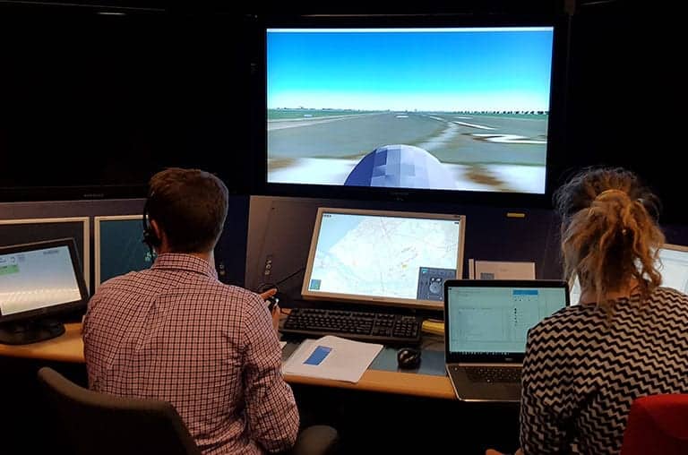
Simulated SkyGuardian UAS airport integration

General Atomics Aeronautical Systems, Inc. (GA‑ASI) has announced that it worked with the Netherlands Research Laboratory (NLR) to conduct a simulated flight demonstration where civil Air Traffic Controllers (ATCOs) in an ATC Tower and Terminal Approach Facility managed the flight of a Medium-altitude, Long-endurance (MALE) Remotely Piloted Aircraft (RPA) in a busy civilian airport like a manned aircraft. The flight featured a simulated MQ-9B SkyGuardian RPA, which is designed and developed by GA‑ASI.

“This simulated MALE RPA flight operating under Instrument Flight Rules (IFR) was actively managed by civil ATCOs, dealing with every conceivable contingency scenario,” said David R. Alexander, president, GA-ASI. “This demonstration helps show the Air Traffic Management community that flying large RPA in civil airspace can be as safe as managing a commercial manned aircraft, when the RPAS is properly designed.”

GA-ASI supported the 3-D modeling of the SkyGuardian so that NLR, through NARSIM, could enable civil ATCOs to control the RPA as if it was any manned aircraft, taking off and landing at a civil airport. NLR facilitated the demonstration in their facility and set up seven contingency and emergency scenarios for the RPAS pilot to fly, including Loss of Propulsion; Loss of Datalink (C2 Link); Loss of Voice Communications; Missed Approach; Missed Departure; Airborne Traffic Conflict; and Failure of the Automatic Landing System. The simulated flights were based out of the Rotterdam Airport (EHRD) with representative civil air traffic.

The Royal Air Force (RAF) is acquiring SkyGuardian as part of its Protector RG Mk1 programme and is scheduled for first delivery in the early 2020s. The Government of Belgium has approved Belgian Defense to negotiate the acquisition of SkyGuardian to meet the nation’s RPA requirements. The aircraft is also being considered by the Australian Defence Force, who chose GA-ASI to supply an RPA system for Project Air 7003.

The post SkyGuardian UAS Conducts Simulated Civilian Airport Integration appeared first on Unmanned Systems Technology.

SkyHopper Drone Data Link Certified in Japan

$
0
0

Mobilicom Skyhopper drone data link in Japan

Mobilicom Ltd has announced that it has become the first supplier with certified high-power, long range, highly secured data link solutions for unmanned aerial vehicles (UAVs) in Japan. This comes as a result of receiving the Japanese high-power GDT (ground data terminal) and ADT (aerial data terminal) transmission certification for its SkyHopper data links. The high-power certification comes after SkyHopper received the low-power Japanese TELEC certification at the end of 2017.

SkyHopper’s high-power certification comes at an ideal time, with the 2020 Olympic Games just around the corner. As Japan prepares itself for the monumental event, SkyHopper provides a solution for drones planned to be used for security and other operations.

Mobilicom is a global provider of holistic end-to-end hardware & software solutions for commercial and industrial drones and robotics including communication, encryption & cybersecurity, integrated video processing, ruggedized controllers and viewers. SkyHopper brings the key components that turn a drone into a smart aerial platform, integrating the pieces that are valuable for the drone’s creation.

Mobilicom’s CEO, Oren Elkayam, said: “To know that we provide the only certified high-power, long range, highly secured drone communication solution in Japan today is as a testament to the quality of our systems. A high-power, long range data link has been in demand by the Japanese drone market for a long time, and we are proud to be able to fill this need.”

Jepico Corporation, a SkyHopper reseller in Japan, has been actively supporting the SkyHopper high power certification process and is currently in the process of obtaining an operators’ license.

TELEC is a certification entity registered with Japan’s Ministry of Internal Affairs and Communication. The certification proves that SkyHopper conforms to the strict technical and legal requirements of Japanese radio law, and thereby complies with industry standards. The TELEC certification validates that the SkyHopper family of products is of the highest quality, and that Mobilicom is committed to delivering these products to the Japanese market.

The post SkyHopper Drone Data Link Certified in Japan appeared first on Unmanned Systems Technology.

Raytheon and Airmap to Develop Safe Drone Integration

$
0
0

Raytheon and Airmap drone integration

Raytheon Company has announced that it has signed a strategic agreement with AirMap, a global airspace intelligence platform for drones, to collaborate on future projects to safely integrate unmanned aerial systems (UAS) into the national airspace system and unlock the positive economic and social benefits of expanded commercial drone operations.

“AirMap is ushering in a new era in drone aviation,” said Matt Gilligan, vice president of Raytheon’s Intelligence, Information and Services business. “Drones must safely operate in an already complex ecosystem, which is where our experience matters.”

The agreement combines the two companies’ expertise:

  • Raytheon’s Standard Terminal Automation Replacement System, or STARS, is used by air traffic controllers across the U.S. to provide safe and efficient aircraft spacing and sequencing guidance for more than 40,000 departing and arriving aircraft daily at both civilian and military airports.
  • AirMap is the leading global provider of airspace intelligence for UAS operations, with over 250,000 registered users. In 2018, the majority of U.S. registered commercial drone pilots used AirMap to request over 45,000 automated authorizations to fly in controlled airspace.

“Raytheon technology has helped safely and effectively manage airspace in the most complex, dense controlled airspace in the world for decades,” said Ben Marcus, AirMap Co-founder and Chairman. “They are an ideal partner to join AirMap on the path toward enabling safe, efficient, and scalable drone operations in U.S. low-altitude airspace between 0 and 400 feet.”

The two companies are working toward an integrated demonstration that will showcase how AirMap’s unmanned aircraft traffic management platform can increase air traffic controllers’ awareness of potential conflict between drones and manned aircraft near airports to ensure overall safety of the airspace.

The post Raytheon and Airmap to Develop Safe Drone Integration appeared first on Unmanned Systems Technology.

AVT Imaging Sensors Integrated on Firefighting Surveillance Drone

$
0
0

Firefighting Surveillance Drone

Ascent Vision Technologies (AVT) has confirmed that Bridger Aerospace has integrated their imaging sensors into Latitude’s FVR-90 VTOL (vertical take-off and landing) fixed-wing unmanned aerial system (UAS), to create the world’s most advanced aerial firefighting surveillance system.

The Gen V system will be used by Bridger’s highly skilled and trained team of drone operators to tackle extreme fires, and better support wildfire management and relief missions.

The fully integrated system combines AVT’s revolutionary lightweight CM142 imaging payload; AVT’s Fire Mapper; and Latitude’s FVR-90 VTOL fixed-wing UAS.

The CM142 optic delivers real-time aerial data, transferring high definition daylight and crisp long-wave infrared imagery directly to the remote ground station. The footage highlights hotspots, areas affected and areas at risk of damage. The Fire Mapper includes short-wave infrared, long-wave infrared and a 13-megapixel daylight sensor. Real-time fire mapping with live locations facilitates better decision making when responding to the fire.

Latitude’s next generation VTOL provides greater flexibility in deployment, allowing take-off and landing to take place from any location, at any time. With an endurance of up to 15 hours, the system can perform for long durations to ensure the team collects the data required for the mission.

Using a fully integrated, user-friendly rover system, Bridger Aerospace will provide firefighters with remote access to live video with real-time overlays of telemetry and metadata. Operators can communicate to the aircraft using the primary datalink and a small portable handheld radio device. The system uses a MIMO (multi in multi out) data link, which extends the range from the ground station out to over 50nm.

The fully integrated system combines everything needed to support the US Government in tackling the country’s most dangerous fires, helping firefighters save lives and reducing damage. Bridger Aerospace is one of the two companies in the United States authorized to conduct BLOS (beyond line of site) flights in active fire zones. With over 13 years of experience in providing solutions for wildfire management, Bridger delivers revolutionary equipment and a skilled team of operators to tackle each firefighting mission.

CEO at Bridger Aerospace, Tim Sheehy, said:
“We have developed a world leading aerial firefighting surveillance tool that will transform aerial data collection for fire management and relief missions in the United States. The system includes Latitude’s FVR-90 VTOL, which is fitted with AVT’s high-performance CM142 sensor and Fire Mapper to support the US government in managing the country’s major wildfires.

This system will have a huge impact on wildfire management by providing all the essential tools needed to help save lives. This revolutionary firefighting surveillance solution will be controlled by Bridger’s highly-trained team of UAS operators to provide a world-leading service to combat wildfires.”

Integrated Systems Manager, Weston Irr, said:
“This marks the second year where Bridger Aerospace supports firefighting missions in the US using an unmanned aerial system. With our new Gen V fully integrated UAS system, we can provide firefighters with remote access to accurate, real-time imagery. This data will have a huge impact on the efficiency of their operation by facilitating fast and informed response to the fire.”

The post AVT Imaging Sensors Integrated on Firefighting Surveillance Drone appeared first on Unmanned Systems Technology.


Thales to Develop Real-Time Remote Drone Identification & Tracking

$
0
0

Drone flying

Thales has announced that it has partnered with digital security firm Gemalto to develop systems for remote identification and tracking of Unmanned Aerial Systems (UAS) by regulatory authorities and law enforcement globally.

Large numbers of new drones are projected to enter our skies over the next 20 years, mostly in low airspace. The resulting complexity in the aviation ecosystem presents significant new challenges to security and safety. This will lead to more stringent registration and identification for UAS being required by civil authorities. Regulatory frameworks will influence how operators plan missions, receive flight approvals and identify and track drones securely.

To support customers in overcoming these complex and varied issues, Thales has developed an aerospace management system that works on the Air Traffic Control of objects in low airspace with flight authorization in controlled airspace. This is a digital, cloud based platform based on live data sharing that has been connecting aviation actors and optimizing operations for three years, and now integrates Unmanned Aerial Vehicle Traffic Management (UTM), making the link between regulation and operations to deliver automated mission and flight authorizations.

The integration of Gemalto’s cyber-secured identity tracking technology into Thales’s existing UTM platform brings an even stronger offering to help Civil Aviation Authorities. It provides a “certified drone identity card” meaning that regulators can verify a drone’s registration number, identify its pilot and confirm that they have the right authorizations to fly, all in a few seconds. The Gemalto UTM tracker builds on existing airspace and regulatory compliance capabilities already available in the Thales UTM platform.

These capabilities have recently been successfully trialed at the FAA UAS Test Site, at Griffiss International Airport, Rome, (NY – USA), in partnership with Oneida County and the Northeast UAS Airspace Integration Research (NUAIR) Alliance. The trial demonstrated the integration of secure, remote identification and tracking into the Thales UTM solution.

“The current aviation ecosystem was not designed to accommodate the type of growth that we will experience over the next few decades. Our goal as an industry is to maintain the highest levels of safety whilst addressing the needs of a rapidly developing market where manned and unmanned systems can coexist. Data security and protection along with equitable access to the airspace is the biggest challenge we face,” said Jean Ferré, Thales Vice President, Air Traffic Management.

The UTM tracker is connected and securely authenticated by the Thales UTM system via cellular network or alternative communication technologies, using secure modules and encryption systems. The tracker embeds a GPS for real-time location information, and carries a tamper-proof element used to securely store all the information and crypto functions involved in the mutual process of authentication between the UTM and the operator. Thus, the remote identification signal is digitally signed, and command and control communications between the flight controller and the ground control station are fully encrypted.

Once the drone’s credentials are validated, a message is sent to the Thales UTM platform confirming the mission is secured and can be conducted. Without this validation a notification is sent to the UTM invalidating the mission and the pilot and appropriate authorities are alerted automatically.

The post Thales to Develop Real-Time Remote Drone Identification & Tracking appeared first on Unmanned Systems Technology.
US Army Retrofits Stinger Missiles for Counter-Drone Operations

$
0
0

US Army counter-drone Stinger missile

The U.S. Army has announced that it is retrofitting Stinger missiles, produced by Raytheon Company, with proximity fuzes to help counter the growing threat of enemy unmanned aircraft systems (UAS). The enhancement enables the lightweight, self-contained Stinger air defense system to destroy a wider array of battlefield threats by detonating its warhead near the target, while maintaining the missile’s proven hit-to-kill capability.

“The Stinger enhancement gives our troops exactly what they need – an affordable and effective way to defeat the growing number of enemy UAS targets in the skies above the battlefield,” said Sam Deneke, Raytheon Land Warfare Systems vice president. “The counter-UAS mission is so critical; several allied nations are interested in this upgraded Stinger.”

The Army completed qualification testing on the new proximity fuze and will begin delivering the enhanced Stinger missile to soldiers later this year.

Combat proven in four major conflicts, the Stinger missile has over 270 fixed- and rotary-wing intercepts. Eighteen nations and all four U.S. military services have procured the missile that can be rapidly deployed by ground troops and on military platforms. Stinger is also used on Apache helicopters for air-to-air engagements.

Watch a video of the Stinger proximity fuse counter-UAV test below:

The post US Army Retrofits Stinger Missiles for Counter-Drone Operations appeared first on Unmanned Systems Technology.

Defibrillator-Carrying Drone Successfully Tested

$
0
0

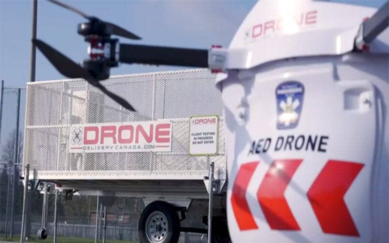
Drone Delivery Canada defibrillator delivery

Drone Delivery Canada (DDC) has announced that it has successfully completed phase one of its AED (automated external defibrillator) On The Fly Pilot with Peel Region Paramedics and achieved 100% success rate, concluding that utilizing DDC’s proprietary drone delivery platform to enable rapid first responder technology via drone produces reduced response time.

The Pilot was to determine the effectiveness of delivery of an AED via drone versus a traditional ambulance. To determine this, phase one of the Pilot consisted of simulating 911 emergency calls in the Township of Caledon in the Region of Peel dispatching DDC’s Sparrow drone equipped with specialized first responder payload that included an automated external defibrillator. The delivery time of the drone was then compared against the traditional dispatching of first responder paramedics. Several staged 911 calls were then executed and, in all cases, DDC’s Sparrow drone arrived on-site ahead of the traditional first responder vehicles. DDC’s Sparrow was able to reduce response times on all calls making the pilot a great success.

“This partnership between DDC and Peel Regional Paramedic Services is ground breaking. The program utilizes DDC’s proprietary drone delivery platform to enable rapid first responder technology via drone with the goal to reduce response time and potentially save lives. We look forward to the next phase to bring this vertical closer to commercialization,” commented Michael Zahra, CEO of Drone Delivery Canada.

Dr. Sheldon Cheskes, Medical Director at Sunnybrook Centre for Prehospital Medicine and the Principal Investigator of the AED on the Fly Pilot Research program, commented: “Phase 1 of our research was an impressive success. We were able to demonstrate that drone technology to deliver AED’s for cardiac arrest is not only feasible but has the potential to reduce response times and improve outcomes from out-of-hospital cardiac arrest. We will continue to work with DDC to ensure a simple and smooth transition from drone landing to bystander retrieval and use of an AED moving forward.”

Watch a video of the pilot trials below:

The post Defibrillator-Carrying Drone Successfully Tested appeared first on Unmanned Systems Technology.

NASA to Send Multirotor UAV to Saturn’s Moon

$
0
0

NASA Dragonfly UAV

NASA has announced that it will send its Dragonfly multirotor UAV (unmanned aerial vehicle) to Saturn’s moon Titan in order to advance the search for the building blocks of life. The Dragonfly mission will fly multiple sorties to sample and examine sites around Saturn’s icy moon.

Dragonfly will launch in 2026 and arrive in 2034. The rotorcraft will fly to dozens of promising locations on Titan looking for prebiotic chemical processes common on both Titan and Earth. Dragonfly marks the first time NASA will fly a multi-rotor vehicle for science on another planet; it has eight rotors and flies like a large drone. It will take advantage of Titan’s dense atmosphere – four times denser than Earth’s – to become the first vehicle ever to fly its entire science payload to new places for repeatable and targeted access to surface materials.

Titan is an analog to the very early Earth, and can provide clues to how life may have arisen on our planet. During its 2.7-year baseline mission, Dragonfly will explore diverse environments from organic dunes to the floor of an impact crater where liquid water and complex organic materials key to life once existed together for possibly tens of thousands of years. Its instruments will study how far prebiotic chemistry may have progressed. They also will investigate the moon’s atmospheric and surface properties and its subsurface ocean and liquid reservoirs. Additionally, instruments will search for chemical evidence of past or extant life.

“With the Dragonfly mission, NASA will once again do what no one else can do,” said NASA Administrator Jim Bridenstine. “Visiting this mysterious ocean world could revolutionize what we know about life in the universe. This cutting-edge mission would have been unthinkable even just a few years ago, but we’re now ready for Dragonfly’s amazing flight.”

Dragonfly took advantage of 13 years’ worth of Cassini data to choose a calm weather period to land, along with a safe initial landing site and scientifically interesting targets. It will first land at the equatorial “Shangri-La” dune fields, which are terrestrially similar to the linear dunes in Namibia in southern Africa and offer a diverse sampling location. Dragonfly will explore this region in short flights, building up to a series of longer “leapfrog” flights of up to 5 miles (8 kilometers), stopping along the way to take samples from compelling areas with diverse geography. It will finally reach the Selk impact crater, where there is evidence of past liquid water, organics – the complex molecules that contain carbon, combined with hydrogen, oxygen, and nitrogen – and energy, which together make up the recipe for life. The lander will eventually fly more than 108 miles (175 kilometers) – nearly double the distance traveled to date by all the Mars rovers combined.

“Titan is unlike any other place in the solar system, and Dragonfly is like no other mission,” said Thomas Zurbuchen, NASA’s associate administrator for Science at the agency’s Headquarters in Washington. “It’s remarkable to think of this rotorcraft flying miles and miles across the organic sand dunes of Saturn’s largest moon, exploring the processes that shape this extraordinary environment. Dragonfly will visit a world filled with a wide variety of organic compounds, which are the building blocks of life and could teach us about the origin of life itself.”

Titan has a nitrogen-based atmosphere like Earth. Unlike Earth, Titan has clouds and rain of methane. Other organics are formed in the atmosphere and fall like light snow. The moon’s weather and surface processes have combined complex organics, energy, and water similar to those that may have sparked life on our planet.

Titan is larger than the planet Mercury and is the second largest moon in our solar system. As it orbits Saturn, it is about 886 million miles (1.4 billion kilometers) away from the Sun, about 10 times farther than Earth. Because it is so far from the Sun, its surface temperature is around -290 degrees Fahrenheit (-179 degrees Celsius). Its surface pressure is also 50 percent higher than Earth’s.

Dragonfly was selected as part of the agency’s New Frontiers program, which includes the New Horizons mission to Pluto and the Kuiper Belt, Juno to Jupiter, and OSIRIS-REx to the asteroid Bennu. Dragonfly is led by Principal Investigator Elizabeth Turtle, who is based at Johns Hopkins University’s Applied Physics Laboratory in Laurel, Maryland. New Frontiers supports missions that have been identified as top solar system exploration priorities by the planetary community. The program is managed by the Planetary Missions Program Office at NASA’s Marshall Space Flight Center in Huntsville, Alabama, for the agency’s Planetary Science Division in Washington.

“The New Frontiers program has transformed our understanding of the solar system, uncovering the inner structure and composition of Jupiter’s turbulent atmosphere, discovering the icy secrets of Pluto’s landscape, revealing mysterious objects in the Kuiper belt, and exploring a near-Earth asteroid for the building blocks of life,” said Lori Glaze, director of NASA’s Planetary Science Division. “Now we can add Titan to the list of enigmatic worlds NASA will explore.”

The post NASA to Send Multirotor UAV to Saturn’s Moon appeared first on Unmanned Systems Technology.

GA-ASI Announces Streamlined ISR Tools for UAS

$
0
0

GA-ASI Integrated Intelligence Center

General Atomics Aeronautical Systems, Inc. (GA-ASI) has unveiled its new Integrated Intelligence Center (I2C), which presents innovative ways to improve the user experience for operators of Remotely Piloted Aircraft (RPA) using automation and user experience-based design (UX).

“I2C will rapidly transform data into actionable intelligence,” said David R. Alexander, president, GA-ASI. “We see benefits to the warfighter on many fronts, including the reduction of operational cost – whether it’s Ground Ops, Air Ops, or Intel Ops. By combining XC2, Automatic Takeoff and Landing, MMC and our single-seat Certifiable Ground Control Station, we will reduce manning by 50 percent.”

GA-ASI’s modular and open software architecture designs promote horizontal integration of third party software and rapid integration of new capabilities, making the following developments the ideal set of Intelligence, Surveillance and Reconnaissance (ISR) tools for streamlined and improved collaboration:

  • eXpeditionary Command & Control (XC2): XC2 laptop leverages GA-ASI’s Advanced Cockpit development by porting select capabilities to a ruggedized laptop. A forward-deployed maintainer can use the laptop to employ automated pre-flight and post-flight checklists that reduce setup times by up to 50 percent, and reduces the airlift requirements by eliminating the need for a forward-deployed Ground Control Station (GCS).
  • Certifiable Ground Control Station (CGCS): The CGCS enables single-seat operations to reduce manpower requirements. Its tactical situation display unifies ISR and C4ISR data, as well as mission planning into a single Common Operating Picture (COP). The integrated Collins Pro Line Fusion enables CGCS certifiability for operation in national airspace.
  • Multi-Mission Controller (MMC): The MMC enables a single user to safely control multiple aircraft and perform transit and routine ISR missions using a hand controller. When an aircraft is tasked with performing more dynamic ISR or a strike mission, MMC allows a rapid handoff of the aircraft to a dedicated GCS, where a mission crew can take control.
  • Metis – Automated intelligence Collection Management: Metis is a map-based interface that enables a pre-approved Metis user to request ISR products from the RPA, similar to ordering a car from Uber. Once the Metis user sends a task, it’s transmitted to MMC in real time. The MMC user selects the task and an integrated third party auto-router automatically generates a safe route to the requested target.
  • STARE Imagery: The System for Tactical Archival, Retrieval, and Exploitation’s (STARE) Common Operation Picture shows aircraft locations, where the operator can look and what they are looking at. The Multi-INT exploitation tool ingests, archives, disseminates and makes ISR data discoverable for imagery analysts to utilize. STARE reduces data exploitation tasks from hours to minutes.
  • Automation of Intel Ops: I2C integrates third party capabilities and software services to make Intel analysts more effective. Automated Activity Alerts – based on Multi-INT data correlation – reduces the need for eyes-on RPA sensor data to pick out significant activity. GA-ASI is partnering with best-of-breed companies specializing in Artificial Intelligence (AI) and Machine Learning with proven AI-based systems deployed across multiple commercial sectors. GA-ASI works with these businesses to train their AI capability with MQ-9, MQ-1C and Predator ISR data.

These tools and capabilities are either operationally deployed, undergoing customer operational assessment or are actively flying aircraft.

The post GA-ASI Announces Streamlined ISR Tools for UAS appeared first on Unmanned Systems Technology.

Viewing all 4454 articles
Browse latest View live


<script src="https://jsc.adskeeper.com/r/s/rssing.com.1596347.js" async> </script>