Quantcast
Channel: UAV News | Drone News | Unmanned Aerial Systems UAS & UAV News
Viewing all 4454 articles
Browse latest View live

IP64-Rated EO/IR Camera Released for UAVs

$
0
0

TeAx Technology IP64 rated EOIR cameraTeAx Technology has announced that it has developed an IP64-rated splash-resistant version of its ThermalCapture Fusion EO/IR camera for UAVs (unmanned aerial vehicles), following increasing requests from the global drone market. The ThermalCapture Fusion is a dual camera system that delivers both thermal and visible imagery.

As the number of professional drone systems has risen, so too has the demand for reliable sensor payloads that capture meaningful data. TeAx Technology has updated ThermalCapture Fusion for full operation under harsh weather conditions.

Features of the new IP-64 rated ThermalCapture Fusion system include:

  • Water protected (IP64) dual camera, compatible with almost any drone
  • Completely aligned thermal and visual sensors
  • Overlay of thermal and visual images in real-time and post-processing
  • Digital thermal radiometric and visual data stored on microSD card
  • Per pixel temperature measurements
  • Hot Spot Detection
  • Geo-referenced data material
  • Serial interface for meta data
  • Analog live video output + HDMI
  • Stores position and time (GPS + PPS)
  • S Bus / PWM compatible
  • Remote controllable
  • Available in 9Hz
  • Compatible with FLIR software tools
  • Capable of recording full thermal frame rates

The post IP64-Rated EO/IR Camera Released for UAVs appeared first on Unmanned Systems Technology.


New Multipurpose Airborne Satellite Terminal Announced

$
0
0

NASA UAV

Orbit Communication Systems, a provider of tracking airborne and maritime terminals and compact ground stations for unmanned systems, has announced the launch of its new MPT 87 Airborne Terminal.

This advanced, MIL-STD qualified terminal initially features a high gain 87cm (34”) hybrid Ku-band antenna, with a Ka-band configuration in development. It will operate across the full Ku band and can be easily switched in real time between different operators and satellites.

The MPT 87 is the latest addition to the MPT terminal family and is planned for initial service operation later this year. Like all other MPT versions, the MPT 87 will be delivered fully integrated with RF and control electronics, and associated software. The lightweight, small-footprint terminal couples high performance and reliability. The MPT modular approach facilitates its adaptation to different unmanned aircraft and platforms, allowing it to address new opportunities and help grow emerging aeronautical communications markets.

“Following our recent announcements of new maritime and airborne satcom terminals, developed in coordination with two of the largest satellite operators (SES and Inmarsat), this high-speed terminal fulfills key requirements for one of our leading defense segment customers,” noted Ben Weinberger, Orbit’s CEO. “The underlying MPT architecture and engineering has allowed us to again expand and tailor our airborne terminal family in a timely and cost-effective manner.”

The post New Multipurpose Airborne Satellite Terminal Announced appeared first on Unmanned Systems Technology.

FlytBase and AirMap Form UTM Partnership

$
0
0

FlytBase drone software

Drone software solutions provider FlytBase and airspace intelligence platform AirMap have announced that the two companies have partnered to speed up the introduction of unmanned traffic management (UTM) technologies into enterprise drone automation solutions. Both companies believe that the future of drones requires close collaborations involving world-class technology and a commitment to safe, secure unmanned aerial vehicles (UAV) operations in controlled airspace.

The commercial drone industry is expected to rapidly mature from proof-of-concept projects and pilot programs to large scale, production deployments of autonomous drone fleets. This will be powered by intelligent automation across the drone technology stack and enabled by seamless integration of capabilities from trusted members of the drone ecosystem.

Airspace intelligence and management is a critical enabler for scalable, safe, beyond-visual-line-of-sight (BVLOS) enterprise drone programs. AirMap’s flexible, future-proof UTM engine will help power FlytBase offerings for a variety of use cases, including security/surveillance, transportation, public safety, and asset inspection.

FlytBase seeks to integrate AirMap’s capabilities into its enterprise solutions, so that sense-and-avoid capabilities can be augmented with airspace, weather information for optimal path planning, while avoiding no-fly zones and manned aircraft. Thus, software-driven automation can enable reliable, repeatable drone missions that create value for all stakeholders. Interfacing AirMap’s UTM service modules with the modular FlytBase platform (with its IoT architecture, intelligent plugins and workflow integration) will result in market-ready, end to end offerings for customers worldwide.

By leveraging AirMap’s rich set of application programming interfaces (APIs), FlytBase will support its global customer base in ensuring that their enterprise drone operations put the safety of the public, and of manned aircraft, at the front and center. By adopting an open architecture philosophy, both companies seek to empower third party vendors and system integrators to build real-world applications for specific sectors, use-cases and business problems.

The post FlytBase and AirMap Form UTM Partnership appeared first on Unmanned Systems Technology.

WASP Lite Aerostat System Selected for US Army Multi-Unit Award

$
0
0

Drone Aviation WASP Lite aerostat

Drone Aviation Holding Corp, a developer of specialized, tethered aerial monitoring and communications platforms, has announced that it has received its first contract award for its newly designed aerostat product, the WASP Lite, from a U.S. Army customer. WASP Lite is the culmination of significant product development and testing that successfully completed training and operational evaluations conducted at multiple U.S. Army bases.

Under the terms of the award, valued in excess of $1.1 million, Drone Aviation will supply multiple WASP Lite aerostat systems capable of enhancing and extending the modern networked battlefield supporting specialized waveform communications equipment and day/night ISR (Intelligence, Surveillance and Reconnaissance) payloads. The WASP Lite employs the same proprietary, advanced tethering technologies found in Drone Aviation’s Winch Aerostat Small Platform (“WASP”) tactical aerostat for secure power and data transmission.

“We are honored to have received our first contract award for our WASP Lite system from this important customer and are privileged that both our WASP and WASP Lite systems have been selected by the U.S. Army,” said Jay Nussbaum, Chairman and CEO of Drone Aviation. “As demonstrated by first-hand customer evaluations, WASP Lite will be a critical asset on the modern, networked battlefield. This award is a testament to our team’s unwavering vision and ability to produce innovative products that combine persistent communications coupled with a powerful eye in the sky, capable of meeting stringent military requirements.”

The WASP Lite system is an ultra-tactical persistent aerial asset designed to be easily transportable in a series of ruggedized cases and is quickly deployable to fill vital capability gaps on the battlefield. Utilizing the proven capabilities of the Company’s larger WASP tactical aerostat system incorporated into a highly mobile, minimized footprint design, WASP Lite is a compact, non-trailer based, persistent aerostat system that can be setup and deployed virtually anywhere – on the ground, on a building rooftop or on the back of a vehicle – and operated while stationary or while moving up to 40 mph. WASP Lite can be deployed up to 1,000 ft. and supports a wide range of payloads including multiple communications waveforms, ISR and signal intelligence (SIGINT).

The post WASP Lite Aerostat System Selected for US Army Multi-Unit Award appeared first on Unmanned Systems Technology.

New First Responder Drone Uses Open-Source Flight Control Software

$
0
0

Impossible Aerospace US-1 drone

Auterion, a developer of enterprise operating system for drones, has announced that it has collaborated with drone manufacturer Impossible Aerospace to help bring to market the US-1 UAV (unmanned aerial vehicle), which is designed to support the aerial imaging needs of law enforcement agencies and first responders.

“During critical public safety incidents, real-time intelligence from a UAV is extremely important. This is why the 2-hour flight time of the US-1 is a clear necessity.” said Spencer Gore, CEO of Impossible Aerospace, “We turned to Auterion for software because their operating system is auditable and trusted for government applications.”

“Public safety organizations can now field a drone with government solicited, cyber-secure and trusted software that enables the drone to stream real-time footage to a command center.” said Kevin Sartori, Co-Founder of Auterion. “Choosing Auterion and its open source, open standards approach will greatly simplify the integration of the US-1 into the IT-infrastructure of public safety organizations.”

Thousands of professional drone pilots and businesses around the world use Auteron’s PX4 open-source flight control software, which was created by Auterion Co-founder, Lorenz Meier, in 2011 and has evolved into a global developer community. Similar to Red Hat, Auterion builds the open-source infrastructure so that drone manufacturers can go to market much faster with new products flying trusted software.

Find Suppliers and Developers of Drone Software 

Impossible Aerospace claims that the US-1 is the quadcopter with the longest flight time on the market. The drone recently made its public safety debut with a California-based police force. The US-1 gives police agencies a new category of assets that sit between lower-end drones and police helicopters. This enables a wider usage of aerial imagery and reduces the cost for first responders at the same time.

The post New First Responder Drone Uses Open-Source Flight Control Software appeared first on Unmanned Systems Technology.

NW-88 Multi-Fuel UAV Engine Continues Testing

$
0
0

NW-88 UAV engine

Northwest UAV has announced that its NW-88 heavy fuel twin-cylinder engine for UAVs (unmanned aerial vehicles), which in just over a year has transitioned from concept to prototype to its current extensively tested phase, is continuing to complete successful test runs. The multi-fuel NW-88 has been designed as a reliable, efficient engine for Group III UAVs.

The NW-88 heavy fuel twin-cylinder UAV engine is set to fill mission gaps in the maturing UAS industry, much like the company’s NW-44 UAV Engine has done before it. The aviation grade NW-88 engine is designed to offer endurance and reliability gains to Group III UAVs in the 75-150 pound weight class, which are increasingly being used for commercial and military purposes.

“We noticed as the popularity of the NW-44 engine grew, that Group III UAVs in the 75-150-pound weight class were experiencing the same endurance and reliability issues that the NW-44 engine addressed in Group II UAVs,” Chris Harris, President and Owner of Northwest UAV said. “OEMs and end users (the OEM’s customers) are hungry for an aviation grade option, which is to say that they are looking for a higher level of maturity, maintainability, reliability, and consistency in their propulsion system. We’ve taken what we’ve learned from developing aviation grade qualities in the NW-44 engine and applied those technologies to the NW-88. In fact, many of the components on the NW-88 are shared with the NW-44. Utilizing proven components greatly reduced the NW-88 development timeline as well as cost and has resulted in superior test results. In addition, these shared components are cost effective for customers deploying both the NW-44 and the NW-88, which were designed for easy maintenance and overhaul.”

As NWUAV continues to test the NW-88 heavy fuel engine in their test facilities, market interest in the engine continues to grow. “We are really pleased with the performance of the NW-88 and are seeing impressive BSFC and HP numbers as it relates to the displacement and overall size and weight of the engine”, said Chris Harris. “When OEM’s select an engine solution they consider many things, but one critical factor that typically gets ignored or overlooked while reviewing performance data is the size of the engine and the associated parasitic drag that will be induced into the airframe, which can have a dramatic effect on endurance. When developing engine systems, we focus heavily on packaging and reducing the overall footprint by incorporating technology such as our patented conformal muffler designed for best BSFC at cruise. We have been asked many times about the potential of efficiency gains with direct injection. We have purposefully stayed away from that approach due to the additional parasitic drag that is induced with the increased cylinder height and the limited time for an injection event on small displacement 2 stroke engines. On a 4-stroke engine there is roughly 270 degrees of crank rotation to inject the required amount of fuel. On a smaller 2-stroke engine there is about 30 degrees of crank rotation after the transfer and exhaust ports are covered by the approaching piston. This leaves about 2 ms to inject fuel, or ~½” of piston movement, before the spark event. To expect a consistent homogeneous fuel mixture prior to the spark event seems unrealistic.”

The NW-88 boxer twin has a unique injection strategy that utilizes twin throttle bodies, injectors and dual rotary valve intakes. This engine core design addresses an industry-wide issue with boxer twins, where both cylinders share the lower end volume leading to variable fuel mixtures at different throttle settings and altitudes. NWUAV’s strategy permits a matched homogeneous fuel mixture between cylinders, which ensures the heavy fuel is well-vaporized prior to entering the cylinder. This leads to impressive BSFC numbers throughout the RPM range.

“The NW-88 engine is a commercial off-the-shelf (COTS) aviation grade engine just like the NW-44,” Harris explained, “A COTS engine solution saves OEMs a substantial amount of time and money. Rather than trying to develop and mature their own engine system, a process that takes years, Northwest UAV does the work for the OEM. We understand the full progression from the ground up, including the cost and infrastructure required to mature initial engine development systems into qualified tested production products.”

The post NW-88 Multi-Fuel UAV Engine Continues Testing appeared first on Unmanned Systems Technology.

Orbital UAV Receives Official Government Visit

$
0
0

Orbital UAV

Orbital Corporation has announced that The Honourable Kim Beazley AC, Governor of Western Australia, recently visited its Perth headquarters, as the company continues to build its international business delivering advanced propulsion systems to the tactical unmanned aerial vehicle (UAV) market.

Governor Beazley has identified the defence industry, defence technologies and the defence of Western Australia as one of his key areas of strategic interest during his tenure as Governor of WA.

“I was delighted to join Orbital UAV and gain a better understanding of the exciting work they are doing in the global UAV sector from here in Perth,” said Governor Beazley.

“I have been aware of the Company for many years and it is testament to their technical capabilities and international reputation that they are today supplying some of the world’s leading tactical UAV manufacturers with their unique propulsion systems and associated technologies,” he said.

Orbital UAV is currently focused on supplying key customer Insitu Inc. – a wholly owned subsidiary of The Boeing Company – with multiple propulsion systems and services that will be applied across Insitu’s entire range of unmanned aircraft system (UAS) platforms. This work forms part of a five-year Long Term Agreement signed in 2018 and worth between A$120-A$350 million.

“During his distinguished political career, Governor Beazley has had firsthand experience of the defence sector and its significance in Australia,” said Todd Alder, Managing Director and CEO of Orbital UAV.

“As state and federal governments continue to drive the strategic importance of increasing Australia’s defence capabilities, we were delighted to be able to demonstrate to the Governor Orbital UAV’s unique offering and highlight the role we are playing in the rapidly growing and evolving UAV market,” he said.

The Australian Defence Force continues to develop its UAS capabilities with initiatives such as the Navy’s commissioning of the 822X Squadron to operate UAS platforms, and the recent launch of the Boeing Airpower Teaming System – designed for global defence customers by Boeing Australia.

“As an Australian-based SME operating on a global level, we are excited by the significant opportunities in this area of the defence sector and we look forward to continuing to support the push to develop Australia’s defence capabilities,” said Mr Alder.

The post Orbital UAV Receives Official Government Visit appeared first on Unmanned Systems Technology.

US Army Next-Generation UAS to Use AI-Based Perception

$
0
0

ModalAi VOXL powered UAS

Robotics startup ModalAI, Inc. has announced that the U.S. Army, through the Department of Defense’s Defense Innovation Unit, has awarded the company a contract to design the hardware architecture for Group 1 Unmanned Aerial Systems (UAS) for use by armed forces operations. ModalAI is developing light-weight, aerial computing for the DoD based on its VOXL platform that uses artificial intelligence (AI) to avoid obstacles, plan mission paths and operate autonomously – all connected via 4G LTE technology.

“ModalAI is applying cell phone technology to make autonomous robots and drones accessible to a broad market,” says Donald Hutson, Chief Technology Officer, ModalAI.

VOXL is a navigation unit from ModalAI that leverages the smartphone ecosystem to create a highly-integrated, machine vision-based, autonomous navigation system for indoor, outdoor, aerial and ground robots. VOXL advances the Qualcomm Flight Pro UAS technology, one of the industry’s fastest processors for camera, security and communications technologies for drones and robotics. VOXL is compatible with open-source technologies such as Linux, Robot Operating System (ROS) and PX4 creating a flexible software architecture for a broad number of applications.

“We are helping organizations like the DoD save lives and increase efficiency with secure perception and communication technology,” says Chad Sweet, Chief Executive Officer, ModalAI. “People that work in high-risk environments benefit from autonomous technology that work on the ground or in the air.”

Contemporary UAS require 3D perception and AI capabilities in the field in order to plan and complete missions successfully. Equipment integrated with VOXL can map their environment, other drones and people while on a mission, and avoid obstructions dynamically. Unlike GPS-exclusive systems that can experience signal drop off due to weak or lost satellite connections, a VOXL-based UAS provides armed forces with computer vision-based navigation so they can use their UAS anywhere.

Currently, ModalAI is developing a flight controller that combines a Qualcomm Snapdragon 820 with an on-board Motor Control Unit (MCU), as well as a ground station using 4G/LTE which enables troops to control multiple UAS in the field. These technologies enable small, light-weight but sophisticated UAS with secure, long-range communications.

The post US Army Next-Generation UAS to Use AI-Based Perception appeared first on Unmanned Systems Technology.


Defect Detection Software Integrated with Drone Railyard Inspection Service

$
0
0

Drone-based railway inspection

360 Rail Services, a provider of engineering, construction, operations and maintenance services for the rail industry, has announced the selection of Ardenna‘s Rail Defect Detection SaaS for integration with their new drone-based rail yard inspection service offering. Ardenna is a developer of Artificial Intelligence (AI)-based defect detection software and has seen great success in main line rail, covering over 28,000 miles of rail and processing over 3 million images.

Ardenna will process 100% of 360’s rail yard imagery captured via drone, identifying anomalies and defects in a fraction of the time required by traditional inspection methods. In addition to providing SaaS, Ardenna will be working in collaboration with 360 to refine and introduce drone-based data collection and automated defect detection to the industrial rail sector.

Industrial rail owners depend on the integrity of their rail infrastructure to safely and reliably transport goods from source to destination. Understanding not only the current condition of the rail, but also being able to predict when failures may occur is critical to efficient rail operations. The AI-based software algorithms provided by Ardenna allow track condition inspections to be conducted in a consistent, repeatable and automated manner. This not only exposes existing anomalies, but allows data to be gathered and used to predict when track repairs need to be conducted in order to prevent failures.

“360 Rail Services has earned a reputation for exceptional service by applying innovative new technologies to reduce or eliminate our customer’s problems, making 360 Rail the industry’s ‘go to’ provider of rail services,” said Larry Stockton, CEO of 360 Rail Services. “We are now building on this foundation of innovation by partnering with Ardenna and selecting their automated rail defect detection SaaS to enable our new drone-based aerial track inspection services.”

“We are excited to be selected by 360 Rail to provide the defect detection capabilities for their new industrial rail yard inspection offering,” said David Patterson, Ardenna’s Director of Business Development. “Our existing rail customers have already recognized the improvements to human safety and track availability that we believe will also directly benefit industrial companies utilizing 360 Rail’s new inspection service.”

The post Defect Detection Software Integrated with Drone Railyard Inspection Service appeared first on Unmanned Systems Technology.

Microdrones to Host GeoDays for Product Demonstrations

$
0
0

Microdrones is hosting GeoDays 2019 June 12th – 14th at their German location: Microdrones, Nerzweg 5, 57072 Siegen, Germany.

At GeoDays 2019 you can learn how to make drones a part of your surveying, mapping, LiDAR and inspection work.  Microdrones experts will show you how their integrated solutions create powerful data deliverables like 3D pointclouds, orthomosaics, or methane inspection concern maps.


Microdrones will also be conducting flight demonstrations, so you can see how Microdrones Integrated Systems collect data efficiently and safely.

On June 12, Microdrones will focus on the mdLiDAR3000 and explain the workflow, watch a product demonstration and see how it generates corrected point clouds.

June 13th and 14th will feature the Microdrones product overview, flight planning and demonstrations, processing and visualizing data sets. Please note that the agenda on June 13th and 14th is the same., so you may pick which day is convenient.

Seats are limited and issued on a first come, first serve basis to the first 100 professionals to register.  To register click here or visit:https://lp.microdrones.com/geo-days 

About Microdrones: Founded in Germany in 2005, Microdrones developed the world’s first commercial quadcopter and the company continues to lead the industry with their professional UAV solutions.

By pairing robust drones with cutting-edge sensors, Microdrones offers advanced turn-key solutions that make it easy for businesses to start using UAVs for surveying, mapping, construction, inspection, precision agriculture, mining, and other commercial applications. A heritage of quality German engineering, extra-long flight times, resistance to environmental challenges, and technology like direct georeferencing make Microdrones solutions exceptionally safe, efficient, and cost-effective choices for commercial users. Microdrones serves markets around the globe. To learn more about Microdrones, click here.

The post Microdrones to Host GeoDays for Product Demonstrations appeared first on Unmanned Systems Technology.

DHL Launches Fully-Automated Urban Drone Delivery Service

$
0
0

DHL drone delivery service

DHL Express has announced that it has partnered with intelligent unmanned aerial vehicle (UAV) company EHang to jointly launch a fully automated and intelligent smart drone delivery solution to tackle the last-mile delivery challenges in the urban areas of China. The launch ceremony was held today at the EHang Command and Control Center in Guangzhou, with the attendance of senior executives from both companies. This cutting-edge solution takes its inaugural flight for a DHL customer, making DHL the first international express company to provide such a service in China. It marks a new milestone in both companies’ continuous efforts to bring innovative and intelligent solutions with greater automation to the market.

“We are delighted to be partnering with EHang to set a new innovation milestone with this new fully-automated and intelligent drone logistics solution, which combines the strength of the world’s largest international express company together with one of the leading UAV companies in the world,” said Wu Dongming, CEO, DHL Express China. “This is an exciting time for the logistics sector, with continued growth of the Chinese economy and cross-border trade, particularly in South China and the Greater Bay Area, which is home to an increasing number of SMEs and startups. This means there is a tremendous volume of logistics needs, which in turn creates new opportunities for implementing innovative solutions that can continuously drive growth with greater efficiency, sustainability and less cost.”

The new customized route, which has been exclusively created for a DHL customer, covers a distance of approximately eight kilometers between the customer premises and the DHL service center in Liaobu, Dongguan, Guangdong Province. Using the most advanced UAV in EHang’s newly-launched Falcon series, featuring the highest level of intelligence, automation, safety and reliability, the new intelligent drone delivery solution overcomes the complex road conditions and traffic congestion common to urban areas. It reduces one-way delivery time from 40 minutes to only eight minutes and can save costs of up to 80% per delivery, with reduced energy consumption and carbon footprint compared with road transportation.

Mr. Hu Huazhi, Founder & CEO of EHang, said, “Together with DHL we are very glad to bring the first smart drone delivery service route to China in Guangzhou; this marks a new beginning in building air logistics for smart cities. Riding on today’s launch, we expect smart drone delivery as an innovative logistics solution to be expanded and realized in more areas, and we look forward to working with DHL in building the eco-system for a multi-dimensional urban air transport system.”

The EHang Falcon smart drone, with eight propellers on four arms, is designed with multiple redundant systems for full backup, and smart and secure flight control modules. Its high-performance features include vertical take-off and landing, high accuracy GPS and visual identification, smart flight path planning, fully-automated flight and real-time network connection and scheduling. As a fully-automated and intelligent solution, the drones, which can carry up to 5kg of cargo per flight, take off and land atop intelligent cabinets that were specifically developed for the fully autonomous loading and offloading of the shipment. The intelligent cabinets seamlessly connect with automated processes including sorting, scanning and storage of express mail, and will feature high-tech functions such as facial recognition and ID scanning.

This smart drone delivery solution will enhance DHL’s delivery capabilities and create a new customer experience in the logistics sector that opens up even more opportunities for sustainable growth and greater economic contribution. Given the growing prominence of B2C business operations and delivery in China, employing drones in express delivery services offers an innovative solution for meeting the increasing demands for time-sensitive delivery, particularly for last mile delivery in urban areas.

Building on the launch of its first fully automated, intelligent drone delivery solution in China, DHL will continue to identify new routes that can be developed for clients in need of tailored customer services and logistics solutions and will work closely with EHang to create a second generation of drones in the near future that will further improve capacity and range in drone-operated express delivery.

The post DHL Launches Fully-Automated Urban Drone Delivery Service appeared first on Unmanned Systems Technology.

New Delair UAV Features Custom Payload Integration

$
0
0

Delair DT26 Open Payload UAV

Delair, a supplier of commercial drone solutions, has announced the introduction of a new model of its long-range UAV (unmanned aerial vehicle), the Delair DT26, which offers an easy-to-integrate architecture for adding user-specified sensors and other payloads to the platform. The Delair DT26 Open Payload model features a removable container which can hold up to 3 Kg of extra payload and be connected to a power supply of up to 140W. It allows drone users to quickly add specialized sensors for specific imagery needs, such as ultra-high resolution, multispectral and hyperspectral, thermal and oblique imaging capabilities. An optional cargo rack can be used to transport any type of items up to 3 Kg over the long distance range the UAV supports.

Aerial data collection in industries such as agriculture, oil and gas, utilities, construction and transportation infrastructure benefit from being able to configure specific solutions with the modular platform that the DT26 provides. In addition to enabling application-specific sensing configurations, the Open Payload model is also well suited for a range of other use models, including research and development projects, sensor testing and proof-of-concept projects.

Typical use cases could include adding: multispectral sensors for monitoring crop health or for asset maintenance; optical gas sensors to inspect equipment and pipelines and monitor for leaks; high resolution sensors for detailed orthophotos of infrastructure in transportation and energy; oblique sensors to get a different view of the same target from the same position; and thermal sensors for detecting hot spots, small defects in equipment and measuring performance of solar collection systems.

“The Delair DT26 is a production proven, long-range and high-performance UAV that now can be custom-configured for any number of use needs through its highly stable payload cabin. The rugged design provides a safe and secure platform for precise and thorough inspections that often require specialized components. The platform can also serve as aerial testbed for sensor research and training as well. The Open Payload version has been specifically designed for efficient integration of sensors that will work seamlessly with the overall flight operation and workflows the DT26 offers and at a very affordable price,” said Benjamin Michel, Chief Product Officer at Delair.

The Delair DT26 Open Payload model is supported by a technical diagnosis service that helps customers evaluate the compatibility of their specific payloads with the UAV’s architecture.

The Delair DT26 features a long endurance flying range of up to 135 minutes, enabling it to operate in BVLOS (Beyond Visual Line Of Sight). The integrated communication system supports both command and control as well as video datalink connectivity via radio or 3G cellular, and a maximum range of 30 km. It comes with flexible mission planning and control software to ensure maximum productivity and ease of use.

The Delair DT26 Open Payload model is easy to deploy and transport, with typical deployment time of under 8 minutes. It can be launched in small spaces via its catapult take-off mechanism and features highly accurate belly landing capabilities, which enables it to land in challenging and remote terrains. Fully configured it weighs 17 Kg and features quick assembly components. A custom carrying case delivers more convenience for moving the UAV from project to project.

The post New Delair UAV Features Custom Payload Integration appeared first on Unmanned Systems Technology.

DJI Adds ADS-B Receivers to New Consumer Drones

$
0
0

DJI drones

DJI has announced that it has committed to install airplane and helicopter detectors in new consumer drones, part of a 10-point plan to help ensure safe operation as the proliferation of UAVs (unmanned aerial vehicles) continues.

All new DJI drone models released after January 1, 2020 that weigh more than 250 grams will include AirSense technology, which receives ADS-B signals from nearby airplanes and helicopters and warns drone pilots if they appear to be on a collision course. This will be the largest single deployment of ADS-B collision awareness technology to date, and sets a new standard by putting professional-grade aviation safety technology in drones available to everyone.

AirSense can detect airplanes and helicopters from miles away, farther than a drone pilot can hear or see them, and displays their locations on the screen of the pilot’s remote controller. It has previously been available only on some professional-grade DJI drones.

“DJI leads the drone industry in developing safety technology and education, and we continue that tradition today by setting higher expectations for ourselves, our competitors and regulators,” said Brendan Schulman, DJI Vice President for Policy & Legal Affairs. “DJI was the first company to offer geofencing, automatic altitude limits, return-to-home technology and other safety features to the world’s growing community of personal and professional drone pilots. We believe our efforts have helped drones attain their enviable safety record, and we expect our new agenda will further improve safety even as more drones take to the skies.”

DJI’s AirSense commitment is the first of 10 points in “Elevating Safety”, a new plan outlining how DJI, other drone manufacturers, and government officials around the world can maintain drones’ safety record. The 10 points are:

  • DJI will install ADS-B receivers in all new drones above 250 grams
  • DJI will develop a new automatic warning for drone pilots flying at extended distances
  • DJI will establish an internal Safety Standards Group to meet regulatory and customer expectations
  • Aviation industry groups must develop standards for reporting drone incidents
  • All drone manufacturers should install geofencing and remote identification
  • Governments must require remote identification
  • Governments must require a user-friendly knowledge test for new drone pilots
  • Governments must clearly designate sensitive restriction areas
  • Local authorities must be allowed to respond to drone threats that are clear and serious
  • Governments must increase enforcement of laws against unsafe drone operation

“Elevating Safety” is based on a comprehensive evaluation of available drone safety data, which concludes that most drone incident data collected by government regulators is misleading or useless, and shows that many media accounts of midair drone incidents are false or unproven.

“When the public, media and regulators focus on outrageous incidents that did not occur, it draws attention away from risks that are less sensational but more prevalent,” Schulman said. “There has never been a confirmed collision between a drone and an airplane, but drones have struck low-flying helicopters at least twice. This led us to focus on AirSense as the next opportunity to make drones safer, and to embrace challenges of adding ADS-B receivers to consumer drone models that are already in development.”

Other aviation organizations agree that installing AirSense in mainstream consumer drones is an important step in protecting airplanes, helicopters and the people who fly in them. DJI’s ambitious schedule aligns with the FAA’s upcoming requirement for essentially all airplanes and helicopters to be equipped with ADS-B transmitters in controlled airspace, starting January 1, 2020.

“Expanding the availability of AirSense to DJI pilots is a meaningful step forward in safely integrating UAS and reducing conflicts with manned aircraft,” said Rune Duke, Senior Director of Airspace and Air Traffic at the Aircraft Owners and Pilots Association. “ADS-B In is used daily by thousands of pilots to increase their situational awareness and ensure safe operations. As the general aviation fleet further equips with ADS-B Out and other NextGen technology, enhancements like AirSense will allow all pilots to maximize their investment. All of aviation will benefit from the incorporation of this technology into DJI’s large fleet.”

“The aerial application industry has over 3,500 agricultural pilots that help farmers grow over 28 percent of our nation’s commercial cropland. They are flying 10 feet off the ground at speeds of over 100 miles per hour. As such, they must have great focus and precision with the important job they are performing,” said Andrew Moore, Executive Director at the National Agricultural Aviation Association. “Studies show that small drones are nearly impossible for our pilots to see, let alone track. An ideal drone system for manned ag pilots is one that has an ADS-B tracking system that can sense and avoid agricultural and other manned aircraft. DJI has taken the first step towards this by now equipping all of their drones with ADS-B tracking so their drone operators will be aware of other aircraft equipped with ADS-B tracking technology. They deserve real credit for this safety initiative. DJI’s safety policy is beyond what we have been urging the FAA and other drone manufacturers to require for multiple years. We appreciate DJI’s commitment to all airspace users’ well-being and look forward to working with them on equipping sense and avoid technology to their drones to complement the ADS-B system.”

“AAAE is pleased with DJI’s decision to equip nearly all of its drones with ADS-B In capabilities,” said Justin Barkowski, Staff Vice President, Regulatory Affairs at the American Association of Airport Executives. “Providing users with better situational awareness of nearby air traffic will only increase safety in the national airspace, particularly around airports where these measures are needed most.”

“Implementation of ADS-B will be another major accomplishment in the NextGen program,” said Edward Bolen, President and CEO at the National Business Aviation Association. “As with widespread use of GPS for precision navigation, ADS-B will enable precision surveillance that will enhance safety and efficiency for all operators in the airspace.”

The post DJI Adds ADS-B Receivers to New Consumer Drones appeared first on Unmanned Systems Technology.

UAS Maritime Surveillance Services Launched in Iceland

$
0
0

Hermes 900 maritime UAS

The European Maritime Safety Agency (EMSA) has announced that a medium altitude long endurance (MALE) unmanned aerial system (UAS) is being used by the Icelandic maritime authorities to enhance the maritime picture over its Exclusive Economic Zone. The UAS service follows a request made by the Icelandic coast guard to EMSA. The UAS will be integrated into the existing surveillance mechanisms and procedures covering coast guard functions in the areas of maritime safety and security, search and rescue, environmental protection, law enforcement and fisheries control.

The particular UAS in use – an Elbit Systems Hermes 900 – is adapted to withstand the strong winds and icy conditions common to the North Atlantic Ocean. It has an endurance of over 12 hours and may perform maritime surveillance tasks in areas extending as far as 200nm from the shoreline. The operations are based at the Egilsstaðir airport in the east of the island. From there, they have the capability to cover more than half of the Icelandic Exclusive Economic Zone.

EMSA’s RPAS services for Iceland involve the cooperation of several Icelandic authorities, who will be able to follow the missions remotely thanks to EMSA’s RPAS data centre. Users will include the Icelandic coast guard, the fisheries directorate, the environment agency, the customs directorate, the police force, and the search and rescue association.

The Hermes 900 RPAS is under contract by EMSA from CEiiA – the Centre of Engineering and Innovation. It is a MALE-class fixed wing, single engine RPAS and is capable of night and day operations. Using SATCOM technology, it can operate beyond radio line of sight. The payload consists of electro-optical and infra-red video cameras, maritime radar, AIS receiver, and an EPIRB receiver.

“EMSA’s RPAS services give us and our users, in this case Iceland, another lens through which we can gain even greater situational awareness. Our services have been used by three different member states since the beginning of the year and more are in the pipeline for the upcoming months,” explained Executive Director, Maja Markovčić Kostelac.

EMSA’s RPAS services were set up in 2017 for maritime surveillance and monitoring operations to support national authorities involved in coast guard functions. This includes: maritime pollution and emissions monitoring; detection of illegal fishing, anti-drug trafficking, and illegal immigration; border surveillance; and, search and rescue operations.

The post UAS Maritime Surveillance Services Launched in Iceland appeared first on Unmanned Systems Technology.

United Arab Emirates Selects RQ-21A Blackjack UAVs

$
0
0

RQ-21A Blackjack UAV

The U.S. State Department has announced that it has approved a possible Foreign Military Sale to the United Arab Emirates of RQ-21A Blackjack Unmanned Aerial Vehicles (UAVs) with support for an estimated cost of $80 million.

The Government of the UAE has requested to buy twenty RQ-21A Blackjack UAVs, as well as forty Global Positioning Systems (GPS) with Selective Availability Anti-Spoofing Module (SAASM) Type II (MPE-S); air vehicle support equipment including eight Ground Control Stations (GCS), four launchers, and four retrievers; spare and repair parts; publications; training; and technical support services.

The RQ-21A Blackjack is a small tactical fixed-wing UAS that can carry up to 39 lbs (17 kg) and has a flight endurance of 16+ hours per day (depending on configuration). It is currently the U.S. Navy and Marine Corps’ Small Tactical Unmanned Aircraft System (STUAS) program of record.

The Secretary of State has determined and provided detailed justification that an emergency exists that requires the immediate sale to the United Arab Emirates of the above defense articles and services in the national security interests of the United States, thereby waiving the Congressional review requirements under Section 36(b) of the Arms Export Control Act, as amended.

This proposed sale will contribute to the foreign and national security of the United States by improving the security of an important ally in the Middle East. This sale is consistent with U.S. national security objectives of assisting the UAE in developing and maintaining a strong and ready self-defense capability and enhancing interoperability with U.S. forces. The UAE will have no difficulty absorbing these UAVs into its armed forces.

The prime contractor will be Insitu, Bingen, WA, a wholly owned subsidiary of the Boeing Company.

The post United Arab Emirates Selects RQ-21A Blackjack UAVs appeared first on Unmanned Systems Technology.


The Use of UAVs for Precision Agriculture

$
0
0

Applanix, a designer of inertial-aided GNSS technology for UAVs, has released an article discussing the use and importance of UAVs in precision agriculture applications. Read the article below to learn more.

UAVs for Precision Agriculture

Farming technology with UAVs has never been more advanced, allowing farmers to precisely analyze and ensure the health and projected growth of their crops and livestock.

Unmanned aerial vehicles (UAVs) are now often seen whipping through the air above fields of cotton, wheat, sorghum, and other crops. They have rapidly become a common and much discussed tool for farmers in their constant quest to increase output and decrease expensive inputs of water, fertilizers, and pesticides. In a recent survey of them, 75% of respondents said that they are using UAVs, or considering their use, and more than 80% of respondents who use UAVs reported doing so once or more a week.

Key uses of UAVs on farms, so far, include monitoring crop growth and health, analyzing fields, assessing the health of livestock, and pinpointing areas in need of extra attention, such as nitrogen sidedressing or fertigation. They may also indicate patterns of damage, from weather or a mechanical application, that cannot be seen from the ground. A 15-minute UAV flight over some fields can accomplish as much as three or four hours of walking through them.

UAVs can also provide an objective documentation of temporal changes within and between growing seasons for long-term observations, such as how a crop responds to a hail damage, the effects of cover crops on soil and cash crops, and the spatial progression of soilborne disease or herbicide-resistant weeds. Farmers also use UAVs at the end of the season to create yield maps.

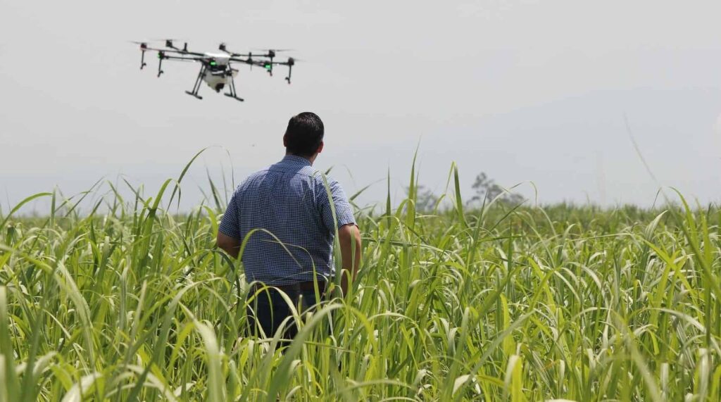
A UAV can typically survey up to 1,500 acres a day. To map entire fields, images are automatically triggered along a preplanned flight path, geotagged, and later stitched together by commercial software on a local computer or through cloud-based services.

Multispectral cameras on UAVs collect the bands used to generate the most common plant stress metric, the normalized difference vegetation index (NDVI). Agronomists can use this data to determine the photosynthetic activity of large acreages of cropland, allowing farmers to determine such important characteristics of their fields as seed emergence rates and areas where pest or disease pressure might be occurring. Hand-held NDVI meters are used to ground-truth the NDVI values collected using UAVs.

Thermal imaging cameras on UAVs are used to gauge the effectiveness of irrigation systems, particularly in vineyards, high-density orchard systems, and hops yards. They have also been tested to develop methods to identify feverish animals before they show symptoms of illness, such as eating less feed or infecting other animals.

UAVs vs. Satellite and Manned Aircraft

Soil properties (such as moisture), topography, and plant health can have significant spatial variation even within the same field. Therefore, precision agriculture, which optimizes inputs to match these variations, requires sub-inch resolution to, say, identify dry spots or distinguish weeds from cotton plants. Such resolution cannot be achieved with aerial imagery, let alone satellite imagery, the two types of remote sensing data that farmers have been using for decades, but can be easily achieved by UAVs, which can fly as low to the ground as needed. The ground pixel size of UAV imagery is typically 3 in. x 3 in. or smaller, compared to 3 ft. x 3 ft. for imagery from manned aircraft and 30 ft. x 30 ft. for satellite imagery.

Another advantage of UAVs is that they are so cheap to purchase, maintain, and operate that large farms can afford to deploy them as needed, either regularly throughout the growing season or intensively at critical times. Growers can easily maneuver rotary-wing drones to hover for close examination over areas of interest—such as irrigation issues, crop stresses, or fence conditions—enabling them to spot trouble early and deal with it before it spreads.

In addition to data collection, UAVs also enable growers to spray their crops precisely and at will, which is critical for fighting herbicide-resistant weeds. Unlike heavy machinery, which cannot go into a field immediately after a heavy rain, UAVs have no impact on the ground. While UAVs can only carry tiny amounts of herbicides compared to carts, these amounts are enough when applied with great spatial accuracy.

The Future

Future improvements that will maximize the value of UAVs to farmers include:

  • substantially greater endurance
  • autonomous operation—making their own decision to safely initiate a mission given local weather conditions such as wind, rain and lightning; taking off and flying fields as often as needed; then landing and docking to download the data they collected and recharge their batteries
  • automated processing of the data and creation of reports and maps
  • permission from the Federal Aviation Administration (FAA) to fly beyond visual line of sight (BVLOS) (Watch our Webinar on mapping & BVLOS) on large farms; this, in turn, will require, inter al., UAV transponders to enable manned aircraft to detect them and avoid them
  • greater cellular coverage in rural areas, to enable farmers to download data from anywhere on their property.

Visit the Applanix website to learn more about their UAV mapping solutions for Precision Agriculture >

The post The Use of UAVs for Precision Agriculture appeared first on Unmanned Systems Technology.

New Flight Planning Software Released for Intel Falcon Drones

$
0
0

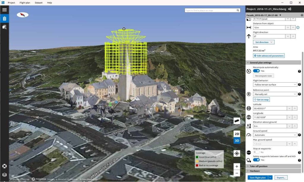
Topcon Intel Mission Control Software for UAVs

Topcon Positioning Group has announced the launch of its next generation flight planning system for its rotary-wing UAV (unmanned aerial vehicle). The Intel Mission Control Software is designed to facilitate automated flight planning, managing missions, and data handling for the Intel Falcon 8+ Drone – Topcon Edition and its available payload options.

The software is designed to increase accuracy with advanced mapping features that allow operators to easily set project parameters and prepare missions using presets for 2D areas like polygon, corridor and city grid, as well as 3D structures like towers, buildings and facades.

“Operators can take advantage of 2D and 3D map views with the ability to import more precise project details and parameters, including restricted airspace, and support to adapt flight planning over difficult terrain. It features the ability to import elevation, KML, GeoTIFF and Shapefiles for real life visualizations targeted for accurate planning. Plus, expanded preset options support automated flight including circle of interest, panorama, and 2D and 3D missions with automatic elevation and terrain adoption,” said Charles Rihner, vice president of planning for Topcon Emerging Business.

Additionally, the software includes automatic pre-flight safety and system checks while in mission planning. “Operators will receive detailed communication such as estimated battery life, airspace integration, ground and object safety limits, maximum dive and climb rate, minimum and maximum altitude, camera speed, number of images, camera storage, GSD check, and target photo coverage and quality,” said Rihner.

The flight planning software is also designed to improve data handling and export to support easier data processing. “It includes automated image matching and geotagging of images during data import, for increased time saving. Operators can preview and inspect the quality of the collected data, including individual images, as well as an overview of data coverage. Then, they can quickly and easily access and export flight data, and filter datasets for easier processing,” said Rihner.

The post New Flight Planning Software Released for Intel Falcon Drones appeared first on Unmanned Systems Technology.

Parrot to Develop Short Range Reconnaissance Drone for U.S. Army

$
0
0

The U.S. Army Program Executive Officer (PEO) for Aviation’s Project Manager, Unmanned Aircraft Systems, partnered with the Defense Innovation Unit (DIU) and the Army’s Maneuver Center of Excellence to identify and prototype new drone capabilities with commercial companies that specialize in on-demand, “eye in the sky” technologies. In this process, the U.S. Army is partnering with the Pentagon’s internal startup accelerator to adapt small commercial drones for the battlefield.

Parrot, the leading European drone group, is one of the 6 companies1 that have met the standards set in the solicitation issued in November 20182 to develop and prototype the next generation of small-unit surveillance drone.

The Short Range Reconnaissance (SRR) effort has recently awarded $11 million in funding to six companies to prototype and evaluate drones that can provide the Soldier on the ground with a rapidly deployable scouting capability to gain situational awareness beyond the next terrain feature. The drones would be expected to fly for 30 minutes straight at a range of up to three kilometers, according to the original solicitation. Officials also specified the aircraft should weigh three pounds or less, take less than 2 minutes to assemble and fit inside a soldier’s standard-issue rucksack.

“Parrot is proud to have been selected by the Army to work on this highly strategic project,” said Henri Seydoux, founder and CEO of Parrot. “The United States has always been a major market for the Parrot Group whether it is for our well-known consumer range or our advanced professional offering. We have always been at the forefront creating advanced, easy to use, compact and reliable drone-based solutions. We also perfectly understand how small unmanned aircraft, such as the Parrot ANAFI platform, has the potential to become a key part of the defense system. We look forward to focusing our advanced R&D on meeting the high standards set by the U.S. Army, to integrate drone efficiency in their day to day operations and support the world leading army defense system”.

Parrot has been the first company to develop the civil drone market and to invest, earlier than any other, in commercial drone solutions creating the leading European drone group. This contract underlines the technological innovations and premier position Parrot has in the global drone market and the excellence of the company’s researches and developments and is testament to Parrot’s global strategy and positioning, particularly in the commercial and Defense & Security drone development.

The post Parrot to Develop Short Range Reconnaissance Drone for U.S. Army appeared first on Unmanned Systems Technology.

UAVOS Introduces New Portable UAV Ground Control Station

$
0
0

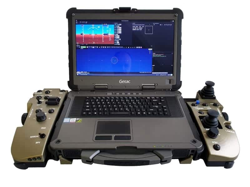
UAVOS PGCS3 ground control station

UAVOS has announced the introduction of a new Portable Ground Control Station for unmanned aerial vehicles (UAVs), the PGCS 3. The basic system configuration features and ergonomic control panel built around a military-grade rugged Getac X500 laptop. The PGCS 3 can be integrated with a variety of different 15” laptop computer models, making the system highly versatile.

The PGCS 3 consists of a detachable computer and a console with additional controls. The system is fully compatible with UAVOS’ UAV autopilot. The console joysticks, push-buttons and switches are industrial water-proofed units. The panel is equipped with a quick-release mechanism for docking the laptop.

The PGCS 3 is designed to monitor, control and display live video streaming from UAVs, and can also be used as a simulator. The station is designed for simultaneous work with an aircraft carrying a payload. A digital modem integrated into the system provides UAV control without using an external antenna. UAVOS has also developed a switching and power supply board which allows the PGCS 3 to work from various power sources, as well as to charge the docked computer.

The PGCS 3 has a compact form factor (length 25.8in/656mm, width 13in/332mm), height 5in/128mm). The console weighs 8.6lb (3.9kg) and the Getac X500 weighs 12lb (5.5kg). The console housing is made of an aluminum alloy and provides protection from moisture and dirt.

“PGCS 3 is another example of UAVOS developing industry-grade technology that supports our customers’ unique needs. The system incorporates features and technologies such as fail-safe features and redundancy, moisture resistance and the ability to operate in a wide range of temperatures – for mission flexibility, scalability, and ease of use, thus making it universally capable for the wide range of future projects,” said Aliaksei Stratsilatau, UAVOS’ Chairman of the Board and lead developer.

The post UAVOS Introduces New Portable UAV Ground Control Station appeared first on Unmanned Systems Technology.

DJI Releases Drone Autonomy Computing Module

$
0
0

DJI Manifold 2 computing platform

DJI has announced the launch of Manifold 2, an ultra-compact onboard supercomputer for DJI drones that enables the next-generation of autonomous aerial robotics solutions. With the additional compute capability of Manifold 2, users can process complex image data onboard the drone and get results immediately, and can program UAVs (unmanned aerial vehicles) to fly autonomously while identifying objects and avoiding obstacles.

“Through partnerships with some of the industry’s leading computing companies and chip manufacturers, we are enabling DJI drones to become intelligent flying robots that can perform complex computing tasks and advanced image processing literally on the fly,” said Jan Gasparic, DJI Director of Strategic Partnerships at DJI. “Manifold 2 expands the use cases of drone technology exponentially by allowing businesses, developers and researchers to build the most advanced autonomous aerial robotics solutions for nearly any industry or task.”

Manifold 2 provides powerful intelligence for a variety of applications with the ability to choose between an Intel Core i7-8550U CPU or NVIDIA Jetson TX2 supercomputer on a module for AI at the edge. Both versions are compatible with DJI’s leading enterprise drones including the Matrice 210 series and Matrice 600 series and can be integrated into the drone’s internal systems and sensors using DJI’s powerful software development kit, allowing for open customization and seamless integration into the DJI ecosystem of software and hardware solution providers. Each Manifold 2 includes USB, UART, CAN ports and more, allowing developers to link multiple Manifold 2 processors and build on top of them to transform DJI drones into specialized aerial robots for specific applications and industries.

“DJI Manifold 2 not only enables the advanced computer vision, perception and navigation featured in Automodality’s patented AMROS and Perceptive Navigation platform suite, it also enables next-generation artificial intelligence out on the edge, a hallmark of Automodality’s software and service offering for industrial inspections,” said Ed Koch, Chief Technology Officer at Automodality, a company developing autonomous drone solutions. “By empowering the drone to perceive and analyze in real-time, Manifold 2 opens new areas and capabilities and allows Automodality-equipped DJI Matrice 210s to autonomously fly where no one else has flown before, in GPS and radio frequency-denied environments where the most valuable and actionable data resides.”

The post DJI Releases Drone Autonomy Computing Module appeared first on Unmanned Systems Technology.

Viewing all 4454 articles
Browse latest View live


<script src="https://jsc.adskeeper.com/r/s/rssing.com.1596347.js" async> </script>