Quantcast
Channel: UAV News | Drone News | Unmanned Aerial Systems UAS & UAV News
Viewing all 4454 articles
Browse latest View live

Airbus to Trial Drone and AR-Based Aircraft Inspection

$
0
0

Airbus drone-based aircraft inspection

Airbus has announced that the Spanish Air Force has become the first air force worldwide to support the development of the company’s drone and augmented reality (AR)-based maintenance inspection services, with the aim of drastically reducing maintenance inspections for large military aircraft and increasing overall fleet availability.

This digital innovation technology will initially be trialled on Spanish Air Force A400M aircraft based at Zaragoza Air Base (31st Wing), with options to extend the technology to other aircraft, including the C295 and the CN235.

General José Luis Pardo Jario, Head of the Spanish Chief of the Air Staff office, said: “This technology has the potential to make a major contribution to maintenance tasks for our fleet. Not only is it more time and cost efficient, above all it allows the upskilling of aircraft maintenance personnel, in accordance with the new digital era we all need to contribute towards in order to reap its benefits.”

The technology relies on drones equipped with sensors and high-definition cameras to scan, in a matter of hours and not days, the exterior of an aircraft undergoing a maintenance inspection. A secured connection allows data and information generated to be displayed on tablets and augmented reality glasses, allowing staff to quickly identify and apply maintenance procedures and corrective actions while ensuring all inspection and maintenance procedures are formally and fully recorded on the maintenance log. Not only does this technology reduce the maintenance inspection time, it supports the early detection of defects and helps guarantee quality and post-maintenance airworthiness.

José Antonio Urbano Torres, Military Aircraft R&D Chief Engineer, said: “Innovation and technological development are part of our DNA. Airbus invests considerable human and economic resources in the research and development of new processes, products and services to meet the current and future needs of our customers. We would like to thank the Spanish Air Force for its contribution and commitment to the development and maturity of this system, which is sure to revolutionise military aircraft maintenance.”

The tests with the Spanish Air Force A400M will allow Airbus to use real user data, not only to consolidate the algorithms for safe autonomous flight of the drone around an aircraft thus avoiding the use of scaffolding and heavy mobile equipment that risks damaging the aircraft, but also to process the terabytes of images and data as a deep learning library that allows for the development of a robust Artificial Intelligence-based defects detection system.

The post Airbus to Trial Drone and AR-Based Aircraft Inspection appeared first on Unmanned Systems Technology.


Canadian Armed Forces UAS Equipped with PicoSAR Radar

$
0
0

Leonardo PicoSAR radarLeonardo has announced that it has signed a multi-million Euro contract with prime contractor QinetiQ to provide a number of PicoSAR Active Electronically Scanned Array (AESA, also known as ‘E-Scan’) radars. The radars will equip the new unmanned Intelligence, Surveillance, Target Acquisition and Reconnaissance (ISTAR) unmanned aerial vehicles (UAVs) that have been ordered by the Canadian Armed Forces. Designed and manufactured by Leonardo in Edinburgh, UK, PicoSAR will be employed by Canadian military units at sea and on land, for both domestic and international operations.

PicoSAR offers high-performance E-scan surveillance capabilities in an extremely compact package. It is ideally suited for installation aboard the Canadian Armed Forces’ new system, which is based on the lightweight UMS Skeldar V-200 Unmanned Aerial System (UAS). With PicoSAR on-board, operators will benefit from a range of modes including high resolution Synthetic Aperture Radar (SAR) imaging and Ground Moving Target Indication (GMTI). Together, these will deliver an effective all-weather ground mapping and surveillance capability for ISTAR missions.

The contract is an example of Leonardo’s open approach to partnerships in the service of providing the best solution for a customer’s needs. As well as equipping its own platforms, Leonardo offers its advanced airborne electronics directly to end users and also works with a wide range of industrial partners to provide sensor capabilities for third party platforms. In this case, Leonardo has worked closely with QinetiQ to ensure that the PicoSAR radar is a good fit for the needs of the Canadian Armed Forces.

PicoSAR is an extremely flexible system and has flown on more than 10 different aircraft. The radar has been flown in Oceania, the Far East, the Middle East, Europe, North Africa, North America and South America and has been acquired by more than 10 customers. PicoSAR is part of a wider portfolio of airborne radars that include M-Scan (mechanically-scanning) and E-scan (electronically scanning) systems for both surveillance and fire-control missions.

The post Canadian Armed Forces UAS Equipped with PicoSAR Radar appeared first on Unmanned Systems Technology.

EO/IR Surveillance Payload Integrated onto SkyGuardian & Reaper UAS

$
0
0

Canadian SkyGuardian UAS

L3 WESCAM and General Atomics Aeronautical Systems, Inc. (GA-ASI) have announced that, as members of Team SkyGuardian Canada and supporters of the MQ-9B SkyGuardian Remotely Piloted Aircraft System (RPAS) for Canada’s RPAS Project, the two companies are integrating WESCAM’s MX-20 electro-optical and infrared (EO/IR) imaging system onto the SkyGuardian RPAS, as well as the MQ-9 Reaper that is currently being operated by several NATO countries. Team SkyGuardian Canada is a coalition of Canadian companies committed to delivering the best RPAS for Canada.

Field-proven, with extensive deployment, WESCAM’s MX-20 is equipped with high-sensitivity multi-spectral sensors for day, low-light and nighttime missions, and offers low-risk “plug-and-play” installation. The MX-20 operates with detection and recognition capabilities at high altitudes in support of persistent surveillance missions.

“Integrating capabilities from L3 WESCAM and our other Team SkyGuardian partners – CAE and MDA – provides the most capable RPAS solution and the best economic value for Canada,” said Linden Blue, CEO, GA-ASI. “The MX-20 integration on MQ-9 builds on our successful integration of the WESCAM MX-15 onto our Predator XP aircraft. Taking advantage of our close North American relationship, our companies can cooperate to provide unprecedented levels of innovation and business opportunity with our RPAS.”

GA-ASI has been proactive in integrating L3 WESCAM products onto their RPAS. “Team SkyGuardian is a significant benefit to L3 WESCAM and provides more opportunities for the modular growth path of the WESCAM MX-20 as mission portfolios evolve and the battlespace continues to change on a global scale,” said Jacques Comtois, Vice President and General Manager of L3 WESCAM. “MX systems are the eyes of customers across more than 80 countries worldwide.”

L3’s WESCAM MX-Series has been engineered to focus on the three factors that drive maximum range: resolution, magnification and stabilization. As a result, each turret has outperformed its major competitor in every performance area, giving WESCAM the longest EO/IR target identification and designating ranges in the industry.

The post EO/IR Surveillance Payload Integrated onto SkyGuardian & Reaper UAS appeared first on Unmanned Systems Technology.

QinetiQ Launches New Supersonic Target UAV

$
0
0

QinetiQ Rattler Supersonic Target UAV

QinetiQ has unveiled a new Unmanned Aerial Vehicle (UAV) supersonic target that can be attached to the company’s jet Banshee aerial target and launched during flight.

Rattler was built to enable ships and aircraft to practice tracking missiles. This new air-launch capability from the jet Banshee has been successfully trialled in Canada over the past twelve months. This evolution in threat representation technology is a key part of QinetiQ’s strategy to lead and deliver world-class test and evaluation, training and mission rehearsal capabilities for governments around the world.

Peter Longstaff, Managing Director of QinetiQ Target Systems says, “Rattler is a low-cost manoeuvrable supersonic target and something brand new for the live fire, test and evaluation community. Rattler costs substantially less than any high-speed threat representative target currently on the market and being air-launched means that we can now conduct a full end-to-end threat representation profile. We are delighted to add the air-launched Rattler to our portfolio of affordable next-generation targets which we can either provide as a product sale or deploy to a customer’s site as part of a managed service for test or training purposes.”

When being air-launched, the jet Banshee aerial target with Rattler attached is set off from a ground launcher, directed into the operational area and can be recovered using a parachute. The Banshee and Rattler combination can be launched in three different modes that replicate various threat profiles.

Once launched, Rattler is operated with a proprietary QinetiQ guidance system and flight termination system (FTS) that enables full control at all times. Rattler can be equipped with customer requested payloads such as radar augmentation and miss distance indication.

The post QinetiQ Launches New Supersonic Target UAV appeared first on Unmanned Systems Technology.

Silent Falcon Extended Endurance UAS Announced

$
0
0

Silent Falcon Extended Endurance UAS

Silent Falcon UAS Technologies, manufacturer of the Silent Falcon solar electric fixed-wing Unmanned Aircraft System (UAS), has announced the introduction of the Silent Falcon EE (Extended Endurance) model. The Silent Falcon EE incorporates the newest technological innovations in solar panels, battery and solar power conversion, and can stay aloft for up to 8 hours in day time, and 4 hours at night.

The communications capabilities of the Silent Falcon EE have also been upgraded by including three MIMO MANET radios at the Ground Control Station with the SF TriAntenna configuration. This configuration significantly increases connectivity, bandwidth and reliability. It also allows one of the radios to be used to be used to connect a remote site, such as a command center to the radio network.

The Silent Falcon platform has been successfully used in various Intelligence, Surveillance, and Reconnaissance; Search and Rescue and long-range border patrol missions across the globe; and in extreme environmental conditions while assisting the US Department of Interior in wildfire fighting operations. Its long-range, long-endurance attributes, as well as its portability and very small operational footprint proved to be key factors contributing to the success of these missions.

“We continually push the envelope bringing new and proven technologies to the Silent Falcon Unmanned Aircraft System, increasing its capabilities, reliability and applicability to diverse missions. The Silent Falcon is an open interface, open architecture modular system that was designed to easily integrate new technologies and capabilities once they have been proven in the field. The Silent Falcon EE is a great example of this – extended endurance with more robust solar power, and rock-solid communications for more reliable longer-range missions,” said John W. Brown, Silent Falcon’s Chairman and CEO.” We are flying the Silent Falcon EE now for our own UAS services customers and look forward to making it the new standard for long endurance, long range electric UAS”.

The post Silent Falcon Extended Endurance UAS Announced appeared first on Unmanned Systems Technology.
DroneSense Software Platform Provides Security for Indy 500

$
0
0

DroneSense software platform at Indy 500

DroneSense has announced that its drone management software platform was used by pilots from Speedway, IN Police Department, the Indianapolis Metro Police Department, Indianapolis Fire, and Wayne Township Fire Department to deploy drones, both large and small, to help protect crowds at the various events throughout the Indy 500 race weekend.

“With the Indy 500 being one of the largest events for attendance in the world, providing overwatch operations is very challenging,” said Ron Shelnutt, Police Officer with the Indianapolis Metro Police Department. “The DroneSense platform is seamless, easy to use and was essential in providing real time video streams from our drones to the command center.”

Drones were flown using the DroneSense software platform, which allowed first responders the ability to live-stream footage into the various command centers, providing officers and security officials with actionable, real-time video for security operations.

“Drones can help make an event like the Indy 500 safer by gathering information in a way that no other platform can,” said Ryan Bracken, DroneSense’s Chief Information Security Officer, and a former FBI special agent. “But that intelligence, whether it’s a video stream or other data, has to get to the right people in real-time to make it usable, and that’s where our software platform excels.”

While most special event organizers are largely focused on keeping drones away, the agencies protecting the Indy 500 saw the cutting edge benefits drones used for security purposes could offer.

Agencies involved in the response obtained a special exemption from the FAA’s national security flight restrictions overtop the event, for purposes of keeping the crowds, drivers and race personnel safe.

The Indy 500 marks the second time drones and the DroneSense software platform were used to protect a large scale event. Earlier this year, DroneSense was deployed with teams from Skyfire Consulting to cover the NFL’s championship game in Atlanta.

The post DroneSense Software Platform Provides Security for Indy 500 appeared first on Unmanned Systems Technology.
Drone Imagery Used for Flood Prevention Modelling Service

$
0
0

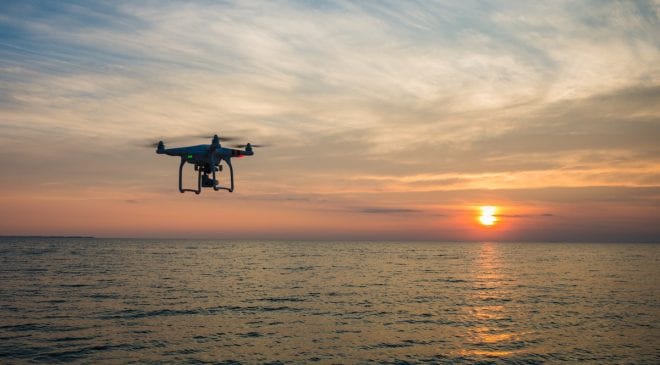
Drone over water

Airbus Aerial and Swiss Re Corporate Solutions have announced a collaboration that will help companies efficiently identify flood risks and more accurately predict weather-related flood damage. Under the collaboration, Swiss Re Corporate Solutions’ flood assessment tool, FLOAT, will be powered by Airbus Aerial’s drone imagery and data.

Swiss Re Corporate Solutions is the commercial insurance arm of the Swiss Re Group. The company’s service, FLOAT, is a cost-efficient way to help companies assess the flood risks of plants and other facilities. FLOAT uses unmanned aerial vehicles (UAVs) to capture highly accurate, location-specific elevation data. The collected data-set is transformed into a realistic visualization of the facility, including a precise interactive simulation that shows potential vulnerabilities and low-points. Swiss Re Corporate Solutions` highly experienced Risk Engineering Services team developed FLOAT by using their deep-rooted industry expertise that spans numerous lines of insurance, including Property.

Launched by global aerospace firm Airbus, Airbus Aerial is an aerial services business leveraging the best software and aerospace technology from across the Airbus enterprise to acquire, manage and share the data and information provided by drones, satellites, high altitude aircraft and other sources within a cloud-based suite.

“We are very excited to announce our collaboration with a global leader in the commercial insurance market, and to be able to offer this unique solution to Swiss Re Corporate Solutions’ clients around the world,” said Jesse Kallman, President of Airbus Aerial, from the company’s Atlanta headquarters.

“Aerial’s ability to deliver cutting-edge and reliable drone imagery and data makes them a perfect match for Swiss Re Corporate Solutions’ goal to help our clients protect their businesses. FLOAT is an innovative and cost-effective service that clearly shows clients where they are at risk for flood, so they can take steps to better protect themselves,” said Philip Brandl, Manager, Risk Engineering Services, EMEA at Swiss Re Corporate Solutions.

The post Drone Imagery Used for Flood Prevention Modelling Service appeared first on Unmanned Systems Technology.

Drone Aviation Awarded Additional $1.7 Contract

$
0
0

Drone Aviation Holding Corp., a manufacturer of tethered drones and lighter-than-air aerostats, has announced that it has been selected by a prime contractor for an additional award valued at approximately $1.7 million. This award is a follow-on to the $3.8 million contract awarded to Drone Aviation by this same prime contractor in January 2019, bringing the total award value to approximately $5.5 million.

“We are honored to have been chosen for this follow-on award by our prime contractor,” said Jay Nussbaum, Chairman and CEO of Drone Aviation. “This award is another important milestone for Drone Aviation, one that creates a valuable new stream of revenue and cashflow for the Company as we continue to execute on our strategic plan.”

Due to customer-related confidentiality considerations, no additional information will be provided related to this award at this time.

Drone Aviation’s tethered aerostat systems are based around a proprietary “smart leash” technology that provides persistent and reliable control, power and communications, bridging the gap between large, complex aerostats and small short-endurance drones.

Their tethered aerial platforms currently serve key tier-one customers including the United States Department of Defense and Department of Homeland Security. They provide multi-mission capabilities, extending the range of communications, ISR (Intelligence, Surveillance & Reconnaissance) and SIGINT (Signals Intelligence) and providing persistent silent protection, day or night.

The post Drone Aviation Awarded Additional $1.7 Contract appeared first on Unmanned Systems Technology.


Airborne Audio Management Solution Selected for Heron TP UAV

$
0
0

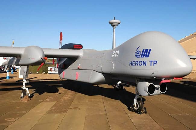
IAI Heron TP UAV

Orbit Communications Systems, a provider of airborne communications solutions, has announced that Israel Aerospace Industries (IAI) has placed a $US1.8 million order for Orbit’s Orion airborne audio management systems for integration aboard its next-generation medium-altitude, long-endurance (MALE) Heron TP unmanned aerial vehicle (UAV). Orbit’s Orion enables essential communications between the UAV and civil Air Traffic Control (ATC) and other ground stations.

Orion is an innovative airborne audio management system, featuring 3D Audio, Adaptive Noise Reduction and Voice-Activated Detection as standard features. A patented Dual IP Ring topology provides unsurpassed system redundancy, and the modular design permits reduced weight, incremental scalability and flexibility to suit both manned and unmanned aircraft of any size.

“All large UAVs are required to communicate directly with civil airports via Air Traffic Control using their own on-board systems,” explained Aharon Huberman, Senior Program Manager in the MALAT division of IAI. “Orbit’s Orion is the most mature solution on the market, in terms of its capabilities, reliability and regulatory compliance.”

“We believe that our ability to adapt the system and deliver it under an extremely tight schedule were key considerations in MALAT’s decision to select our audio management solution,” commented Ben Weinberger, CEO of Orbit. “We are proud to provide readily integrated radio gateway solutions to help simplify IAI’s development and operation on a system level,” he added.

The IAI Heron TP is an unmanned reconnaissance aircraft developed by the MALAT division of Israel Aerospace Industries. The UAV is an advanced version of the IAI Heron.

The post Airborne Audio Management Solution Selected for Heron TP UAV appeared first on Unmanned Systems Technology.

Drone Parachute System Granted FAA Waiver to Fly Over People

$
0
0

ParaZero SafeAir drone parachute system

ParaZero Technologies Ltd., a drone safety systems company, has announced that the Federal Aviation Administration (FAA) has approved a first-ever waiver allowing general contractor, Hensel Phelps, to fly over people using ParaZero’s ASTM compliant SafeAir Phantom Parachute System.

Hensel Phelps is one of the largest general contractors in the United States and has been leading the industry in adoption of UAS (unmanned aerial system) technology for construction. The use of UAS benefits projects by helping teams enhance safety, improve efficiency, manage and monitor schedules and communicate logistics. Hensel Phelps maintains an unwavering commitment to safety for all of their projects and this safety culture extends to their use of UAS technology.

Code of Federal Regulations 14, Part 107, defines the rules and requirements for operators of UAS (a.k.a. drones) for commercial purposes. Section 107.39 restricts any UAS operations over human beings. While necessary for safety reasons, this has been a major detriment to the growth of the commercial UAS industry as it has limited many operations in urban and sub-urban environments.

As part of the waiver approval process, the FAA used the information included in the waiver application to determine the system acceptably met ASTM F3322-18. UAS operators that purchased the ParaZero SafeAir Phantom ASTM Professional Kit, received the documentation required to demonstrate the compliance of the system.

This waiver represents the first time the FAA has collaborated with industry in developing a publically available standard, worked with an applicant to ensure the testing and data collected acceptably met the standard, and issued a waiver using an industry standard as a basis to determine that a proposed sUAS operation can be safely conducted under the terms and conditions of a waiver under Part 107.

According to the FAA: This process is scalable and available to other applicants who propose to use the same drone and parachute combination. The FAA will require each applicant to provide the testing, documentation, and statement of compliance listed in ASTM3322-18 in their applications using the same drone and parachute combination.

“The FAA has demonstrated a truly collaborative approach, through which they help develop the ASTM standard, work together in the UASIPP and provide feedback on the waiver applications and documentation,” said Avi Lozowick, ParaZero’s Vice President of Policy and Strategy.

“Safety is a core value at Hensel Phelps,” commented Richard Lopez, National UAS Operations Executive for Hensel Phelps. “Utilizing UAS, equipped with ParaZero’s SafeAir Systems, on our job sites allows us to operate more efficiently and accurately and we are committed to leveraging this technology as safely as possible.”

ParaZero CEO, Eden Attias comments: “The approval of this waiver is the goal ParaZero has been striving to achieve for the past two years. A replicable process is key to enable the growth of the UAS industry.”

The post Drone Parachute System Granted FAA Waiver to Fly Over People appeared first on Unmanned Systems Technology.

Boeing Invests in Commercial UAS Services & Repair Provider

$
0
0

Robotic Skies drone servicing and repair

Boeing has announced its investment in Robotic Skies, a services provider that connects manufacturers and operators of commercial unmanned aircraft systems (UAS) with a global network of more than 170 civil aviation authority-certified repair stations.

Robotic Skies is the only global network of certified UAS maintenance centers. It offers comprehensive turnkey field service programs designed to keep UAS flying safely, efficiently and affordably around the world. Each service center in the network possesses the aviation expertise and factory training to ensure the mission readiness of a wide variety of unmanned aircraft.

“With safety as a cornerstone, we are shaping a robust operational ecosystem for on-demand mobility that supports the future of aircraft, air vehicles and autonomous systems,” said Brian Schettler, managing director for Boeing HorizonX Ventures.

The investment is part of Boeing’s disciplined, long-term strategy of entering into value-added partnerships that enhance and accelerate growth and deliver key differentiators for customers.

“Unmanned and autonomous commercial aircraft operations are increasingly mirroring those in manned aviation, including the need for quality maintenance provided by certified technicians,” said Brad Hayden, founder and CEO of Robotic Skies. “This latest investment will allow us to continue to grow our global footprint and expand operational capabilities to support customers.”

Boeing HorizonX Ventures led this funding round with participation from Thayer Ventures, Sun Mountain Capital and KickStart Seed Fund. The investment builds on a previously-announced collaboration with Robotic Skies, Boeing Global Services and its subsidiaries Aviall and Jeppesen to provide enhanced commercial UAS services.

The post Boeing Invests in Commercial UAS Services & Repair Provider appeared first on Unmanned Systems Technology.
Black Hawk Helicopter Flown With Optionally Piloted Vehicle Technology

$
0
0

Optionally Piloted Black Hawk helicopter

Sikorsky has announced that a technology kit developed by the company has been used for the first time to operate a Black Hawk helicopter with full-authority, fly-by-wire flight controls. The flight marked the official start to the flight test program for the soon-to-be optionally piloted aircraft. Follow-on flight testing aims to include envelope expansion throughout the summer leading to fully autonomous flight (zero pilots) in 2020.

“This technology brings a whole new dimension of safety, reliability and capability to existing and future helicopters and to those who depend on them to complete their missions,” said Chris Van Buiten, Vice President, Sikorsky Innovations. “We’re excited to be transforming a once mechanically controlled aircraft into one with fly-by-wire controls. This flight demonstrates the next step in making optionally piloted – and optimally piloted – aircraft, a reality.”

This is the first full authority fly-by-wire retrofit kit developed by Sikorsky that has completely removed mechanical flight controls from the aircraft.

Through DARPA’s Aircrew Labor In-Cockpit Automation System (ALIAS) program, Sikorsky is developing an OPV approach it describes as pilot directed autonomy to give operators the confidence to fly aircraft safely, reliably and affordably in optimally piloted modes enabling flight with two, one or zero crew. The program aims to improve operator decision aiding for manned operations while also enabling both unmanned and reduced crew operations.

Sikorsky has been demonstrating its MATRIX Technology on a modified S-76B called the Sikorsky Autonomy Research Aircraft (SARA). The aircraft, which has been in test since 2013, has more than 300 hours of autonomous flight.

Sikorsky recently announced that its S-92 helicopter fleet update will include the introduction of phase one MATRIX Technology that will bring advanced computing power to the platform. This foundation enables adoption of autonomous landing technology.

The post Black Hawk Helicopter Flown With Optionally Piloted Vehicle Technology appeared first on Unmanned Systems Technology.
Extended Capacity InstantEye Mk-3 sUAS Variants Developed

$
0
0

InstantEye Robotics Mk-3 GEN4-D1 sUAS

InstantEye Robotics has announced the availability of new extended range, endurance, and payload capacity variants of the InstantEye Mk-3 family of Group I sUAS (small unmanned aerial systems).

The InstantEye Mk-3 GEN4-D1 (ISR) is a long-endurance variant of the Mk-3 GEN4D aircraft platform. The ISR variant uses proprietary battery chemistry, incorporated in purpose-built cell designs, with demonstrated flight times exceeding 50 minutes and organic ISR capability (thermal and 5MP E/O video) sensors. The system provides either the Tactical Standoff (640 x 480 thermal and 4x E/O) or Close Area Target Reconnaissance (10X E/O) payloads in its ISR configuration. Its folding prop design enables a highly packable 12 x 12 inch footprint, and its high rate charger maintains operational readiness without sacrificing cycle life or safety. Successful operations at the Joint Interagency Field Experimentation (JIFX 19-3), conducted at Camp Roberts, CA demonstrated communications at 7.5 km effective range, automated transit to a 2 km distant location, and the conduct of covert surveillance on that site from a standoff distance of 500 meters with over 30 minutes on station.

The InstantEye Mk-3 GEN5 system is an even more compact soldier borne asset with the same organic thermal and E/O capability as the Mk-3 GEN4D systems. During JIFX 19-3 this system demonstrated an operational range of 4.5 km, stable flight through wind conditions exceeding 20 mph, and a 27 minute flight endurance time with its new battery configuration. The system has demonstrated the ability to reach an altitude exceeding 6,000 ft. AGL.

The heavy-lift variant of the Mk-3 GEN4-D1 (HL) system demonstrated delivery of a 3 lb. explosive charge to a simulated IED, ~100 meters distant, while trailing Shock Tube Initiator (STI). The charge was reproducibly placed within 6 inches of the IED, providing the capability to rapidly and remotely inspect and defeat the device.

“This capability allows the user to continuously observe named areas of interest, prosecute fire missions, and actionably influence wide (>100 km2) areas of the battlespace, day or night, from a rucksack, without relying on low density, high demand, and high cost assets,” said Mike Mackiewicz, InstantEye’s Director, Defense Technology Operations. “With an ability to operate in all weather and locations, it is an unmatched tactical enabler with operational effects.”

The post Extended Capacity InstantEye Mk-3 sUAS Variants Developed appeared first on Unmanned Systems Technology.

New LiDAR Data Processing Software Released

$
0
0

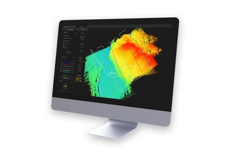
YellowScan CloudStation LiDAR processing software

YellowScan, a developer of UAV (unmanned aerial vehicle) LiDAR solutions, has announced the release of its new CloudStation software, which provides a complete solution for the creation and manipulation of point-cloud data. It allows users to extract, process and display data immediately after flight acquisition. The auto-generation of flight lines and the production of LAS files are now done in a few clicks.

“This launch is an exciting move for YellowScan, it allows a better and simplified experience for the customers,” said Tristan Allouis, Chief Technical Officer of YellowScan. “Better user experience leads to more efficiency for our clients’ demanding projects.”

Key business benefits that can be achieved from using CloudStation include:

  • Checking the integrity of data in the field
  • Verifying area coverage
  • Making sure all objects being mapped are identified
  • Extracting LAS files with only few clicks, within a few minutes

CloudStation is available with the acquisition of a YellowScan LiDAR solution.

The post New LiDAR Data Processing Software Released appeared first on Unmanned Systems Technology.

LORD Provides Inertial Sensing Technology for GPS-Denied Environments

$
0
0

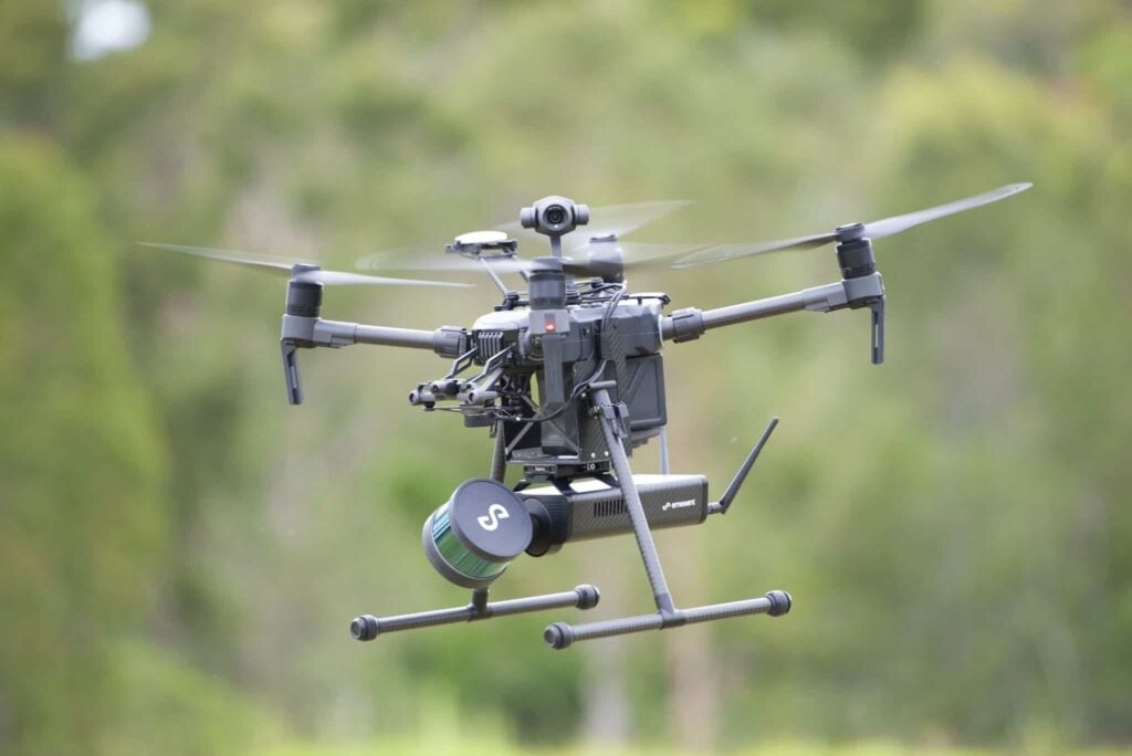
Hovermap autonomous drone mapping payload

LORD Corporation has confirmed that it has partnered with Emesent, a developer of autonomous technology for industrial drones, to bring inertial sensing technology to Emesent’s Hovermap 3D lidar mapping and autonomy payload platform. Hovermap automates the collection and analysis of data in challenging GPS-denied environments, delivering efficiency, safety and operational insights to various industries, including the underground industry. LORD inertial sensors enable Hovermap technology by providing precise position, orientation and velocity information in a small and lightweight package.

“LORD inertial sensors come with a common protocol and advanced software – integrating the best-in-class low noise, low drift gyros and accelerometers,” said Muj Haidri, Director of LORD Sensing. “Hovermap is the first drone payload of its kind, operating in the challenging environments that our inertial sensors are designed to excel in. We are proud to be associated with such a leading edge and innovative company as Emesent.”

As a Simultaneous Localisation and Mapping (SLAM) -based LiDAR mapping and autonomy payload, Hovermap relies on LORD inertial sensors to aid the SLAM solution in real-time. Hovermap’s advanced autonomy algorithms build on this real-time SLAM solution to allow autonomous flight in GPS-denied environments with omni-directional LiDAR-based collision avoidance. This enables safe autonomous drone flight indoors, underground or up-close to structures for mapping and inspection. Hovermap is used for underground mine mapping, asset management in telecom, transmissions, towers, wind turbines and bridges, as well as energy powerline inspections and construction building monitoring.

“We have stringent requirements for a light-weight, robust and reliable sensor, and LORD Corporation inertial sensors have a proven track record in the autonomy space,” said Dr. Stefan Hrabar, CEO of Emesent. “After more than two years of testing in our prototypes, we were happy with their innovative solution and have built this into the commercial Hovermap payload.”

Emesent provides value-added services for LORD with wide-ranging expertise integrating its sensors in their Hovermap payload. By partnering, the combined effort resulted in an efficient and safe data capture solution which provides insights to challenging GPS-denied environments.

Watch a video of the Hovermap platform trial in an underground mine below:

The post LORD Provides Inertial Sensing Technology for GPS-Denied Environments appeared first on Unmanned Systems Technology.

Ka-Band In-Flight Connectivity System Unveiled for UAVs

$
0
0

Viasat Global Aero Terminal 5518Viasat has announced the availability of its new Ka-band Global Aero Terminal (GAT-5518), which provides in-flight connectivity (IFC) services for government, business and military Unmanned Aerial Vehicles (UAVs) and other aircraft.

The compact terminal delivers the industry’s highest data rates for an 18 inch antenna, providing the highest forward link capacity (to the aircraft) and highest return link capacity (from the aircraft) to perform high-bandwidth applications such as advanced video streaming services.

The GAT-5518 is the latest satellite communications (SATCOM) innovation to join Viasat’s broad portfolio of Ka-band aero antenna systems. The system can meet a variety of requirements for UAVs and fixed-wing aircraft, including real-time intelligence, surveillance, and reconnaissance (ISR); enabling operational-support airlift missions; moving personnel and equipment across the battlefield; providing advanced situational awareness; en-route mission planning; MedEvac and telemedicine services; search and rescue; and border and maritime surveillance. Additionally, the terminal was designed to leverage Viasat’s Hybrid Adaptive Network (HAN) architecture, which allows users to seamlessly operate across commercial and government SATCOM networks. The HAN architecture conceives an end-to-end network that provides mitigation against congestion situations, intentional and unintentional interference sources and cyber threats through implementation of layered resiliency in highly-contested environments.

Find suppliers of SATCOM solutions and antennas for UAVs >

“We’re focused on delivering advanced antenna systems that meet in-flight connectivity requirements across multiple airframe and end-user types,” said Kent Leka, general manager, Antenna Systems at Viasat. “In designing and developing new aero terminals we take into consideration the broad user base and application sets to ensure the terminal’s viability across various markets. We’re confident the compact GAT-5518 will provide broader operational flexibility to enhanced reliability and resiliency to meet the diverse needs of business and military users.”

The GAT-5518 terminal completed the rigorous Federal Aviation Administration (FAA) D0-160G certification process. This certification confirms the terminal’s ability to provide reliable IFC services across the full International Telecommunication Union (ITU) Ka-band spectrum, which includes commercial and Mil-Ka frequency bands; across varying polarity layouts; across multiple orbital regimes, including both medium earth orbit (MEO) and geosynchronous (GEO) satellite systems; and across multiple network and ground infrastructures. The terminal is also expected to be forward-compatible, enabling it to leverage current and future Viasat satellite systems, as well as operate over third party satellite networks.

The terminal is made up of a two-axis steerable, two-way Ka-band antenna with an integrated antenna control unit (ACU), an antenna power supply unit and a modem. The GAT-5518’s antenna can be tail, fuselage or hatch-mounted.

The post Ka-Band In-Flight Connectivity System Unveiled for UAVs appeared first on Unmanned Systems Technology.

Honeywell Radar System Selected for Automated Air Taxi Takeoff & Landing

$
0
0

Honeywell IntuVue RDR-84K Band Radar SystemHoneywell has announced that it has signed an agreement with an unnamed air taxi developer to supply multiple units of its new IntuVue RDR-84K Band Radar System for the developer’s urban air mobility (UAM) prototype aircraft. The innovative, compact and lightweight software-based radar detects multiple obstacles in and around its flight path and is a major step toward automating the takeoff and landing of UAM aircraft.

“The RDR-84K is one of the many solutions we offer UAM companies,” said Carl Esposito, president, Electronic Solutions, Honeywell Aerospace. “We’re continuously developing new technology to meet the future demands and needs of all developers so they can create concept UAM aircraft that disrupt transportation and change the way people commute.”

Currently under testing and preproduction, the IntuVue RDR-84K Radar is Honeywell’s next-generation radar system and is built upon Honeywell’s 70 years of experience creating radar and sensor technologies.

Honeywell’s radar relies on the use of software to help collect relevant information for operators. Because the system is software based, the functionality of the radar is customizable depending on use, and the streamlined system allows for more integration.

Honeywell’s offering is an electronically steered phased-array radar and has no moving parts, which contrasts with the complexity of an electronically steered antenna. It reduces the number of sensors, hardware requirements and installations, maintenance, size, weight, and power needs — and lowers the initial and total cost of ownership.

Unlike traditional, hardware-based radar sensors, the IntuVue RDR-84K uses multiple beams that scan simultaneously and can detect different inputs such as other aircraft, terrain and runways at the same time. It allows an automated vehicle or unmanned aircraft to “see” and detect multiple inputs simultaneously, including weather, aircraft, people and buildings — revolutionizing vehicle autonomy. Its benefits include a much better “picture” of everything ahead of the aircraft, an ability to adapt the “focus” on important items ahead, and an ability to customize or change the radar’s functionality.

By scanning multiple data points at once and only focusing on the most important pieces of information below and in front of the vehicle, the radar helps enhance safety. This leads to safer, more efficient operations and a broad range of capabilities for connected or virtual operators.

The software embedded in the new radar technology passes only pertinent information from the sensors to UAM operators, and this enables UAM aircraft to land safely with little to no input from the operator. The sensing technology was designed with smaller aircraft in mind, including helicopters, UAM aircraft, unmanned aerial vehicles (UAVs) and autonomous military ground vehicles.

Honeywell has more than 100 years of experience helping to develop all types of aircraft, and its products fly on tens of thousands of airplanes and rotorcraft worldwide. Earlier this year, the company announced three other UAM development agreements, and Honeywell will continue to identify opportunities that will help bring this new mode of transportation to reality.

The post Honeywell Radar System Selected for Automated Air Taxi Takeoff & Landing appeared first on Unmanned Systems Technology.

Electrohydraulic Flight Control Actuation Selected for MQ-25 Unmanned Tanker

$
0
0

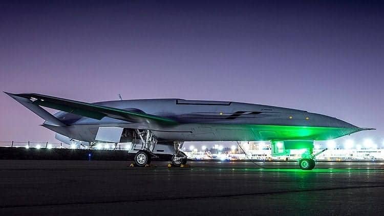
MQ-25 unmanned tanker UAV

Parker Aerospace, a developer of motion and control technologies, has announced that it has been awarded a contract by The Boeing Company to supply flight control tail actuation for the MQ-25 unmanned aerial refueling program.

The tail flight control actuator supplied by Parker Aerospace uses the company’s proven electrohydraulic servo actuation (EHSA) technology that is flying today on many military, commercial, and business aviation platforms. Parker’s flight control actuator is supporting Boeing’s MQ-25 test asset.

“Parker Aerospace’s MQ-25 flight control actuator is engineered similar to Parker’s other actuators currently serving the U.S. military,” said Drexel Pope, director of new development programs at the Control Systems Division of Parker Aerospace. “The actuator is highly efficient with a strong pedigree of proven performance. Parker flight control actuators are known throughout the industry for providing reliable performance to customer specifications.”

The MQ-25 is the U.S. Navy’s first operational carrier-based unmanned aerial vehicle (UAV) and is designed to provide a much-needed refueling capability. The contract supports Boeing’s engineering and manufacturing development program to provide four MQ-25 aircraft to the U.S. Navy for Initial Operational Capability by 2024.

Parker Aerospace has been supplying flight control actuators to Boeing since the 1950s. This latest contract will help support scores of jobs for Parker, which is a supplier to a range of Boeing defense and commercial programs.

“The MQ-25 program is vital because it will help the U.S. Navy extend the range of the carrier air wing, and Boeing and our industry team is all-in on delivering this capability,” said Dave Bujold, Boeing’s MQ-25 program director. “The work we’re doing is also foundational for the future of Boeing – where we’re building autonomous systems from seabed to space.”

The post Electrohydraulic Flight Control Actuation Selected for MQ-25 Unmanned Tanker appeared first on Unmanned Systems Technology.

NASA Autonomous Mars Helicopter Enters Final Testing Phase

$
0
0

NASA autonomous Mars helicopter

NASA has announced that its autonomous Mars Helicopter flight demonstration project has passed a number of key tests and moved into the final testing phase. In 2021, the small, autonomous helicopter will be the first vehicle in history to attempt to establish the viability of heavier-than-air vehicles flying on another planet.

“Nobody’s built a Mars Helicopter before, so we are continuously entering new territory,” said MiMi Aung, project manager for the Mars Helicopter at NASA’s Jet Propulsion Laboratory in Pasadena, California. “Our flight model — the actual vehicle that will travel to Mars — has recently passed several important tests.”

The team has previously operated the flight model in a simulated Martian environment. The helicopter was moved to Lockheed Martin Space in Denver for compatibility testing with the Mars Helicopter Delivery System, which will hold the 4-pound (1.8-kilogram) spacecraft against the belly of the Mars 2020 rover during launch and interplanetary cruise before deploying it onto the surface of Mars after landing.

As a technology demonstrator, the Mars Helicopter carries no science instruments. Its purpose is to confirm that powered flight in the tenuous Martian atmosphere (which has 1% the density of Earth’s) is possible and that it can be controlled from Earth over large interplanetary distances. The helicopter also carries a camera capable of providing high-resolution color images to further demonstrate the vehicle’s potential for documenting the Red Planet.

Future Mars missions could enlist second-generation helicopters to add an aerial dimension to their explorations. They could investigate previously unvisited or difficult-to-reach destinations such as cliffs, caves and deep craters, act as scouts for human crews or carry small payloads from one location to another. But before any of that happens, a test vehicle has to prove it is possible.

In Denver, the Mars Helicopter and its delivery system were checked to make sure that the electrical connections and mechanisms that linked the flight vehicle with its cradle fit snuggly. Then, while still mated, the duo endured the sorts of vibrations they will experience during launch and in-flight operations. The thermal vacuum portion of the testing introduced them to the kinds of extreme temperatures (down to -200 degrees Fahrenheit, or -129 degrees Celsius) that they will encounter in space and on Mars and that could cause components to malfunction or fail.

The Mars Helicopter returned to JPL for further testing and finishing touches. Among the highlights: A new solar panel that will power the helicopter has been installed, and the vehicle’s rotor blades have been spun up to ensure that the more than 1,500 individual pieces of carbon fiber, flight-grade aluminum, silicon, copper, foil and aerogel continue to work as a cohesive unit.

“We expect to complete our final tests and refinements and deliver the helicopter to the High Bay 1 clean room for integration with the rover sometime this summer,” said Aung, “but we will never really be done with testing the helicopter until we fly at Mars.”

The Mars Helicopter will launch with the Mars 2020 rover on a United Launch Alliance Atlas V rocket in July 2020 from Space Launch Complex 41 at Cape Canaveral Air Force Station, Florida. When it lands in Jezero Crater on Feb. 18, 2021, the rover will also be the first spacecraft in the history of planetary exploration with the ability to accurately retarget its point of touchdown during the landing sequence.

The 2020 rover will conduct geological assessments of its landing site on Mars, determine the habitability of the environment, search for signs of ancient Martian life and assess natural resources and hazards for future human explorers. In another first, scientists will use the instruments aboard the rover to identify and collect samples of rock and soil, encase them in sealed tubes, and leave them on the planet’s surface for potential return to Earth on a future Mars mission.

JPL is building and will manage operations of the Mars 2020 rover and Mars Helicopter for the NASA Science Mission Directorate at the agency’s headquarters in Washington. NASA’s Launch Services Program, based at the agency’s Kennedy Space Center in Florida, is responsible for launch management.

The post NASA Autonomous Mars Helicopter Enters Final Testing Phase appeared first on Unmanned Systems Technology.

AeroVironment Acquires VTOL UAS Developer

$
0
0

Pulse Aerospace helicopter UAS

AeroVironment has announced that it has acquired Pulse Aerospace, LLC, a developer and supplier of small VTOL unmanned aircraft systems (UAS), for $25.7 million. Pulse’s HeliSynth technology provides flight control, payload, and endurance capabilities to both defense and commercial end markets. Pulse recently received a multi-year contract award with a maximum value of more than $13 million from an undisclosed defense customer for its Vapor unmanned VTOL systems, spares and services.

AeroVironment expects the transaction to be accretive to its earnings by the third full year of operations.

“The talented Pulse Aerospace team has created a solution set that is unique and will expand our family of unmanned systems by addressing increasing demand from our customers for small VTOL solutions,” said Wahid Nawabi, AeroVironment’s president and chief executive officer. “This transaction brings together two highly complementary companies in terms of products, markets and culture, and will better position AeroVironment to grow our share of the small UAS market. The team at Pulse Aerospace shares our focus on disruptive innovation and we welcome them to AeroVironment. Together, we will deliver even more capability to our customers in the United States and more than 45 allied countries around the world.”

“We are excited to join together to realize the full benefits of this transaction as we employ key, future-defining technologies such as robotics, sensors, software analytics and connectivity. Additionally, we look forward to gaining access to the strong technical talent pool in the Lawrence, Kansas area to help achieve our long-term growth objectives,” Nawabi added.

“AeroVironment’s global market presence dramatically increases the reach of Pulse’s VTOL UAS technology,” said Aaron Lessig, Pulse Aerospace, LLC’s chief executive officer. “Pulse’s offering expands AeroVironment’s mission capabilities with increased payload capacity, which broadens customer use cases. We look forward to growing AeroVironment’s share of the global unmanned systems market together.”

In connection with the transaction, Pulse Aerospace’s Lawrence, Kansas facility will become AeroVironment Innovation Center – Midwest, with a focus on small VTOL unmanned aircraft and mission planning solutions.

The post AeroVironment Acquires VTOL UAS Developer appeared first on Unmanned Systems Technology.

Viewing all 4454 articles
Browse latest View live


<script src="https://jsc.adskeeper.com/r/s/rssing.com.1596347.js" async> </script>